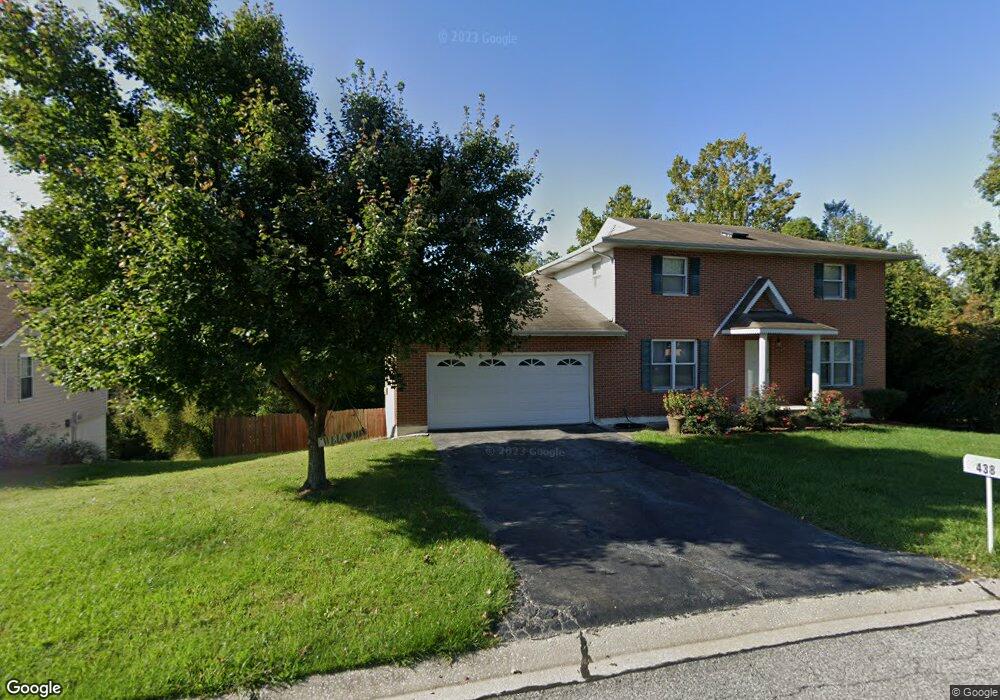
438 Bunker Hill Dr Collinsville, IL 62234
Estimated Value: $252,011 - $290,000
4
Beds
4
Baths
952
Sq Ft
$287/Sq Ft
Est. Value
About This Home
This home is located at 438 Bunker Hill Dr, Collinsville, IL 62234 and is currently estimated at $273,503, approximately $287 per square foot. 438 Bunker Hill Dr is a home located in Madison County with nearby schools including John A Renfro Elementary School, Dorris Intermediate School, and Collinsville Middle School.
Ownership History
Date
Name
Owned For
Owner Type
Purchase Details
Closed on
Apr 10, 2014
Sold by
Saddler Reginald and Saddler Melinda R
Bought by
Saddler Melinda R
Current Estimated Value
Purchase Details
Closed on
Sep 1, 2005
Sold by
Gavelis Albina
Bought by
Saddler Reginald and Saddler Melinda R
Home Financials for this Owner
Home Financials are based on the most recent Mortgage that was taken out on this home.
Original Mortgage
$125,600
Outstanding Balance
$71,152
Interest Rate
6.8%
Mortgage Type
Fannie Mae Freddie Mac
Estimated Equity
$202,351
Create a Home Valuation Report for This Property
The Home Valuation Report is an in-depth analysis detailing your home's value as well as a comparison with similar homes in the area
Home Values in the Area
Average Home Value in this Area
Purchase History
| Date | Buyer | Sale Price | Title Company |
|---|---|---|---|
| Saddler Melinda R | -- | None Available | |
| Saddler Reginald | $157,000 | Abstracts & Titles Inc |
Source: Public Records
Mortgage History
| Date | Status | Borrower | Loan Amount |
|---|---|---|---|
| Open | Saddler Reginald | $125,600 |
Source: Public Records
Tax History Compared to Growth
Tax History
| Year | Tax Paid | Tax Assessment Tax Assessment Total Assessment is a certain percentage of the fair market value that is determined by local assessors to be the total taxable value of land and additions on the property. | Land | Improvement |
|---|---|---|---|---|
| 2024 | $4,636 | $78,520 | $14,650 | $63,870 |
| 2023 | $4,636 | $71,730 | $13,330 | $58,400 |
| 2022 | $3,989 | $66,330 | $12,330 | $54,000 |
| 2021 | $3,890 | $62,310 | $11,580 | $50,730 |
| 2020 | $3,731 | $59,450 | $11,050 | $48,400 |
| 2019 | $3,896 | $61,370 | $11,070 | $50,300 |
| 2018 | $3,794 | $58,130 | $10,480 | $47,650 |
| 2017 | $3,791 | $56,970 | $10,270 | $46,700 |
| 2016 | $3,983 | $56,970 | $10,270 | $46,700 |
| 2015 | $3,881 | $55,490 | $10,000 | $45,490 |
| 2014 | $3,881 | $55,490 | $10,000 | $45,490 |
| 2013 | $3,881 | $55,490 | $10,000 | $45,490 |
Source: Public Records
Map
Nearby Homes
- 414 Bunker Hill Dr
- 22 Brookwood Dr
- 5 Brookwood Dr
- 1224 Cedar Ridge Ct
- 10 White Lily Dr
- 2007 Belt Line Rd
- 0 N Keebler Ave
- 1121 Carraway Ct
- 203 Greenfield Dr
- 1059 Lafayette Ct Unit A
- 1035 Lafayette Ct Unit B
- 1051 Lafayette Ct Unit A
- 123 Elliot St
- 308 Brown Ave
- 1120 Williams St
- 0 Strong Ave
- 617 N Morrison Ave
- 123 W Wickliffe Ave
- 1210 Constance St
- 580 N Guernsey St
- 436 Bunker Hill Dr
- 440 Bunker Hill Dr
- 427 Bunker Hill Dr
- 434 Bunker Hill Dr
- 425 Bunker Hill Dr
- 302 Monticello Dr
- 423 Bunker Hill Dr
- 308 Monticello Dr
- 432 Bunker Hill Dr
- 307 Monticello Dr
- 309 Monticello Dr
- 310 Monticello Dr
- 305 Monticello Dr
- 303 Monticello Dr
- 430 Bunker Hill Dr
- 311 Monticello Dr
- 301 Monticello Dr
- 420 Chapel Dr
- 419 Bunker Hill Dr
- 200 Omega Dr