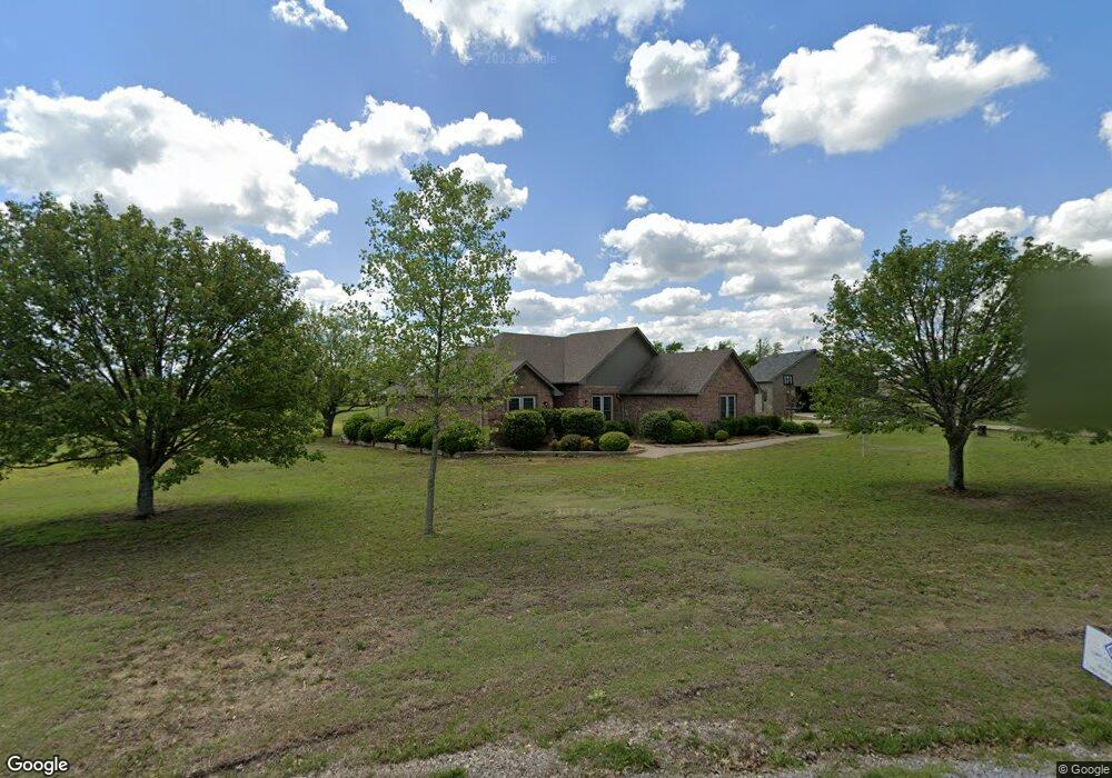
438 Choctaw Est Cir Sherman, TX 75092
Estimated Value: $414,208 - $562,000
3
Beds
2
Baths
1,755
Sq Ft
$277/Sq Ft
Est. Value
About This Home
This home is located at 438 Choctaw Est Cir, Sherman, TX 75092 and is currently estimated at $486,052, approximately $276 per square foot. 438 Choctaw Est Cir is a home located in Grayson County with nearby schools including S&S Consolidated Elementary School, S&S Consolidated Middle School, and S. & S. Cons H.S..
Ownership History
Date
Name
Owned For
Owner Type
Purchase Details
Closed on
Sep 18, 2008
Sold by
Cartus Financial Corp
Bought by
Moore Gerald F and Moore Peggy M
Current Estimated Value
Home Financials for this Owner
Home Financials are based on the most recent Mortgage that was taken out on this home.
Original Mortgage
$154,850
Outstanding Balance
$103,243
Interest Rate
6.57%
Mortgage Type
Purchase Money Mortgage
Estimated Equity
$382,809
Purchase Details
Closed on
Jun 26, 2008
Sold by
Allen Rex G and Allen Susan L
Bought by
Cartus Financial Corp
Create a Home Valuation Report for This Property
The Home Valuation Report is an in-depth analysis detailing your home's value as well as a comparison with similar homes in the area
Home Values in the Area
Average Home Value in this Area
Purchase History
| Date | Buyer | Sale Price | Title Company |
|---|---|---|---|
| Moore Gerald F | -- | Sherman Title | |
| Cartus Financial Corp | -- | Sherman Title |
Source: Public Records
Mortgage History
| Date | Status | Borrower | Loan Amount |
|---|---|---|---|
| Open | Moore Gerald F | $154,850 |
Source: Public Records
Tax History Compared to Growth
Tax History
| Year | Tax Paid | Tax Assessment Tax Assessment Total Assessment is a certain percentage of the fair market value that is determined by local assessors to be the total taxable value of land and additions on the property. | Land | Improvement |
|---|---|---|---|---|
| 2025 | $1,668 | $391,531 | -- | -- |
| 2024 | $5,314 | $355,937 | $0 | $0 |
| 2023 | $1,624 | $323,579 | $0 | $0 |
| 2022 | $4,533 | $269,523 | $0 | $0 |
| 2021 | $4,660 | $245,021 | $32,000 | $213,021 |
| 2020 | $4,508 | $229,802 | $32,000 | $197,802 |
| 2019 | $4,843 | $227,743 | $32,000 | $195,743 |
| 2018 | $4,237 | $217,572 | $32,000 | $185,572 |
| 2017 | $3,999 | $204,483 | $32,000 | $172,483 |
| 2016 | $3,636 | $185,380 | $27,000 | $158,380 |
| 2015 | $2,896 | $182,810 | $21,000 | $161,810 |
| 2014 | $2,566 | $158,350 | $21,000 | $137,350 |
Source: Public Records
Map
Nearby Homes
- 6514 Joyce Ln
- 1171 Rockport Rd
- 586 Pleasant Home Rd
- 2615 Rolling Hills Dr
- 3356 Old Dorchester Rd
- 00 Primrose Ln
- 1401 Cimmaron Trail
- 1404 Tejas Dr
- 1426 S Raven Dr
- 1407 Swan Ridge Dr
- 4501 Hawk Ln
- 6935 S Farm To Market Road 1417
- 4507 Falcon Dr
- 2134 Peggeys Cove
- 3508 Ballam St
- 1415 Mallard Dr
- 3302 Hanan St
- 1412 Ascot Ave
- 2401 Southridge Ln
- 1612 Heritage Creek Dr
- 416 Choctaw Est Cir
- 416 Choctaw Estate Cir
- 477 Choctaw Est Cir
- 498 Choctaw Est Cir
- 468 Choctaw Est Cir
- 517 Choctaw Est Cir
- 542 Choctaw Est Cir
- 351 Choctaw Est Cir
- 351 Choctaw Est Cir
- 328 Choctaw Est Cir
- 472 Choctaw Est Cir
- 565 Choctaw Est Cir
- 255 Choctaw Est Cir
- 320 Choctaw Est Cir
- 588 Choctaw Est Cir
- 386 Rockport Rd
- 256 Choctaw Est Cir
- 189 Choctaw Est Cir
- 17 Lot Choctaw Estates Cir
- 284 Choctaw Est Cir