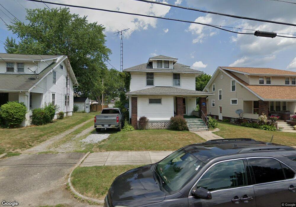
438 E Mill St Alliance, OH 44601
Estimated Value: $133,000 - $165,285
3
Beds
3
Baths
1,356
Sq Ft
$107/Sq Ft
Est. Value
About This Home
This home is located at 438 E Mill St, Alliance, OH 44601 and is currently estimated at $145,071, approximately $106 per square foot. 438 E Mill St is a home located in Stark County with nearby schools including Alliance Elementary School at Rockhill, Alliance Intermediate School at Northside, and Alliance Middle School.
Ownership History
Date
Name
Owned For
Owner Type
Purchase Details
Closed on
May 17, 2022
Sold by
Longobardi Todd W
Bought by
Longobardi Todd W
Current Estimated Value
Purchase Details
Closed on
Mar 23, 2001
Sold by
Longobardi Todd W
Bought by
Longobardi Todd W and Longobardi Melanie Ann
Home Financials for this Owner
Home Financials are based on the most recent Mortgage that was taken out on this home.
Original Mortgage
$22,900
Interest Rate
7.05%
Mortgage Type
Stand Alone Second
Purchase Details
Closed on
Jul 7, 1999
Sold by
Marschinke Charles and Sheen Joan
Bought by
Longobardi Todd W
Home Financials for this Owner
Home Financials are based on the most recent Mortgage that was taken out on this home.
Original Mortgage
$67,900
Interest Rate
7.28%
Mortgage Type
Purchase Money Mortgage
Create a Home Valuation Report for This Property
The Home Valuation Report is an in-depth analysis detailing your home's value as well as a comparison with similar homes in the area
Home Values in the Area
Average Home Value in this Area
Purchase History
| Date | Buyer | Sale Price | Title Company |
|---|---|---|---|
| Longobardi Todd W | -- | Whitaker Mark A | |
| Longobardi Todd W | -- | -- | |
| Longobardi Todd W | $70,000 | -- |
Source: Public Records
Mortgage History
| Date | Status | Borrower | Loan Amount |
|---|---|---|---|
| Previous Owner | Longobardi Todd W | $22,900 | |
| Previous Owner | Longobardi Todd W | $67,900 |
Source: Public Records
Tax History Compared to Growth
Tax History
| Year | Tax Paid | Tax Assessment Tax Assessment Total Assessment is a certain percentage of the fair market value that is determined by local assessors to be the total taxable value of land and additions on the property. | Land | Improvement |
|---|---|---|---|---|
| 2025 | $1,028 | $49,320 | $10,500 | $38,820 |
| 2024 | $781 | $49,320 | $10,500 | $38,820 |
| 2023 | $1,491 | $35,320 | $8,230 | $27,090 |
| 2022 | $1,429 | $35,320 | $8,230 | $27,090 |
| 2021 | $1,430 | $35,320 | $8,230 | $27,090 |
| 2020 | $1,286 | $29,650 | $7,140 | $22,510 |
| 2019 | $1,267 | $29,660 | $7,140 | $22,520 |
| 2018 | $1,274 | $29,660 | $7,140 | $22,520 |
| 2017 | $1,230 | $28,180 | $5,880 | $22,300 |
| 2016 | $1,240 | $28,180 | $5,880 | $22,300 |
| 2015 | $1,237 | $27,860 | $5,880 | $21,980 |
| 2014 | $1,296 | $27,790 | $5,880 | $21,910 |
| 2013 | $646 | $27,790 | $5,880 | $21,910 |
Source: Public Records
Map
Nearby Homes
- 2351 S Freedom Ave
- 2408 S Linden Ave
- 2041 Watson Ave
- 1805 S Linden Ave
- 390 E College St
- 2405 Cherry Ave
- 2372 S Union Ave
- 2406 S Union Ave
- 555 E Milton St
- 853 Fairway Dr
- 1608 S Liberty Ave
- 2117 Miller Ave
- 233 Shadyside Ct
- 834 Devine St
- 224 Shadyside Ct
- 551 South St
- 2364 Shunk Ave
- 2560 S Mahoning Ave
- 167 11th St
- 2705 Shunk Ave
- 448 E Mill St
- 426 E Mill St
- 458 E Mill St
- 2128 S Linden Ave
- 416 E Mill St
- 2118 S Linden Ave
- 464 E Mill St
- 2112 S Linden Ave
- 425 E Mill St
- 2127 S Freedom Ave
- 404 E Mill St
- 2117 S Freedom Ave
- 2068 S Linden Ave
- 472 E Mill St
- 455 E Mill St
- 437 E Mill St
- 2109 S Freedom Ave
- 2206 S Linden Ave
- 2058 S Linden Ave
- 2103 S Freedom Ave