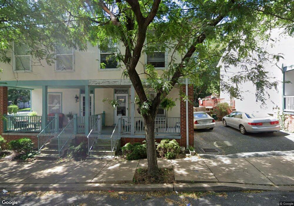
438 Locust St Lancaster, PA 17602
Churchtowne NeighborhoodEstimated Value: $142,000 - $219,500
3
Beds
2
Baths
1,224
Sq Ft
$156/Sq Ft
Est. Value
About This Home
This home is located at 438 Locust St, Lancaster, PA 17602 and is currently estimated at $191,125, approximately $156 per square foot. 438 Locust St is a home located in Lancaster County with nearby schools including Carter & MacRae Elementary School, Reynolds Middle School, and McCaskey High School.
Ownership History
Date
Name
Owned For
Owner Type
Purchase Details
Closed on
Jul 31, 2002
Sold by
Bright Side Development Corp & Land Tr
Bought by
Mcmichael Deborah
Current Estimated Value
Home Financials for this Owner
Home Financials are based on the most recent Mortgage that was taken out on this home.
Original Mortgage
$38,400
Outstanding Balance
$16,353
Interest Rate
6.64%
Estimated Equity
$174,772
Create a Home Valuation Report for This Property
The Home Valuation Report is an in-depth analysis detailing your home's value as well as a comparison with similar homes in the area
Home Values in the Area
Average Home Value in this Area
Purchase History
| Date | Buyer | Sale Price | Title Company |
|---|---|---|---|
| Mcmichael Deborah | $48,000 | -- |
Source: Public Records
Mortgage History
| Date | Status | Borrower | Loan Amount |
|---|---|---|---|
| Open | Mcmichael Deborah | $38,400 | |
| Closed | Mcmichael Deborah | $7,200 |
Source: Public Records
Tax History Compared to Growth
Tax History
| Year | Tax Paid | Tax Assessment Tax Assessment Total Assessment is a certain percentage of the fair market value that is determined by local assessors to be the total taxable value of land and additions on the property. | Land | Improvement |
|---|---|---|---|---|
| 2025 | $2,485 | $62,800 | $7,800 | $55,000 |
| 2024 | $2,485 | $62,800 | $7,800 | $55,000 |
| 2023 | $2,443 | $62,800 | $7,800 | $55,000 |
| 2022 | $2,341 | $62,800 | $7,800 | $55,000 |
| 2021 | $2,244 | $61,500 | $7,800 | $53,700 |
| 2020 | $2,244 | $61,500 | $7,800 | $53,700 |
| 2019 | $2,210 | $61,500 | $7,800 | $53,700 |
| 2018 | $875 | $61,500 | $7,800 | $53,700 |
| 2017 | $2,361 | $51,400 | $8,100 | $43,300 |
| 2016 | $2,339 | $51,400 | $8,100 | $43,300 |
| 2015 | $913 | $51,400 | $8,100 | $43,300 |
| 2014 | $1,614 | $51,400 | $8,100 | $43,300 |
Source: Public Records
Map
Nearby Homes
- 14 E Farnum St
- 513 Howard Ave
- 507 Locust St
- 462 S Christian St
- 316 Beaver St
- 520 S Duke St
- 341 S Prince St
- 14 S Queen St
- 114 S Prince St
- 518 Green St
- 346 S Prince St
- 348 S Prince St
- 536 Woodward St
- 567 S Christian St
- 459 S Queen St
- 555 Woodward St
- 530 S Lime St
- 442 Fremont St
- 215 W Vine St
- 217 W Vine St
- 434 Locust St
- 440 Locust St
- 432 Locust St
- 423 S Christian St
- 433 Howard Ave
- 425 S Christian St
- 435 Howard Ave
- 426 Locust St
- 429 Howard Ave
- 427 S Christian St
- 425 Howard Ave
- 431 Locust St
- 429 S Christian St
- 422 Locust St
- 424 S Christian St
- 429 Locust St
- 427 Locust St
- 426 S Christian St
- 431 S Christian St
- 421 Howard Ave