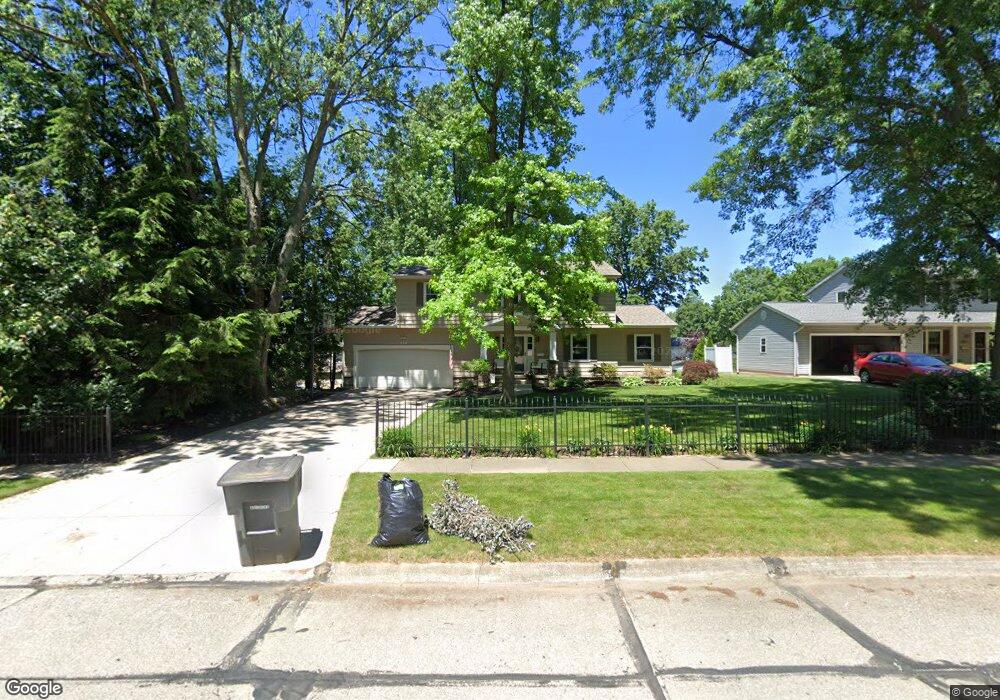
438 McEntee Dr Wadsworth, OH 44281
Estimated Value: $315,909 - $356,000
4
Beds
3
Baths
2,158
Sq Ft
$154/Sq Ft
Est. Value
About This Home
This home is located at 438 McEntee Dr, Wadsworth, OH 44281 and is currently estimated at $332,727, approximately $154 per square foot. 438 McEntee Dr is a home located in Medina County with nearby schools including Overlook Elementary School, Central Intermediate School, and Wadsworth Middle School.
Ownership History
Date
Name
Owned For
Owner Type
Purchase Details
Closed on
May 21, 1999
Sold by
Westmoreland Robert J and Westmoreland Yvette C
Bought by
Jariga William M and Jariga Amy L
Current Estimated Value
Home Financials for this Owner
Home Financials are based on the most recent Mortgage that was taken out on this home.
Original Mortgage
$135,000
Outstanding Balance
$34,535
Interest Rate
6.92%
Estimated Equity
$298,192
Purchase Details
Closed on
Dec 28, 1996
Sold by
Looper Carnney J and Looper Delores J
Bought by
Westmoreland Robert J and Westmoreland Yvette C
Home Financials for this Owner
Home Financials are based on the most recent Mortgage that was taken out on this home.
Original Mortgage
$135,375
Interest Rate
7.54%
Create a Home Valuation Report for This Property
The Home Valuation Report is an in-depth analysis detailing your home's value as well as a comparison with similar homes in the area
Home Values in the Area
Average Home Value in this Area
Purchase History
| Date | Buyer | Sale Price | Title Company |
|---|---|---|---|
| Jariga William M | $159,000 | Bond & Associates Title Agen | |
| Westmoreland Robert J | $142,500 | Mcta |
Source: Public Records
Mortgage History
| Date | Status | Borrower | Loan Amount |
|---|---|---|---|
| Open | Jariga William M | $135,000 | |
| Previous Owner | Westmoreland Robert J | $135,375 |
Source: Public Records
Tax History
| Year | Tax Paid | Tax Assessment Tax Assessment Total Assessment is a certain percentage of the fair market value that is determined by local assessors to be the total taxable value of land and additions on the property. | Land | Improvement |
|---|---|---|---|---|
| 2024 | $3,481 | $75,720 | $20,780 | $54,940 |
| 2023 | $3,338 | $75,480 | $20,780 | $54,700 |
| 2022 | $3,332 | $75,480 | $20,780 | $54,700 |
| 2021 | $3,155 | $60,390 | $16,630 | $43,760 |
| 2020 | $2,780 | $60,390 | $16,630 | $43,760 |
| 2019 | $2,784 | $60,390 | $16,630 | $43,760 |
| 2018 | $2,476 | $50,360 | $16,680 | $33,680 |
| 2017 | $2,477 | $50,360 | $16,680 | $33,680 |
| 2016 | $2,518 | $50,360 | $16,680 | $33,680 |
| 2015 | $2,400 | $45,770 | $15,160 | $30,610 |
| 2014 | $2,440 | $45,770 | $15,160 | $30,610 |
| 2013 | $2,443 | $45,770 | $15,160 | $30,610 |
Source: Public Records
Map
Nearby Homes
- 198 Summit St
- 295 High Point Dr
- 388 Crestwood Ave
- 228 Hartman Rd
- 404 Shannon Dr
- 751 Archwood Rd
- 531 Woodland Ave
- 281 High St
- 468 High St
- 189 Pine St
- 681 Highland Ave
- 695 Hillcrest Dr
- 267 Marlow St
- 1315 Fieldcrest Dr Unit 90
- 902 Devonwood Dr
- 221 Franks Ave
- 910 Devonwood Dr
- V/L Hartman Rd
- 991 Broad St
- 681 Oakcrest Dr
Your Personal Tour Guide
Ask me questions while you tour the home.