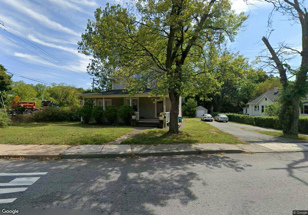
438 N Main St Wharton, NJ 07885
Estimated Value: $514,000 - $561,000
--
Bed
--
Bath
2,244
Sq Ft
$243/Sq Ft
Est. Value
About This Home
This home is located at 438 N Main St, Wharton, NJ 07885 and is currently estimated at $545,517, approximately $243 per square foot. 438 N Main St is a home located in Morris County with nearby schools including Marie V. Duffy Elementary School and A C Mac Kinnon Middle School.
Ownership History
Date
Name
Owned For
Owner Type
Purchase Details
Closed on
Oct 4, 1999
Sold by
Studley Rebecca and Studley Paul
Bought by
Quintero Marco and Lopez Anat Y
Current Estimated Value
Home Financials for this Owner
Home Financials are based on the most recent Mortgage that was taken out on this home.
Original Mortgage
$183,450
Outstanding Balance
$55,264
Interest Rate
7.8%
Mortgage Type
FHA
Estimated Equity
$490,253
Purchase Details
Closed on
May 20, 1994
Sold by
Kovach Mary
Bought by
Studley Rebecca
Create a Home Valuation Report for This Property
The Home Valuation Report is an in-depth analysis detailing your home's value as well as a comparison with similar homes in the area
Home Values in the Area
Average Home Value in this Area
Purchase History
| Date | Buyer | Sale Price | Title Company |
|---|---|---|---|
| Quintero Marco | $185,000 | Fidelity National Title Ins | |
| Studley Rebecca | $75,000 | -- |
Source: Public Records
Mortgage History
| Date | Status | Borrower | Loan Amount |
|---|---|---|---|
| Open | Quintero Marco | $183,450 |
Source: Public Records
Tax History Compared to Growth
Tax History
| Year | Tax Paid | Tax Assessment Tax Assessment Total Assessment is a certain percentage of the fair market value that is determined by local assessors to be the total taxable value of land and additions on the property. | Land | Improvement |
|---|---|---|---|---|
| 2025 | $12,395 | $451,900 | $86,800 | $365,100 |
| 2024 | $11,611 | $418,900 | $83,200 | $335,700 |
| 2023 | $11,611 | $387,800 | $79,600 | $308,200 |
| 2022 | $10,544 | $364,000 | $79,600 | $284,400 |
| 2021 | $10,544 | $345,600 | $79,600 | $266,000 |
| 2020 | $10,235 | $329,200 | $76,000 | $253,200 |
| 2019 | $9,644 | $312,700 | $72,400 | $240,300 |
| 2018 | $9,117 | $301,700 | $72,400 | $229,300 |
| 2017 | $8,936 | $292,500 | $68,700 | $223,800 |
| 2016 | $8,017 | $281,600 | $68,700 | $212,900 |
| 2015 | $8,410 | $278,100 | $68,700 | $209,400 |
| 2014 | $8,395 | $274,600 | $68,700 | $205,900 |
Source: Public Records
Map
Nearby Homes
- 399 N Main St
- 52 W Union Turnpike
- 322 P7 Richard Mine Rd Unit 7
- 322 Richard Mine Rd
- 322 Richard Mine Rd Unit 4
- 22145 Westview
- 18116 Westview Unit 116E
- 18116 Westview
- 19123 Westview Unit 19123
- 42 Fern Ave
- 8 Baker Ave
- 10 Fernandez Ln
- 3 Sickle St
- 75 White St
- 32 Teabo Rd
- 17 Anderson Rd
- 15 Rock Hollow Rd
- 70 Davis Ave Ab
- 24 Homestead Way
- 30 Independence Way
- 430 N Main St
- 426 N Main St
- 422 N Main St
- 437 N Main St
- 6 W Union Turnpike
- 435 N Main St
- 36 E Union Turnpike
- 431 N Main St
- 423 N Main St
- 427 N Main St
- 1 Jackson Ave
- 412 N Main St Unit 414
- 12 W Union Turnpike
- 44 E Union Turnpike
- 405 N Main St
- 404 N Main St
- 403 No Main St
- 50 E Union Turnpike
- 19 Jackson Ave
- 14 W Union Turnpike