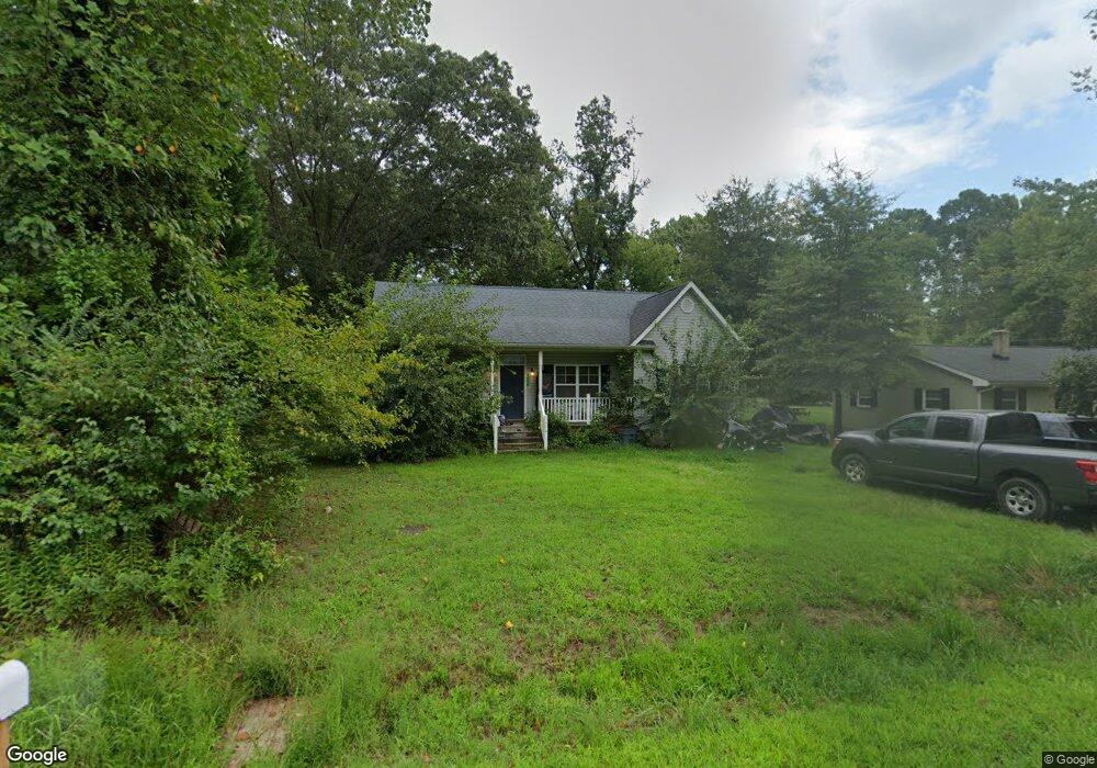
438 Rolando Dr Colonial Beach, VA 22443
Estimated Value: $305,183 - $389,000
--
Bed
--
Bath
1,528
Sq Ft
$221/Sq Ft
Est. Value
About This Home
This home is located at 438 Rolando Dr, Colonial Beach, VA 22443 and is currently estimated at $337,796, approximately $221 per square foot. 438 Rolando Dr is a home located in Westmoreland County with nearby schools including Montross Middle School, Westmoreland High School, and Monroe Bay Christian Academy.
Ownership History
Date
Name
Owned For
Owner Type
Purchase Details
Closed on
Aug 8, 2011
Sold by
Northern Neck Builders And Pro
Bought by
Snyder John Steven
Current Estimated Value
Home Financials for this Owner
Home Financials are based on the most recent Mortgage that was taken out on this home.
Original Mortgage
$161,805
Outstanding Balance
$111,718
Interest Rate
4.51%
Mortgage Type
VA
Estimated Equity
$226,078
Purchase Details
Closed on
Feb 10, 2011
Sold by
Hussey Keith
Bought by
Northern Neck Builders And Pro
Create a Home Valuation Report for This Property
The Home Valuation Report is an in-depth analysis detailing your home's value as well as a comparison with similar homes in the area
Home Values in the Area
Average Home Value in this Area
Purchase History
| Date | Buyer | Sale Price | Title Company |
|---|---|---|---|
| Snyder John Steven | $158,400 | -- | |
| Northern Neck Builders And Pro | $22,500 | -- |
Source: Public Records
Mortgage History
| Date | Status | Borrower | Loan Amount |
|---|---|---|---|
| Open | Northern Neck Builders And Pro | $161,805 |
Source: Public Records
Tax History Compared to Growth
Tax History
| Year | Tax Paid | Tax Assessment Tax Assessment Total Assessment is a certain percentage of the fair market value that is determined by local assessors to be the total taxable value of land and additions on the property. | Land | Improvement |
|---|---|---|---|---|
| 2024 | $1,371 | $201,600 | $35,100 | $166,500 |
| 2023 | $1,250 | $201,600 | $35,100 | $166,500 |
| 2022 | $1,250 | $201,600 | $35,100 | $166,500 |
| 2021 | $1,232 | $162,100 | $35,100 | $127,000 |
| 2020 | $1,232 | $162,100 | $35,100 | $127,000 |
| 2019 | $1,054 | $162,100 | $35,100 | $127,000 |
| 2018 | $989 | $162,100 | $35,100 | $127,000 |
| 2017 | -- | $162,100 | $35,100 | $127,000 |
| 2016 | $973 | $162,100 | $35,100 | $127,000 |
| 2015 | -- | $168,800 | $35,100 | $133,700 |
| 2014 | -- | $0 | $0 | $0 |
| 2013 | -- | $168,800 | $35,100 | $133,700 |
Source: Public Records
Map
Nearby Homes
- 0 Monroe Dr Unit VAWE2009818
- 219 Cedar Ln
- 222 Shore Dr
- 0 San Pedro Dr Unit VAWE2008614
- 405 Cedar Ln
- 189 Piney Forest Dr
- 141 Wakefield Dr
- 39 Fort King Dr
- 000 Fort King Dr
- 3 Shore Dr
- 14 Shore Dr
- 1224 Shore Dr
- 1252 Shore Dr
- Lot 9 Section 10 Sebastian Ave
- Lot 3 Paynes Point Dr
- Lot 1A Esmond Ln
- 1407 Lossing Ave
- 1212 Lossing Ave
- 122 Sulgrave St
- Lot 1 Marilou Ln
- 422 Rolando Dr
- 466 Rolando Dr
- 0 Monroe Point Unit 1006664524
- 0 Monroe Point Unit WE7270217
- 0 LOT 22 Monroe Dr
- 421 Rolando Dr
- 433 Rolando Dr
- 1303 Holly Vista Dr
- 451 Rolando Dr
- 394 Rolando Dr
- 1341 Holly Vista Dr
- 397 Rolando Dr
- 1355 Holly Vista Dr
- 492 Rolando Dr
- 381 Rolando Dr
- 1259 Holly Vista Dr
- 232 Westmoreland Dr
- 368 Rolando Dr
- 1369 Holly Vista Dr
- 278 Westmoreland Dr