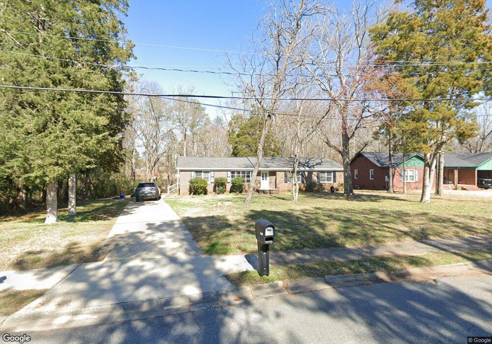
438 Starcrest Cir Rock Hill, SC 29730
Estimated Value: $233,000 - $299,000
3
Beds
2
Baths
1,550
Sq Ft
$180/Sq Ft
Est. Value
About This Home
This home is located at 438 Starcrest Cir, Rock Hill, SC 29730 and is currently estimated at $279,461, approximately $180 per square foot. 438 Starcrest Cir is a home located in York County with nearby schools including Sunset Park Elementary School, Saluda Trail Middle School, and South Pointe High School.
Ownership History
Date
Name
Owned For
Owner Type
Purchase Details
Closed on
Jul 28, 2025
Sold by
Bueno Johan S
Bought by
Grant Jacob and Starnes Jasmine
Current Estimated Value
Home Financials for this Owner
Home Financials are based on the most recent Mortgage that was taken out on this home.
Original Mortgage
$291,620
Outstanding Balance
$291,047
Interest Rate
6.81%
Mortgage Type
FHA
Estimated Equity
-$11,586
Purchase Details
Closed on
Jan 20, 2016
Sold by
Howze Angela Jones
Bought by
Federal National Mortgage Association and Fannie Mae
Purchase Details
Closed on
May 8, 2002
Sold by
K Ted Group Llc
Bought by
Bee Kay Properties Llc
Purchase Details
Closed on
May 7, 2002
Sold by
Albright Ned M and Albright Edward Marshall
Bought by
K Ted Group Llc
Create a Home Valuation Report for This Property
The Home Valuation Report is an in-depth analysis detailing your home's value as well as a comparison with similar homes in the area
Home Values in the Area
Average Home Value in this Area
Purchase History
| Date | Buyer | Sale Price | Title Company |
|---|---|---|---|
| Grant Jacob | $297,000 | None Listed On Document | |
| Grant Jacob | $297,000 | None Listed On Document | |
| Federal National Mortgage Association | $50,000 | -- | |
| Bee Kay Properties Llc | $1,284,200 | -- | |
| K Ted Group Llc | $817,712 | -- | |
| K Ted Group Llc | $817,712 | -- |
Source: Public Records
Mortgage History
| Date | Status | Borrower | Loan Amount |
|---|---|---|---|
| Open | Grant Jacob | $291,620 |
Source: Public Records
Tax History Compared to Growth
Tax History
| Year | Tax Paid | Tax Assessment Tax Assessment Total Assessment is a certain percentage of the fair market value that is determined by local assessors to be the total taxable value of land and additions on the property. | Land | Improvement |
|---|---|---|---|---|
| 2024 | $1,084 | $4,943 | $1,120 | $3,823 |
| 2023 | $1,087 | $4,943 | $1,120 | $3,823 |
| 2022 | $1,095 | $4,943 | $1,120 | $3,823 |
| 2021 | -- | $4,943 | $1,120 | $3,823 |
| 2020 | $1,097 | $4,943 | $0 | $0 |
| 2019 | $1,108 | $4,840 | $0 | $0 |
| 2018 | $1,107 | $4,840 | $0 | $0 |
| 2017 | $1,066 | $4,840 | $0 | $0 |
| 2016 | $2,730 | $6,900 | $0 | $0 |
| 2014 | $2,641 | $6,900 | $1,560 | $5,340 |
| 2013 | $2,641 | $6,960 | $1,560 | $5,400 |
Source: Public Records
Map
Nearby Homes
- 329 Arnold St
- 426 Williamson St
- 417 Baker Street Extension
- 420 Baker Street Extension
- 481 Milhaven St
- 263 Robinson St
- 420 Byars St
- 1195 Cavalier Ln
- 269 Cornelius Dr
- 718 Harrison St
- 664 Simpson St
- 116 Scottie Ct
- 244 1/2 Blanche Cir Unit 49
- 309 Haddington Ct
- 316 Scoggins St
- 235 Florence St
- 205, 207, 209 Friedheim Rd
- 1315 Pinkney St
- 206 Friedheim Rd
- 236 Emmett St
- 420 Starcrest Cir
- 418 Starcrest Cir
- 421 Starcrest Cir
- 417 Starcrest Cir
- 1142 Stanley Dr
- 1124 Ogden Rd
- 1140 Ogden Rd
- 1150 Stanley Dr
- 1151 Stanley Dr
- 1148 Ogden Rd
- 1158 Stanley Dr
- 1159 Stanley Dr
- 1160 Ogden Rd
- 1127 Ogden Rd
- 1119 Ogden Rd
- 1166 Stanley Dr
- 1166 Stanley Dr
- 1133 Ogden Rd
- 1151 Ogden Rd
- 1151 Ogden Rd