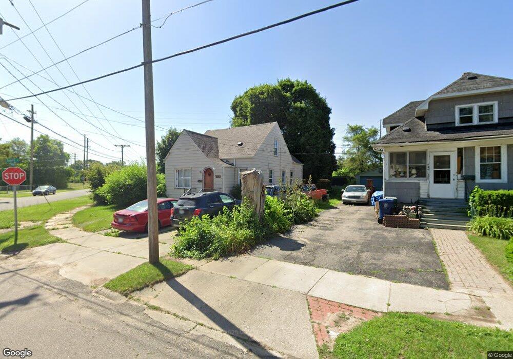
438 Tennyson Ave Flint, MI 48507
Circle Drive NeighborhoodEstimated Value: $66,000 - $87,000
2
Beds
2
Baths
1,263
Sq Ft
$60/Sq Ft
Est. Value
About This Home
This home is located at 438 Tennyson Ave, Flint, MI 48507 and is currently estimated at $76,323, approximately $60 per square foot. 438 Tennyson Ave is a home located in Genesee County with nearby schools including Freeman Elementary School, Flint Southwestern Classical Academy, and International Academy of Flint (K-12).
Ownership History
Date
Name
Owned For
Owner Type
Purchase Details
Closed on
Jan 11, 2023
Sold by
Dean Alyssia
Bought by
Shampine Jacob
Current Estimated Value
Purchase Details
Closed on
Jul 31, 2020
Sold by
Bogard Lanah J and Harris Lanah J
Bought by
Shampine Jacob and Dean Alyssia
Purchase Details
Closed on
May 20, 2004
Sold by
Fannie Mae
Bought by
Harris Donald L and Harris Lanah J
Purchase Details
Closed on
Mar 24, 2003
Sold by
Mortgage Electronic Registration Systems
Bought by
Federal National Mortgage Association
Create a Home Valuation Report for This Property
The Home Valuation Report is an in-depth analysis detailing your home's value as well as a comparison with similar homes in the area
Home Values in the Area
Average Home Value in this Area
Purchase History
| Date | Buyer | Sale Price | Title Company |
|---|---|---|---|
| Shampine Jacob | -- | -- | |
| Shampine Jacob | $10,000 | None Available | |
| Harris Donald L | $45,000 | Greco Title | |
| Federal National Mortgage Association | -- | -- |
Source: Public Records
Tax History
| Year | Tax Paid | Tax Assessment Tax Assessment Total Assessment is a certain percentage of the fair market value that is determined by local assessors to be the total taxable value of land and additions on the property. | Land | Improvement |
|---|---|---|---|---|
| 2025 | $1,570 | $29,000 | $0 | $0 |
| 2024 | $1,448 | $20,300 | $0 | $0 |
| 2023 | $1,277 | $16,900 | $0 | $0 |
| 2022 | $0 | $14,100 | $0 | $0 |
| 2021 | $1,391 | $13,200 | $0 | $0 |
| 2020 | $1,095 | $13,900 | $0 | $0 |
| 2019 | $1,148 | $11,600 | $0 | $0 |
| 2018 | $1,388 | $11,300 | $0 | $0 |
| 2017 | $1,350 | $0 | $0 | $0 |
| 2016 | $1,017 | $0 | $0 | $0 |
| 2015 | -- | $0 | $0 | $0 |
| 2014 | -- | $0 | $0 | $0 |
| 2012 | -- | $12,700 | $0 | $0 |
Source: Public Records
Map
Nearby Homes
- 530 McKeighan Ave
- 338 Browning Ave
- 617 McKeighan Ave
- 4133 Custer Ave
- 4126 Circle Dr
- 4127 Custer Ave
- 4526 Milton Dr
- 416 Burroughs Ave
- 326 Burroughs Ave
- 3442 Griffith Ct
- 802 McKeighan Ave
- 818 Dell Ave
- 352 Buckingham Ave
- 621 Burroughs Ave
- 361 Buckingham Ave
- 630 Buckingham Ave
- 3512 Barcey Ct
- 1483 Carman St
- 4424 Cheyenne Ave
- 1453 Carman St
- 434 Tennyson Ave
- 430 Tennyson Ave
- 433 E Hemphill Rd
- 429 E Hemphill Rd
- 429 E Hemphill Rd Unit A
- 4537 Pengelly Rd
- 426 Tennyson Ave
- 4601 Pengelly Rd
- 4605 Pengelly Rd
- 4529 Pengelly Rd
- 425 E Hemphill Rd
- 4609 Pengelly Rd
- 422 Tennyson Ave
- 419 Tennyson Ave
- 4533 Pengelly Rd
- 421 E Hemphill Rd
- 410 Tennyson Ave
- 418 Tennyson Ave
- 4521 Pengelly Rd
- 415 Tennyson Ave
Your Personal Tour Guide
Ask me questions while you tour the home.