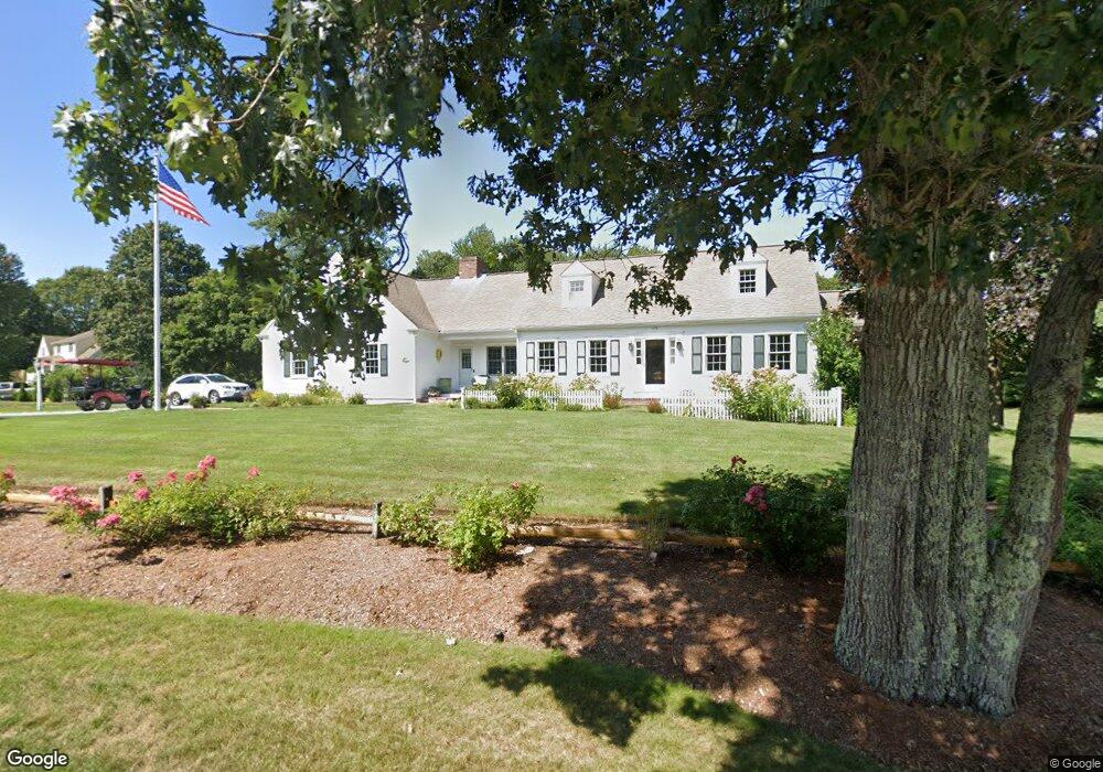
438 Weir Rd Yarmouth Port, MA 02675
Yarmouth Port NeighborhoodEstimated Value: $937,000 - $1,091,000
4
Beds
4
Baths
2,801
Sq Ft
$359/Sq Ft
Est. Value
About This Home
This home is located at 438 Weir Rd, Yarmouth Port, MA 02675 and is currently estimated at $1,004,491, approximately $358 per square foot. 438 Weir Rd is a home located in Barnstable County with nearby schools including Dennis-Yarmouth Regional High School and St. Pius X. School.
Ownership History
Date
Name
Owned For
Owner Type
Purchase Details
Closed on
Apr 1, 2010
Sold by
Grew David A and Grew Eunice M
Bought by
Eunice M Grew T
Current Estimated Value
Create a Home Valuation Report for This Property
The Home Valuation Report is an in-depth analysis detailing your home's value as well as a comparison with similar homes in the area
Home Values in the Area
Average Home Value in this Area
Purchase History
| Date | Buyer | Sale Price | Title Company |
|---|---|---|---|
| Eunice M Grew T | -- | -- |
Source: Public Records
Tax History Compared to Growth
Tax History
| Year | Tax Paid | Tax Assessment Tax Assessment Total Assessment is a certain percentage of the fair market value that is determined by local assessors to be the total taxable value of land and additions on the property. | Land | Improvement |
|---|---|---|---|---|
| 2025 | $7,654 | $1,081,100 | $188,500 | $892,600 |
| 2024 | $7,131 | $966,200 | $164,100 | $802,100 |
| 2023 | $7,112 | $876,900 | $149,300 | $727,600 |
| 2022 | $6,379 | $694,900 | $142,500 | $552,400 |
| 2021 | $6,208 | $649,400 | $142,500 | $506,900 |
| 2020 | $5,987 | $598,700 | $151,400 | $447,300 |
| 2019 | $5,517 | $546,200 | $151,400 | $394,800 |
| 2018 | $5,360 | $520,900 | $126,100 | $394,800 |
| 2017 | $5,219 | $520,900 | $126,100 | $394,800 |
| 2016 | $5,099 | $510,900 | $116,100 | $394,800 |
| 2015 | $4,902 | $488,200 | $111,000 | $377,200 |
Source: Public Records
Map
Nearby Homes