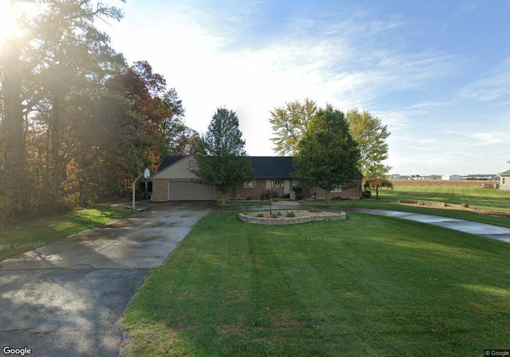
4380 State Route 705 E Fort Loramie, OH 45845
Estimated Value: $337,795 - $457,000
3
Beds
3
Baths
3,120
Sq Ft
$124/Sq Ft
Est. Value
About This Home
This home is located at 4380 State Route 705 E, Fort Loramie, OH 45845 and is currently estimated at $385,949, approximately $123 per square foot. 4380 State Route 705 E is a home located in Shelby County with nearby schools including Fort Loramie Elementary School and Fort Loramie Junior/Senior High School.
Ownership History
Date
Name
Owned For
Owner Type
Purchase Details
Closed on
May 29, 2024
Sold by
Wehrman Daniel J and Wehrman Ellen E
Bought by
Wehrman Drew D and Ernst Taylor L
Current Estimated Value
Home Financials for this Owner
Home Financials are based on the most recent Mortgage that was taken out on this home.
Original Mortgage
$200,000
Outstanding Balance
$194,069
Interest Rate
7.1%
Mortgage Type
New Conventional
Estimated Equity
$191,880
Create a Home Valuation Report for This Property
The Home Valuation Report is an in-depth analysis detailing your home's value as well as a comparison with similar homes in the area
Home Values in the Area
Average Home Value in this Area
Purchase History
| Date | Buyer | Sale Price | Title Company |
|---|---|---|---|
| Wehrman Drew D | $296,000 | None Listed On Document |
Source: Public Records
Mortgage History
| Date | Status | Borrower | Loan Amount |
|---|---|---|---|
| Open | Wehrman Drew D | $200,000 |
Source: Public Records
Tax History Compared to Growth
Tax History
| Year | Tax Paid | Tax Assessment Tax Assessment Total Assessment is a certain percentage of the fair market value that is determined by local assessors to be the total taxable value of land and additions on the property. | Land | Improvement |
|---|---|---|---|---|
| 2024 | $2,762 | $77,800 | $11,430 | $66,370 |
| 2023 | $2,762 | $77,800 | $11,430 | $66,370 |
| 2022 | $2,364 | $61,060 | $9,280 | $51,780 |
| 2021 | $2,388 | $61,060 | $9,280 | $51,780 |
| 2020 | $2,388 | $61,060 | $9,280 | $51,780 |
| 2019 | $2,237 | $57,410 | $7,700 | $49,710 |
| 2018 | $2,185 | $57,410 | $7,700 | $49,710 |
| 2017 | $0 | $0 | $0 | $0 |
Source: Public Records
Map
Nearby Homes
- 8381 Ohio 66
- 11519 Eilerman Rd
- 12244 Short Dr Unit Condo Unit 10
- 47 N Frankfort St
- 193 N Paris St
- 11968 Arling Rd
- 0 Stonegate Dr Unit 21 10544857
- 0 Stonegate Dr Unit 14 10544847
- 17 Stonegate Dr
- 36 Shania Place Unit 23
- 27 Shania Place Unit 26
- 19 Shania Place Unit 33
- 28 Shania Place Unit 33
- 11 Shania Place Unit 28
- 6388 Stoker Rd
- 5025 Walzer Rd
- 561 S Walnut St Unit Lot3
- 13400 Whitefeather Trail
- 149 Janice Dr
- 157 Janice Dr
- 810 E Park St
- 808 E Park St
- 4480 State Route 705 E
- 4550 State Route 705 E
- 580 Greenback Rd
- 560 Greenback Rd
- 9611 Dawson Rd
- 540 Greenback Rd
- 565 Elizabeth Ct
- 561 Elizabeth Ct
- 557 Elizabeth Ct
- 520 Greenback Rd
- 553 Elizabeth Ct
- 195 Woodland Dr
- 500 Greenback Rd
- 552 Elizabeth Ct
- 549 Elizabeth Ct
- 546 Elizabeth Ct
- 190 Woodland Dr
- 545 Elizabeth Ct