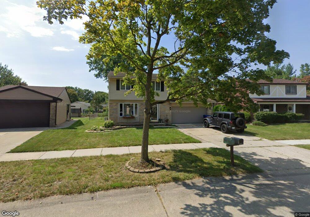
43807 Yorktown St Canton, MI 48188
Estimated Value: $332,000 - $347,000
3
Beds
2
Baths
1,385
Sq Ft
$244/Sq Ft
Est. Value
About This Home
This home is located at 43807 Yorktown St, Canton, MI 48188 and is currently estimated at $338,379, approximately $244 per square foot. 43807 Yorktown St is a home located in Wayne County with nearby schools including Bentley Elementary School, Canton High School, and Salem High School.
Ownership History
Date
Name
Owned For
Owner Type
Purchase Details
Closed on
Oct 19, 2018
Sold by
Isaacson Douglas S
Bought by
Sosnowski Kory Allen and Donhaue Erin Elizabeth
Current Estimated Value
Home Financials for this Owner
Home Financials are based on the most recent Mortgage that was taken out on this home.
Original Mortgage
$209,000
Outstanding Balance
$182,648
Interest Rate
4.6%
Mortgage Type
New Conventional
Estimated Equity
$155,731
Purchase Details
Closed on
Apr 7, 1997
Sold by
Cynthia Cynthia L and Cynthia Terrance A
Bought by
Smelcer Christine E and Smelcer Sean
Create a Home Valuation Report for This Property
The Home Valuation Report is an in-depth analysis detailing your home's value as well as a comparison with similar homes in the area
Home Values in the Area
Average Home Value in this Area
Purchase History
| Date | Buyer | Sale Price | Title Company |
|---|---|---|---|
| Sosnowski Kory Allen | $220,000 | First American Title Ins Co | |
| Smelcer Christine E | $135,700 | -- |
Source: Public Records
Mortgage History
| Date | Status | Borrower | Loan Amount |
|---|---|---|---|
| Open | Sosnowski Kory Allen | $209,000 |
Source: Public Records
Tax History Compared to Growth
Tax History
| Year | Tax Paid | Tax Assessment Tax Assessment Total Assessment is a certain percentage of the fair market value that is determined by local assessors to be the total taxable value of land and additions on the property. | Land | Improvement |
|---|---|---|---|---|
| 2025 | $2,006 | $141,500 | $0 | $0 |
| 2024 | $2,006 | $135,900 | $0 | $0 |
| 2023 | $1,912 | $123,700 | $0 | $0 |
| 2022 | $4,204 | $107,300 | $0 | $0 |
| 2021 | $4,079 | $104,100 | $0 | $0 |
| 2020 | $4,027 | $98,800 | $0 | $0 |
| 2019 | $3,955 | $94,490 | $0 | $0 |
| 2018 | $2,496 | $85,840 | $0 | $0 |
| 2017 | $3,131 | $83,400 | $0 | $0 |
| 2016 | $4,222 | $82,200 | $0 | $0 |
| 2015 | $6,748 | $77,130 | $0 | $0 |
| 2013 | $6,537 | $69,970 | $0 | $0 |
| 2010 | -- | $61,120 | $33,183 | $27,937 |
Source: Public Records
Map
Nearby Homes
- 1619 Nowland Ct
- 43661 Antietam Ct
- 43592 Champlain Ct
- 43664 Appomattox Ct
- 43450 Fredericksburg St
- 45030 Glengarry Rd
- 45242 Thornhill Rd
- 550 Cherry Grove Rd Unit 111
- 1937 S Cavalier Dr
- 278 Cornell St
- 45400 William Ct
- 603 Concord Dr Unit 67
- 139 Concord Dr
- 550 Concord Dr Unit 75
- 44322 Vassar St
- 1834 Maple Park Dr W Unit 9
- 2562 Woodmont Dr E
- 2210 Woodmont Dr W
- 2349 Abbey Ct
- 1530 Fairfax Dr
- 43813 Yorktown St
- 43801 Yorktown St
- 43825 Chalmette Ct
- 44232 Cherbourg St
- 43829 Chalmette Ct
- 44238 Cherbourg St
- 43808 Yorktown St
- 43802 Yorktown St
- 43865 Yorktown St
- 43814 Yorktown St
- 44244 Cherbourg St
- 43833 Chalmette Ct
- 43790 Yorktown St
- 43857 Chalmette Ct
- 43868 Shiloh Ct
- 44213 Cherbourg St
- 44225 Cherbourg St
- 44201 Cherbourg St
- 44250 Cherbourg St
- 44231 Cherbourg St