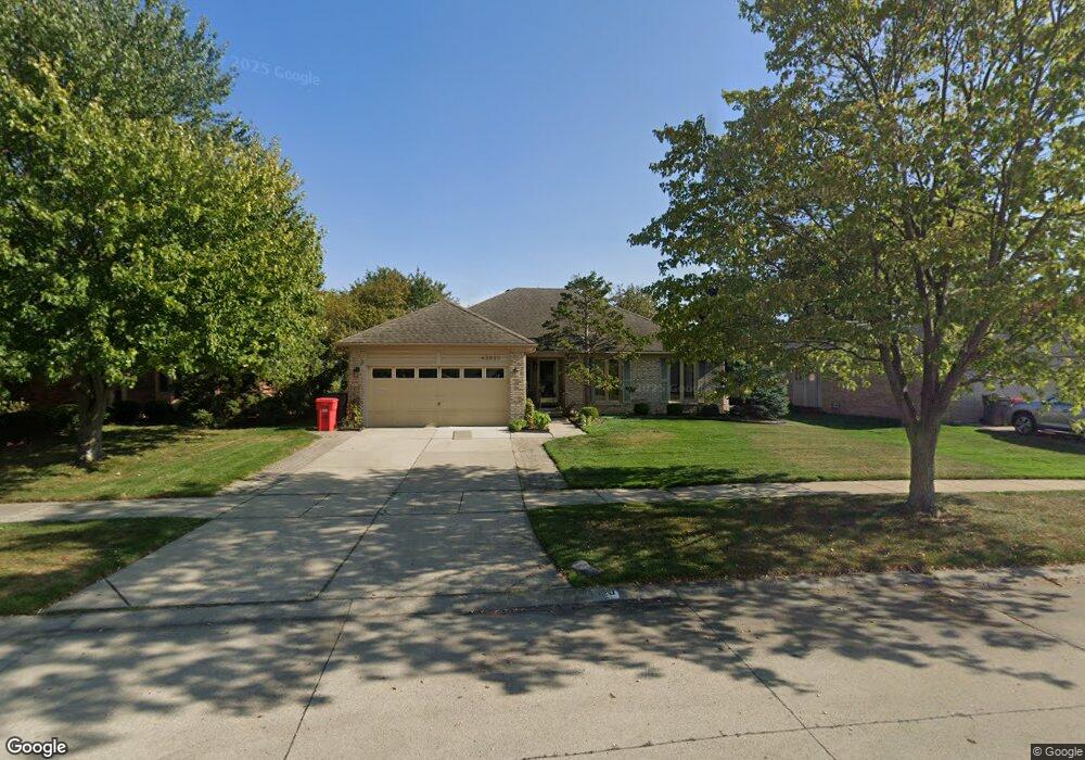
43820 Boulder Dr Clinton Township, MI 48038
Estimated Value: $361,056 - $406,000
--
Bed
1
Bath
1,878
Sq Ft
$207/Sq Ft
Est. Value
About This Home
This home is located at 43820 Boulder Dr, Clinton Township, MI 48038 and is currently estimated at $389,014, approximately $207 per square foot. 43820 Boulder Dr is a home located in Macomb County with nearby schools including Cherokee Elementary School, Wyandot Middle School, and Chippewa Valley High School.
Ownership History
Date
Name
Owned For
Owner Type
Purchase Details
Closed on
Jun 2, 2018
Sold by
Denardo Dolcie J
Bought by
Denardo Dolcie and Denardo John L
Current Estimated Value
Purchase Details
Closed on
Nov 20, 2012
Sold by
Denardo John L and Denardo Dolcie
Bought by
Denardo Dolcie J
Home Financials for this Owner
Home Financials are based on the most recent Mortgage that was taken out on this home.
Original Mortgage
$75,000
Interest Rate
3.36%
Mortgage Type
New Conventional
Purchase Details
Closed on
Apr 29, 2004
Sold by
Denardo John L and Denardo Dolcie
Bought by
Denardo John L and Denardo Dolcie
Create a Home Valuation Report for This Property
The Home Valuation Report is an in-depth analysis detailing your home's value as well as a comparison with similar homes in the area
Home Values in the Area
Average Home Value in this Area
Purchase History
| Date | Buyer | Sale Price | Title Company |
|---|---|---|---|
| Denardo Dolcie | -- | None Available | |
| Denardo Dolcie J | -- | None Available | |
| Denardo John L | -- | Greco |
Source: Public Records
Mortgage History
| Date | Status | Borrower | Loan Amount |
|---|---|---|---|
| Closed | Denardo Dolcie J | $75,000 |
Source: Public Records
Tax History Compared to Growth
Tax History
| Year | Tax Paid | Tax Assessment Tax Assessment Total Assessment is a certain percentage of the fair market value that is determined by local assessors to be the total taxable value of land and additions on the property. | Land | Improvement |
|---|---|---|---|---|
| 2025 | $4,517 | $183,200 | $0 | $0 |
| 2024 | $2,691 | $172,200 | $0 | $0 |
| 2023 | $2,553 | $154,000 | $0 | $0 |
| 2022 | $4,093 | $129,900 | $0 | $0 |
| 2021 | $3,980 | $123,400 | $0 | $0 |
| 2020 | $2,342 | $119,900 | $0 | $0 |
| 2019 | $3,708 | $114,200 | $0 | $0 |
| 2018 | $3,642 | $107,400 | $0 | $0 |
| 2017 | $3,598 | $101,300 | $25,800 | $75,500 |
| 2016 | $3,576 | $101,300 | $0 | $0 |
| 2015 | -- | $93,900 | $0 | $0 |
| 2014 | -- | $90,400 | $0 | $0 |
| 2011 | -- | $84,800 | $21,000 | $63,800 |
Source: Public Records
Map
Nearby Homes
- 44130 Cadburry Dr
- 20561 Longwood Dr Unit 64
- 43377 Rivergate Dr
- 43476 Hillsboro Dr
- 43363 Herring Dr
- 43373 Brooks Dr
- 20465 Saint Laurence Dr
- 43274 Hillsboro Dr
- 20654 Dunham Rd Unit 24
- 44304 Pentwater Dr
- 44192 Rivergate Dr
- 19118 Killeen Dr
- 20445 Villa Grande Cir Unit 48
- 0 Clinton River Rd Unit 20251013874
- 20194 Calumet Dr
- 44105 Dunham Ct
- 44000 Dunham Ct
- 20757 Cueter Ln
- 43105 Sinnamon Dr
- 19790 Westchester Dr Unit 11
- 43840 Boulder Dr
- 43800 Boulder Dr
- 20295 Dunham Rd
- 20315 Dunham Rd
- 20295 Dunham Rd
- 43780 Boulder Dr
- 20275 Dunham Rd
- 20325 Dunham Rd
- 43815 Boulder Dr
- 20245 Dunham Rd
- 43900 Boulder Dr
- 43885 Boulder Dr
- 20345 Dunham Rd
- 43785 Boulder Dr
- 20215 Dunham Rd
- 43920 Boulder Dr
- 43923 Trent Dr
- 43915 Boulder Dr
- 43765 Boulder Dr
- 20365 Dunham Rd