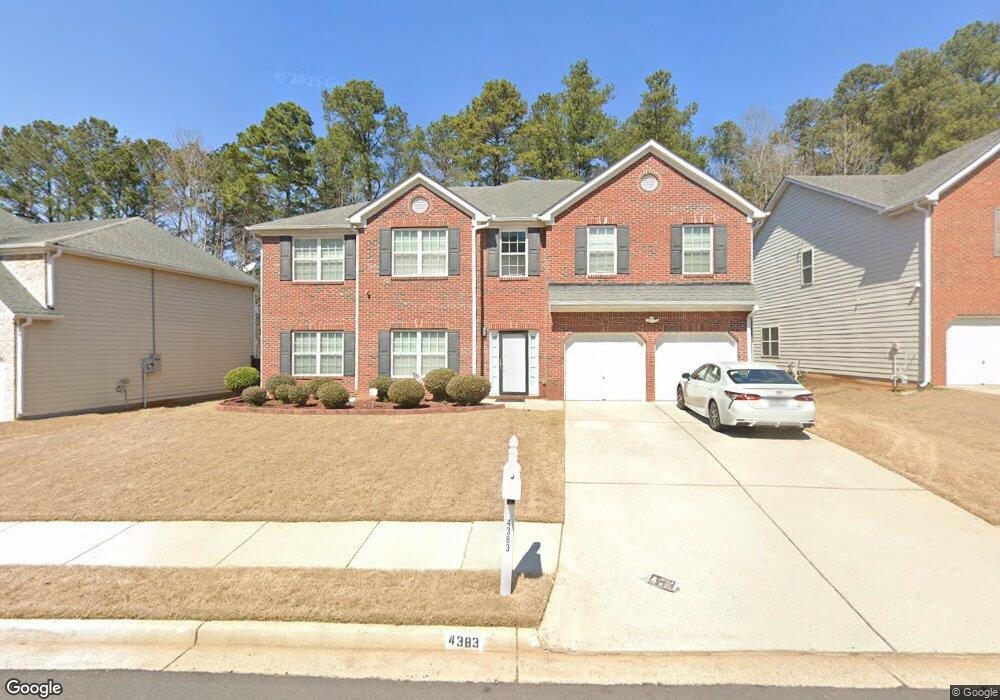
4383 Shamrock Dr Atlanta, GA 30349
Estimated Value: $375,948 - $462,000
5
Beds
4
Baths
3,753
Sq Ft
$111/Sq Ft
Est. Value
About This Home
This home is located at 4383 Shamrock Dr, Atlanta, GA 30349 and is currently estimated at $414,737, approximately $110 per square foot. 4383 Shamrock Dr is a home located in Fulton County with nearby schools including Wolf Creek Elementary, Renaissance Middle School, and Langston Hughes High School.
Ownership History
Date
Name
Owned For
Owner Type
Purchase Details
Closed on
Oct 27, 2006
Sold by
Silver Creek Communities Inc
Bought by
Davis Paul and Davis Julie L
Current Estimated Value
Home Financials for this Owner
Home Financials are based on the most recent Mortgage that was taken out on this home.
Original Mortgage
$213,750
Outstanding Balance
$127,144
Interest Rate
6.31%
Mortgage Type
New Conventional
Estimated Equity
$287,593
Create a Home Valuation Report for This Property
The Home Valuation Report is an in-depth analysis detailing your home's value as well as a comparison with similar homes in the area
Home Values in the Area
Average Home Value in this Area
Purchase History
| Date | Buyer | Sale Price | Title Company |
|---|---|---|---|
| Davis Paul | $267,300 | -- |
Source: Public Records
Mortgage History
| Date | Status | Borrower | Loan Amount |
|---|---|---|---|
| Open | Davis Paul | $213,750 |
Source: Public Records
Tax History Compared to Growth
Tax History
| Year | Tax Paid | Tax Assessment Tax Assessment Total Assessment is a certain percentage of the fair market value that is determined by local assessors to be the total taxable value of land and additions on the property. | Land | Improvement |
|---|---|---|---|---|
| 2025 | $2,403 | $98,800 | $20,840 | $77,960 |
| 2023 | $2,793 | $98,960 | $19,720 | $79,240 |
| 2022 | $2,311 | $98,960 | $19,720 | $79,240 |
| 2021 | $2,279 | $96,120 | $19,160 | $76,960 |
| 2020 | $2,287 | $94,960 | $18,920 | $76,040 |
| 2019 | $2,307 | $83,360 | $19,320 | $64,040 |
| 2018 | $2,274 | $74,440 | $11,920 | $62,520 |
| 2017 | $1,893 | $63,520 | $9,920 | $53,600 |
| 2016 | $1,891 | $63,520 | $9,920 | $53,600 |
| 2015 | $1,897 | $63,520 | $9,920 | $53,600 |
| 2014 | $1,974 | $63,520 | $9,920 | $53,600 |
Source: Public Records
Map
Nearby Homes
- 4327 Shamrock Dr
- 4270 Holliday Rd
- 4189 Post Oak Grove
- 4185 Post Oak Grove
- 6292 Dekeon Dr
- 4369 Estate St
- 4247 Butternut Place
- 6639 Overlook Ridge
- 6474 E Stubbs Rd
- 4224 Butternut Place
- 6684 Crane Ave
- 0 Jones Rd Unit 10486732
- 0 Jones Rd Unit 7548174
- 6390 E Stubbs Rd
- 6476 Snowden Dr
- 4140 Butternut Place
- 6640 E Stubbs Rd
- 0 Derrick Rd SE Unit 10621019
- 0 Derrick Rd SE Unit 22713952
- 436 Berkshire Place
- 4387 Shamrock Dr
- 4379 Shamrock Dr
- 4379 Shamrock Dr Unit 73
- 4395 Shamrock Dr
- 4384 Shamrock Dr
- 4380 Shamrock Dr
- 4388 Shamrock Dr
- 4375 Shamrock Dr
- 4376 Shamrock Dr
- 4392 Shamrock Dr
- 4371 Shamrock Dr
- 4396 Shamrock Dr
- 6460 Jones Rd
- 4400 Shamrock Dr
- 4367 Shamrock Dr
- 6470 Jones Rd Unit 1
- 6450 Jones Rd
- 4368 Shamrock Dr
- 4359 Shamrock Dr
- 4364 Shamrock Dr