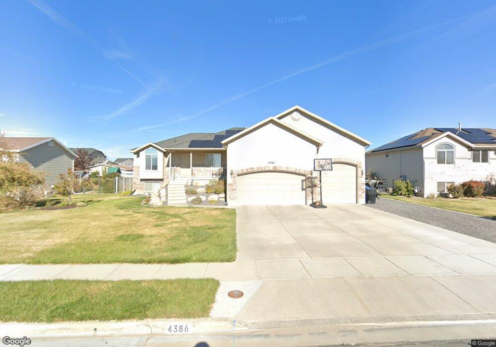
4386 W 25 S West Point, UT 84015
Estimated Value: $589,000 - $650,000
7
Beds
3
Baths
3,133
Sq Ft
$199/Sq Ft
Est. Value
About This Home
This home is located at 4386 W 25 S, West Point, UT 84015 and is currently estimated at $622,952, approximately $198 per square foot. 4386 W 25 S is a home located in Davis County with nearby schools including West Point School, West Point Junior High School, and Syracuse High School.
Ownership History
Date
Name
Owned For
Owner Type
Purchase Details
Closed on
Aug 16, 2023
Sold by
Perkins Alexander J
Bought by
Perkins Alexander J and Perkins Lindi
Current Estimated Value
Purchase Details
Closed on
Aug 15, 2020
Sold by
Smith Jesse A and Smith Candise L
Bought by
Perkins Alexander J
Home Financials for this Owner
Home Financials are based on the most recent Mortgage that was taken out on this home.
Original Mortgage
$500,000
Interest Rate
6.81%
Mortgage Type
New Conventional
Purchase Details
Closed on
Nov 18, 2016
Sold by
Smith Candise L and Smith Jesse A
Bought by
Smith Jesse A and Smith Candise L
Purchase Details
Closed on
Aug 25, 2010
Sold by
Cheney James
Bought by
Smith Candise L and Smith Jesse A
Home Financials for this Owner
Home Financials are based on the most recent Mortgage that was taken out on this home.
Original Mortgage
$207,209
Interest Rate
4.5%
Mortgage Type
FHA
Purchase Details
Closed on
Oct 17, 2007
Sold by
Cheney James
Bought by
Cheney James
Purchase Details
Closed on
Jan 12, 2006
Sold by
Brown Matthew T
Bought by
Cheney James
Home Financials for this Owner
Home Financials are based on the most recent Mortgage that was taken out on this home.
Original Mortgage
$163,040
Interest Rate
6.25%
Mortgage Type
Fannie Mae Freddie Mac
Purchase Details
Closed on
Jun 30, 2005
Sold by
Out West Development Llc
Bought by
Brown Matthew T
Home Financials for this Owner
Home Financials are based on the most recent Mortgage that was taken out on this home.
Original Mortgage
$153,600
Interest Rate
5.58%
Mortgage Type
Construction
Create a Home Valuation Report for This Property
The Home Valuation Report is an in-depth analysis detailing your home's value as well as a comparison with similar homes in the area
Home Values in the Area
Average Home Value in this Area
Purchase History
| Date | Buyer | Sale Price | Title Company |
|---|---|---|---|
| Perkins Alexander J | -- | Truly Title | |
| Perkins Alexander J | -- | Truly Title | |
| Perkins Alexander J | -- | First American Title | |
| Perkins Alexander J | -- | First American Title | |
| Smith Jesse A | -- | Security Title | |
| Smith Candise L | -- | First American Title | |
| Cheney James | -- | Mountain View Title & Escrow | |
| Cheney James | -- | Utah Commercial Title Co | |
| Brown Matthew T | -- | Security Title |
Source: Public Records
Mortgage History
| Date | Status | Borrower | Loan Amount |
|---|---|---|---|
| Previous Owner | Perkins Alexander J | $500,000 | |
| Previous Owner | Smith Candise L | $207,209 | |
| Previous Owner | Cheney James | $163,040 | |
| Previous Owner | Brown Matthew T | $153,600 |
Source: Public Records
Tax History Compared to Growth
Tax History
| Year | Tax Paid | Tax Assessment Tax Assessment Total Assessment is a certain percentage of the fair market value that is determined by local assessors to be the total taxable value of land and additions on the property. | Land | Improvement |
|---|---|---|---|---|
| 2025 | $3,579 | $329,450 | $123,109 | $206,341 |
| 2024 | $3,434 | $317,350 | $110,780 | $206,570 |
| 2023 | $2,872 | $488,000 | $141,405 | $346,595 |
| 2022 | $3,109 | $289,300 | $74,497 | $214,803 |
| 2021 | $2,775 | $386,000 | $112,779 | $273,221 |
| 2020 | $2,504 | $343,000 | $95,396 | $247,604 |
| 2019 | $2,334 | $315,000 | $92,358 | $222,642 |
| 2018 | $2,197 | $292,000 | $90,937 | $201,063 |
| 2016 | $1,923 | $134,090 | $35,248 | $98,842 |
| 2015 | $2,029 | $134,035 | $35,248 | $98,787 |
| 2014 | $1,815 | $121,350 | $35,248 | $86,102 |
| 2013 | -- | $116,852 | $31,094 | $85,758 |
Source: Public Records
Map
Nearby Homes
- 4325 W 75 N
- 4362 West St Unit 106
- 4358 West St Unit 105
- 128 N 4500 W
- 120 N 4325 W
- 4366 W 200 N
- 4594 W 75 N Unit 405
- 4669 W 75 N
- 4352 W 300 N
- 356 S 4300 W Unit 611
- 364 S 4300 W Unit 610
- 477 N 4500 W
- 357 N 4000 W
- 3949 W 250 N
- 3851 W 50 S Unit 425
- 3849 W 50 S Unit 426
- 3847 W 50 S Unit 428
- 3833 W 50 S Unit 429
- 3827 W 50 S Unit 431
- 9 S 3830 W Unit 441
- 4386 W 25 S Unit 107
- 4402 W 25 S
- 4370 W 25 S Unit 108
- 4387 W 75 N Unit 206
- 4418 W 25 S
- 4354 W 25 S
- 4401 W 75 N Unit 207
- 4365 W 75 N Unit 205
- 4371 W 25 S
- 4429 W 75 N
- 4429 W 75 N Unit 115
- 4387 W 25 S
- 4338 W 25 S
- 4436 W 25 S
- 4355 W 25 S
- 4411 W 25 S Unit 126
- 4411 W 25 S
- 4343 W 75 N Unit 204
- 4423 W 25 S
- 4447 W 75 N Unit 114