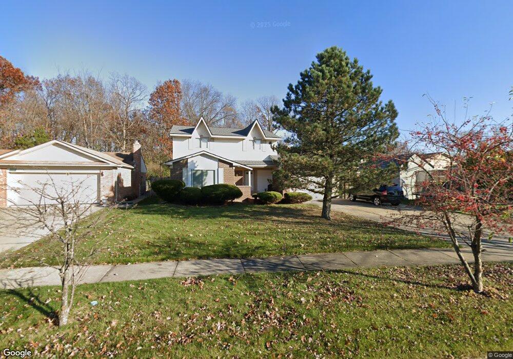
43866 Somerset Square Unit Bldg-Unit Canton, MI 48187
Estimated Value: $392,000 - $411,724
--
Bed
4
Baths
1,722
Sq Ft
$235/Sq Ft
Est. Value
About This Home
This home is located at 43866 Somerset Square Unit Bldg-Unit, Canton, MI 48187 and is currently estimated at $404,431, approximately $234 per square foot. 43866 Somerset Square Unit Bldg-Unit is a home located in Wayne County with nearby schools including Canton High School, Discovery Middle School, and Salem High School.
Ownership History
Date
Name
Owned For
Owner Type
Purchase Details
Closed on
Jun 2, 2020
Sold by
Bennett Michael E and Bennett Rita
Bought by
Bennett Michael E and Bennett Rita M
Current Estimated Value
Purchase Details
Closed on
Feb 9, 2018
Sold by
White Phillip and White Phillip
Bought by
Bennett Michael E
Purchase Details
Closed on
May 9, 2003
Sold by
White Laurie Ann
Bought by
White Phillip
Purchase Details
Closed on
Oct 28, 1997
Sold by
Kathy Fordel Jeffrey M and Kathy Fordel
Bought by
White Phillip
Create a Home Valuation Report for This Property
The Home Valuation Report is an in-depth analysis detailing your home's value as well as a comparison with similar homes in the area
Home Values in the Area
Average Home Value in this Area
Purchase History
| Date | Buyer | Sale Price | Title Company |
|---|---|---|---|
| Bennett Michael E | -- | None Available | |
| Bennett Michael E | $217,000 | None Available | |
| White Phillip | -- | -- | |
| White Phillip | $160,900 | -- |
Source: Public Records
Tax History Compared to Growth
Tax History
| Year | Tax Paid | Tax Assessment Tax Assessment Total Assessment is a certain percentage of the fair market value that is determined by local assessors to be the total taxable value of land and additions on the property. | Land | Improvement |
|---|---|---|---|---|
| 2025 | $2,482 | $171,800 | $0 | $0 |
| 2024 | $2,482 | $163,600 | $0 | $0 |
| 2023 | $2,367 | $144,000 | $0 | $0 |
| 2022 | $5,242 | $133,100 | $0 | $0 |
| 2021 | $5,081 | $129,100 | $0 | $0 |
| 2020 | $7,175 | $122,500 | $0 | $0 |
| 2019 | $7,045 | $116,940 | $0 | $0 |
| 2018 | $2,979 | $107,330 | $0 | $0 |
| 2017 | $4,151 | $101,600 | $0 | $0 |
| 2016 | $4,576 | $98,100 | $0 | $0 |
| 2015 | $7,639 | $90,100 | $0 | $0 |
| 2013 | $7,400 | $79,000 | $0 | $0 |
| 2010 | -- | $79,050 | $35,812 | $43,238 |
Source: Public Records
Map
Nearby Homes
- 43737 Westminister Way
- 43764 Hanford Rd
- 835 Coldrose Way
- 43625 Westminister Way
- 44018 Bannockburn Dr
- 43783 Leeann Ln
- 43875 Leeann Ln
- 44585 Nantucket Dr
- 6877 Pittsford St
- 6586 Carriage Hills Dr
- 43051 Fernwood St
- 58560 Stuart Dr
- 1926 Marlowe St
- 6907 Harvard Ln
- 6972 Harvard Ln
- 6986 Harvard Ln Unit 129
- 44497 Savery Dr Unit 103
- 1954 E Franklin Dr
- 6838 Bostonhill Ln
- 1822 N Sheldon Rd
- 43866 Somerset Square
- 43880 Somerset Square
- 43792 Westminister Way
- 43810 Westminister Way
- 43908 Somerset Square
- 43778 Westminister Way
- 43855 Somerset Square
- 43875 Somerset Square
- 43764 Westminister Way
- 43922 Somerset Square
- 44014 Westminister Way
- 43919 Somerset Square
- 43750 Westminister Way
- 43936 Somerset Square
- 44035 Yorkshire Dr
- 43807 Westminister Way
- 43793 Westminister Way
- 43821 Westminister Way
- 43779 Westminister Way
- 44007 Westminister Way