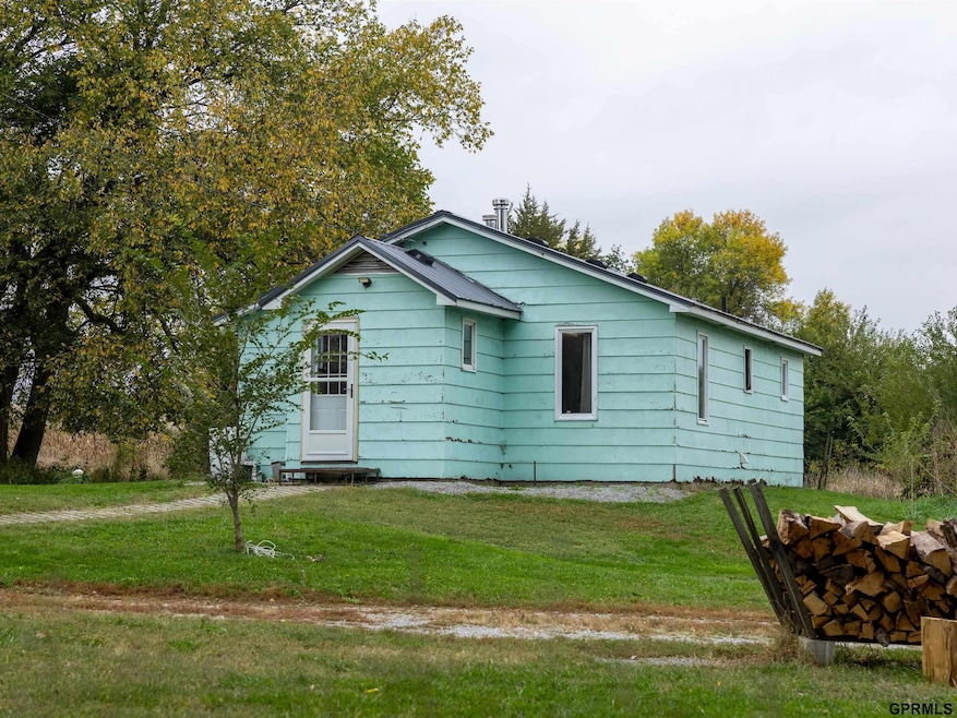

4388 H Rd Dunbar, NE 68346
Estimated payment $1,147/month
Highlights
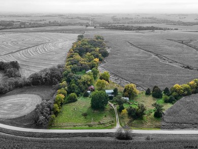
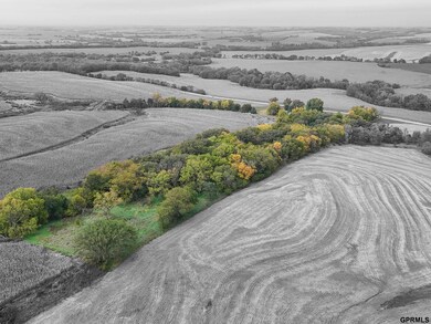
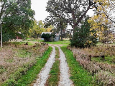
- 10.01 Acre Lot
- Wood Burning Stove
- No HOA
- Elementary School at Syracuse Rated A-
- Ranch Style House
- 2 Car Detached Garage
About This Home
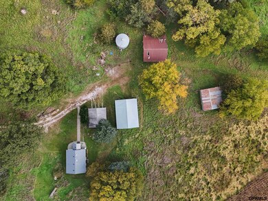
Come and see this 10+ acre retreat! This adorable cottage has seen some major updates in the past 5 years, including a new roof, washer and dryer, tankless water heater, flooring, new well pressure tank, all the electrical has been updated and a bathroom update all the way down to the plumbing. The main living space is a 2-bed, 1 bath, perfect for either a getaway space or a primary residence. The property has some amazing features including mature trees and several outbuildings/structures. With no surrounding neighbors, this space provides an immense amount of privacy. This country oasis is ready for its new owners! Please reference Land Listing MLS#22529951.
Home Details
Home Type
- Single Family
Est. Annual Taxes
- $1,122
Year Built
- Built in 1960
Lot Details
- 10.01 Acre Lot
- Lot Dimensions are 1662 x 419
Parking
- 2 Car Detached Garage
Home Design
- Ranch Style House
- Slab Foundation
Interior Spaces
- 724 Sq Ft Home
- Ceiling Fan
- Wood Burning Stove
- Crawl Space
Flooring
- Wall to Wall Carpet
- Luxury Vinyl Tile
Bedrooms and Bathrooms
- 2 Bedrooms
- 1 Full Bathroom
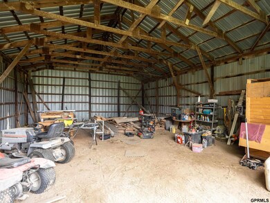
Outdoor Features
- Shed
- Outbuilding
Schools
- Syracuse Elementary And Middle School
- Syracuse High School
Utilities
- Window Unit Cooling System
- Forced Air Heating System
- Heating System Uses Natural Gas
- Propane
- Well
- Septic Tank
Community Details
- No Home Owners Association
- Dunbar Subdivision
Listing and Financial Details
- Assessor Parcel Number 002155500
Map
Home Values in the Area
Average Home Value in this Area
Tax History
| Year | Tax Paid | Tax Assessment Tax Assessment Total Assessment is a certain percentage of the fair market value that is determined by local assessors to be the total taxable value of land and additions on the property. | Land | Improvement |
|---|---|---|---|---|
| 2024 | $1,549 | $127,960 | $83,204 | $44,756 |
| 2023 | $1,715 | $119,784 | $75,640 | $44,144 |
| 2022 | $1,547 | $108,920 | $75,640 | $33,280 |
| 2021 | $1,500 | $108,920 | $75,640 | $33,280 |
| 2020 | $6,348 | $457,750 | $426,940 | $30,810 |
| 2019 | $6,500 | $462,310 | $431,500 | $30,810 |
| 2018 | $6,273 | $473,910 | $443,100 | $30,810 |
| 2017 | $6,556 | $478,210 | $447,400 | $30,810 |
| 2016 | $6,060 | $469,930 | $439,120 | $30,810 |
| 2015 | $6,020 | $461,980 | $431,170 | $30,810 |
| 2014 | $5,757 | $407,150 | $376,340 | $30,810 |
| 2012 | $5,079 | $352,390 | $321,580 | $30,810 |
Property History
| Date | Event | Price | List to Sale | Price per Sq Ft |
|---|---|---|---|---|
| 10/22/2025 10/22/25 | Pending | -- | -- | -- |
| 10/17/2025 10/17/25 | For Sale | $200,000 | -- | $276 / Sq Ft |
Purchase History
| Date | Type | Sale Price | Title Company |
|---|---|---|---|
| Personal Reps Deed | $140,000 | Ambassador Title Services |
Mortgage History
| Date | Status | Loan Amount | Loan Type |
|---|---|---|---|
| Open | $133,000 | New Conventional |
Source: Great Plains Regional MLS
MLS Number: 22528713
APN: 002155500
Disclaimer: Certain information contained herein is derived from information provided by parties other than Homes.com. All information provided is deemed reliable, but is not guaranteed to be accurate and should be independently verified.
![]() Listing information is provided by Participants of the Great Plains Regional Multiple Listing Service Inc.
Listing information is provided by Participants of the Great Plains Regional Multiple Listing Service Inc.
IDX information is provided exclusively for personal, non-commercial use, and may not be used for any purpose other than to identify prospective properties consumers may be interested in purchasing.
Information is deemed reliable but not guaranteed.
Copyright 2025, Great Plains Regional MLS LLC
