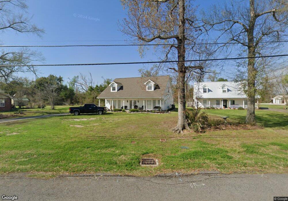
439 Bagdad Rd Westlake, LA 70669
Estimated Value: $168,126 - $270,000
--
Bed
--
Bath
--
Sq Ft
1,830
Sq Ft Lot
About This Home
This home is located at 439 Bagdad Rd, Westlake, LA 70669 and is currently estimated at $225,532. 439 Bagdad Rd is a home located in Calcasieu Parish with nearby schools including Westwood Elementary School, Western Heights Elementary School, and S.P. Arnett Middle School.
Ownership History
Date
Name
Owned For
Owner Type
Purchase Details
Closed on
Aug 26, 2023
Sold by
Preston J Properties Llc
Bought by
Poole Anna Cadie St Rom and Bass Claire Marie St Rom
Current Estimated Value
Purchase Details
Closed on
Feb 4, 2015
Sold by
Harrison Samuel Wade and Elkins Elizabeth Ann
Bought by
Byrd Joshua Lee and Byrd Lindsay Dayle
Home Financials for this Owner
Home Financials are based on the most recent Mortgage that was taken out on this home.
Original Mortgage
$181,070
Interest Rate
3.78%
Mortgage Type
New Conventional
Create a Home Valuation Report for This Property
The Home Valuation Report is an in-depth analysis detailing your home's value as well as a comparison with similar homes in the area
Home Values in the Area
Average Home Value in this Area
Purchase History
| Date | Buyer | Sale Price | Title Company |
|---|---|---|---|
| Poole Anna Cadie St Rom | -- | None Listed On Document | |
| Byrd Joshua Lee | $190,600 | None Available |
Source: Public Records
Mortgage History
| Date | Status | Borrower | Loan Amount |
|---|---|---|---|
| Previous Owner | Byrd Joshua Lee | $181,070 |
Source: Public Records
Tax History Compared to Growth
Tax History
| Year | Tax Paid | Tax Assessment Tax Assessment Total Assessment is a certain percentage of the fair market value that is determined by local assessors to be the total taxable value of land and additions on the property. | Land | Improvement |
|---|---|---|---|---|
| 2024 | $631 | $13,250 | $1,080 | $12,170 |
| 2023 | $631 | $13,250 | $1,080 | $12,170 |
| 2022 | $646 | $13,250 | $1,080 | $12,170 |
| 2021 | $630 | $13,250 | $1,080 | $12,170 |
| 2020 | $1,339 | $11,990 | $1,040 | $10,950 |
| 2019 | $1,522 | $13,170 | $1,000 | $12,170 |
| 2018 | $607 | $13,170 | $1,000 | $12,170 |
| 2017 | $1,453 | $13,170 | $1,000 | $12,170 |
| 2016 | $1,442 | $13,170 | $1,000 | $12,170 |
| 2015 | $1,473 | $13,170 | $1,000 | $12,170 |
Source: Public Records
Map
Nearby Homes
- 0 Tbd Bagdad Rd
- 1931 Miller Ave
- 0 Dewitt St
- 1416 Miller Ave
- 2034 Gus St
- 0 Mims Rd Unit SWL24003447
- 0 Mims Rd Unit Mims Rd 26-4577
- 812 Miller Ave
- 345 Fred Lutz Rd
- 2406 Miller Ave
- 401 E Krause St
- 1308 S Rue Des Chene
- 1424 Rue Des Chene
- 414 E Krause St
- 1444 Beech St
- 1430 Beech St
- 637 River Rd
- 1324 Beech St
- 405 Mckinley St
- 1705 N Hilma St