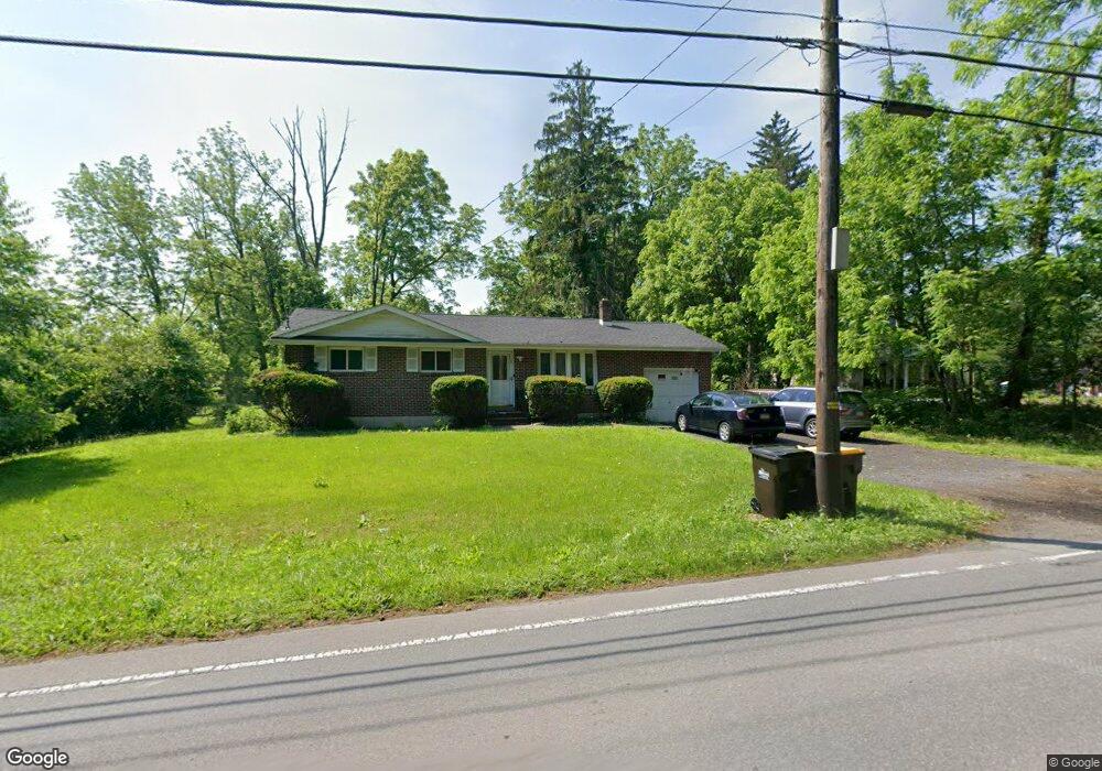
439 Mill Creek Rd East Stroudsburg, PA 18301
Estimated Value: $242,470 - $293,000
3
Beds
1
Bath
1,107
Sq Ft
$238/Sq Ft
Est. Value
About This Home
This home is located at 439 Mill Creek Rd, East Stroudsburg, PA 18301 and is currently estimated at $263,118, approximately $237 per square foot. 439 Mill Creek Rd is a home located in Monroe County with nearby schools including Stroudsburg Junior High School, Stroudsburg High School, and Notre Dame Elementary School.
Ownership History
Date
Name
Owned For
Owner Type
Purchase Details
Closed on
Oct 27, 2006
Sold by
Ralston Kathleen and Galinsky Michael
Bought by
Khalil Afaf
Current Estimated Value
Home Financials for this Owner
Home Financials are based on the most recent Mortgage that was taken out on this home.
Original Mortgage
$17,800
Outstanding Balance
$11,273
Interest Rate
7.5%
Mortgage Type
Adjustable Rate Mortgage/ARM
Estimated Equity
$251,845
Purchase Details
Closed on
Jun 22, 2005
Sold by
Federal National Mortgage Association
Bought by
Ralston Kathleen and Galinsky Michael
Home Financials for this Owner
Home Financials are based on the most recent Mortgage that was taken out on this home.
Original Mortgage
$83,000
Interest Rate
5.67%
Mortgage Type
New Conventional
Create a Home Valuation Report for This Property
The Home Valuation Report is an in-depth analysis detailing your home's value as well as a comparison with similar homes in the area
Home Values in the Area
Average Home Value in this Area
Purchase History
| Date | Buyer | Sale Price | Title Company |
|---|---|---|---|
| Khalil Afaf | $222,500 | W A Abstract Inc | |
| Ralston Kathleen | $78,900 | First American Title Insuran |
Source: Public Records
Mortgage History
| Date | Status | Borrower | Loan Amount |
|---|---|---|---|
| Open | Khalil Afaf | $17,800 | |
| Previous Owner | Ralston Kathleen | $83,000 |
Source: Public Records
Tax History Compared to Growth
Tax History
| Year | Tax Paid | Tax Assessment Tax Assessment Total Assessment is a certain percentage of the fair market value that is determined by local assessors to be the total taxable value of land and additions on the property. | Land | Improvement |
|---|---|---|---|---|
| 2025 | $926 | $114,670 | $22,080 | $92,590 |
| 2024 | $773 | $114,670 | $22,080 | $92,590 |
| 2023 | $3,828 | $114,670 | $22,080 | $92,590 |
| 2022 | $3,908 | $114,670 | $22,080 | $92,590 |
| 2021 | $3,788 | $114,670 | $22,080 | $92,590 |
| 2020 | $3,355 | $114,670 | $22,080 | $92,590 |
| 2019 | $3,437 | $18,230 | $2,750 | $15,480 |
| 2018 | $3,667 | $18,230 | $2,750 | $15,480 |
| 2017 | $3,667 | $18,230 | $2,750 | $15,480 |
| 2016 | $690 | $18,230 | $2,750 | $15,480 |
| 2015 | -- | $18,230 | $2,750 | $15,480 |
| 2014 | -- | $18,230 | $2,750 | $15,480 |
Source: Public Records
Map
Nearby Homes
- 720 Stokes Mill Rd
- 179 King St
- 0 Seneca Way
- 118 Burgoon Rd
- 772 Mohawk Trail
- 0 Monroe-Heights Rd
- 137 Berwick Heights Rd
- 1191 Appenzeller Ave
- 1184 Appenzeller Ave
- 3 Oakland Ave
- 1 Oakland Ave
- 144 W Broad St
- 727 Milford Rd
- 198 Grove St
- 202 N Courtland St Unit 1 & 2
- 202 N Courtland St
- 197 Meyers St
- 508 S of T 508
- 0 Eagle Drive (Bush) Ct
- 521 Emerald Ct
- 439 Stokes Ave
- 439 Stokes Ave
- 439 Stokes Ave
- 427 Stokes Ave
- 451 Mill Creek Rd
- 451 Stokes Ave
- 16 Chapman Rd
- 14 Chapman Rd
- 419 Stokes Ave
- 0 Chapman Rd
- 460 Stokes Ave
- 450 Farm St
- 12 Chapman Rd
- 600 Stokes Mill Rd
- 33 Bonnie Dr
- 17 Chapman Rd
- 502 Stokes Mill Rd
- 602 Stokes Mill Rd
- 19 Chapman Rd
- 32 Bonnie Dr