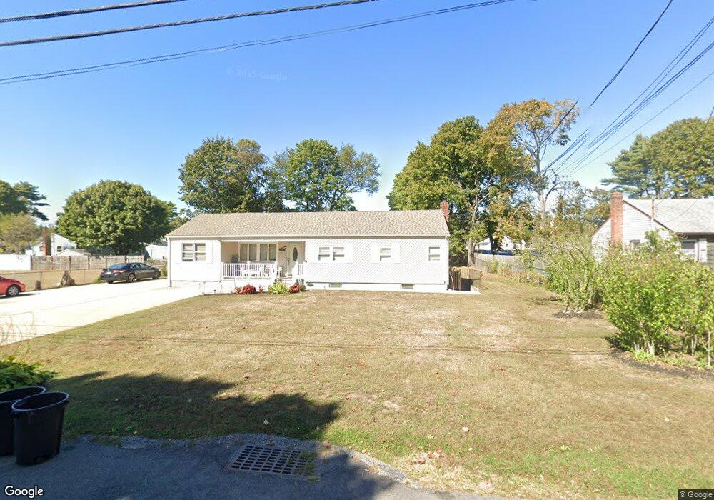
439 Nostrand Ave Central Islip, NY 11722
Estimated Value: $565,515 - $641,000
Studio
--
Bath
--
Sq Ft
19,602
Sq Ft Lot
About This Home
This home is located at 439 Nostrand Ave, Central Islip, NY 11722 and is currently estimated at $613,879. 439 Nostrand Ave is a home located in Suffolk County with nearby schools including Anthony Alfano Elementary School and Central Islip Senior High School.
Ownership History
Date
Name
Owned For
Owner Type
Purchase Details
Closed on
Oct 5, 2000
Sold by
Blanco Jose and Blanco Amanda
Bought by
Blanco Jose and Blanco Amanda
Current Estimated Value
Home Financials for this Owner
Home Financials are based on the most recent Mortgage that was taken out on this home.
Original Mortgage
$125,800
Outstanding Balance
$45,583
Interest Rate
7.83%
Estimated Equity
$568,296
Purchase Details
Closed on
May 28, 1998
Sold by
Zielenski Josephine and Zielenski Walter J
Bought by
Blanco Jose and Blanco Amanda
Home Financials for this Owner
Home Financials are based on the most recent Mortgage that was taken out on this home.
Original Mortgage
$112,500
Interest Rate
10.75%
Mortgage Type
Stand Alone First
Create a Home Valuation Report for This Property
The Home Valuation Report is an in-depth analysis detailing your home's value as well as a comparison with similar homes in the area
Home Values in the Area
Average Home Value in this Area
Purchase History
| Date | Buyer | Sale Price | Title Company |
|---|---|---|---|
| Blanco Jose | -- | L I Title | |
| Blanco Jose | $125,000 | First American Title Ins Co |
Source: Public Records
Mortgage History
| Date | Status | Borrower | Loan Amount |
|---|---|---|---|
| Open | Blanco Jose | $125,800 | |
| Closed | Blanco Jose | $112,500 |
Source: Public Records
Tax History
| Year | Tax Paid | Tax Assessment Tax Assessment Total Assessment is a certain percentage of the fair market value that is determined by local assessors to be the total taxable value of land and additions on the property. | Land | Improvement |
|---|---|---|---|---|
| 2024 | -- | $38,000 | $9,400 | $28,600 |
| 2023 | -- | $38,000 | $9,400 | $28,600 |
| 2022 | $9,858 | $38,000 | $9,400 | $28,600 |
| 2021 | $9,858 | $38,000 | $9,400 | $28,600 |
| 2020 | $10,812 | $38,000 | $9,400 | $28,600 |
| 2019 | $9,858 | $0 | $0 | $0 |
| 2018 | -- | $38,000 | $9,400 | $28,600 |
| 2017 | $9,979 | $38,000 | $9,400 | $28,600 |
| 2016 | $9,901 | $38,000 | $9,400 | $28,600 |
| 2015 | -- | $38,000 | $9,400 | $28,600 |
| 2014 | -- | $38,000 | $9,400 | $28,600 |
Source: Public Records
Map
Nearby Homes
- 452 Nostrand Ave
- 457 Nostrand Ave
- 0 Joshuas Path Unit KEY922069
- 153 Calebs Path
- 56 Gates Ave
- 90 Bushwick Ave
- 120 Evergreen Ave
- 2 Vita Dr
- 19 Fulton St
- 42 Gates Ave
- 155 Calebs Path
- 110 Brightside Ave
- 35 Bushwick Ave
- 44 Lexington Ave
- 1043 Wilson Blvd
- 1010 Motor Pkwy
- 11 Mcgowan Ln
- 16 Columbus Ave
- 10 Linda Ln
- 8 Myrtle Ave
- 443 Nostrand Ave
- 87 Calebs Path
- 91 Calebs Path
- 97 Calebs Path
- 436 Ralph Ave
- 447 Nostrand Ave
- 440 Ralph Ave
- 444 Nostrand Ave
- 99 Calebs Path
- 444 Ralph Ave
- 451 Nostrand Ave
- 448 Nostrand Ave
- 90 Calebs Path
- 92 Calebs Path
- 98 Calebs Path
- 448 Ralph Ave
- 58 Nostrand Ave
- 62 Ralph Ave
- 433 Ralph Ave
- 84 Calebs Path
Your Personal Tour Guide
Ask me questions while you tour the home.