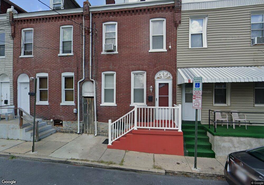
439 Pershing Ave Lancaster, PA 17602
Mussertown NeighborhoodEstimated Value: $175,000 - $206,000
4
Beds
1
Bath
1,384
Sq Ft
$134/Sq Ft
Est. Value
About This Home
This home is located at 439 Pershing Ave, Lancaster, PA 17602 and is currently estimated at $185,381, approximately $133 per square foot. 439 Pershing Ave is a home located in Lancaster County with nearby schools including King Elementary School, Lincoln Middle School, and McCaskey High School.
Create a Home Valuation Report for This Property
The Home Valuation Report is an in-depth analysis detailing your home's value as well as a comparison with similar homes in the area
Home Values in the Area
Average Home Value in this Area
Tax History
| Year | Tax Paid | Tax Assessment Tax Assessment Total Assessment is a certain percentage of the fair market value that is determined by local assessors to be the total taxable value of land and additions on the property. | Land | Improvement |
|---|---|---|---|---|
| 2025 | $1,496 | $37,800 | $4,100 | $33,700 |
| 2024 | $1,496 | $37,800 | $4,100 | $33,700 |
| 2023 | $1,471 | $37,800 | $4,100 | $33,700 |
| 2022 | $1,409 | $37,800 | $4,100 | $33,700 |
| 2021 | $1,379 | $37,800 | $4,100 | $33,700 |
| 2020 | $1,379 | $37,800 | $4,100 | $33,700 |
| 2019 | $1,358 | $37,800 | $4,100 | $33,700 |
| 2018 | $369 | $37,800 | $4,100 | $33,700 |
| 2017 | $2,623 | $57,100 | $6,800 | $50,300 |
| 2016 | $2,599 | $57,100 | $6,800 | $50,300 |
| 2015 | $1,014 | $57,100 | $6,800 | $50,300 |
| 2014 | $1,841 | $57,100 | $6,800 | $50,300 |
Source: Public Records
Map
Nearby Homes
- 43 Green St
- 312 E Orange St
- 530 S Lime St
- 145 E King St Unit 401
- 561 S Lime St
- 123 E King St
- 227 S Ann St
- 225 Dauphin St
- 522 E Orange St
- 350 E Chestnut St
- 53 S Marshall St
- 121 S Marshall St
- 412 Locust St
- 520 S Duke St
- 415 Church St
- 14 E Farnum St
- 14 S Queen St
- 565 S Christian St
- 101 N Queen St Unit 412
- 101 N Queen St Unit 407
- 437 Pershing Ave
- 441 Pershing Ave
- 435 Pershing Ave
- 443 Pershing Ave
- 433 Pershing Ave
- 445 Pershing Ave
- 103 & 109 Locust St
- 101 Locust St
- 455 Pershing Ave
- 105 Locust St
- 440 Pershing Ave
- 109 Locust St
- 459 Pershing Ave
- 432 S Shippen St
- 434 S Shippen St
- 84 Locust St
- 430 S Shippen St
- 86 Locust St
- 436 S Shippen St
- 440 S Shippen St
Your Personal Tour Guide
Ask me questions while you tour the home.