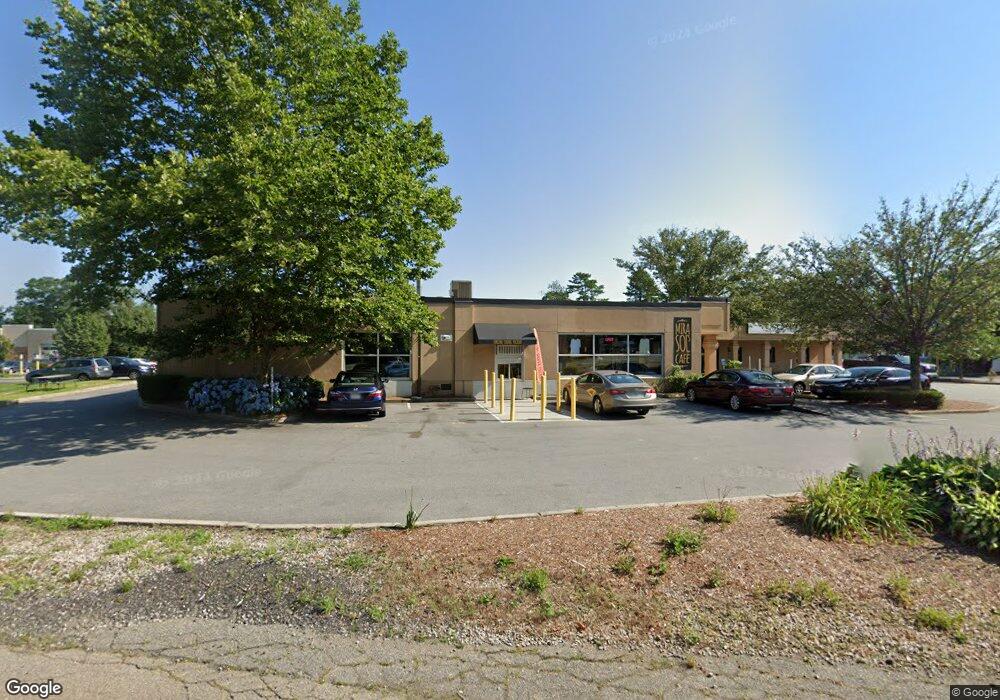
439 State Rd Dartmouth, MA 02747
Smith Mills Neighborhood
--
Bed
2
Baths
6,326
Sq Ft
1.01
Acres
About This Home
This home is located at 439 State Rd, Dartmouth, MA 02747. 439 State Rd is a home located in Bristol County with nearby schools including Dartmouth High School, Nazarene Christian Academy, and Friends Academy.
Ownership History
Date
Name
Owned For
Owner Type
Purchase Details
Closed on
Sep 4, 2025
Sold by
Lowe Bradford W
Bought by
Vt Donut Ent Re Hldg Llc and Northern Re Holdings Llc
Home Financials for this Owner
Home Financials are based on the most recent Mortgage that was taken out on this home.
Original Mortgage
$1,400,000
Outstanding Balance
$1,397,578
Interest Rate
6.74%
Mortgage Type
New Conventional
Purchase Details
Closed on
Dec 12, 2018
Sold by
Lowe Bradford W
Bought by
Lowe-Fitzgerald Lora and Lowe Bradford W
Purchase Details
Closed on
Dec 10, 2018
Sold by
Lowe Bradford W
Bought by
Lowe Bradford W and Lowe Scott W
Purchase Details
Closed on
Sep 29, 2003
Sold by
Jardin Elisa N and Ferreira Shirley
Bought by
Lowe Bradford W
Home Financials for this Owner
Home Financials are based on the most recent Mortgage that was taken out on this home.
Original Mortgage
$1,500,000
Interest Rate
6.29%
Mortgage Type
Commercial
Create a Home Valuation Report for This Property
The Home Valuation Report is an in-depth analysis detailing your home's value as well as a comparison with similar homes in the area
Home Values in the Area
Average Home Value in this Area
Purchase History
| Date | Buyer | Sale Price | Title Company |
|---|---|---|---|
| Vt Donut Ent Re Hldg Llc | $3,150,000 | -- | |
| Vt Donut Ent Re Hldg Llc | $3,150,000 | -- | |
| Lowe-Fitzgerald Lora | -- | -- | |
| Lowe Bradford W | -- | -- | |
| Lowe Bradford W | -- | -- | |
| Lowe Bradford W | $1,200,000 | -- | |
| Lowe Bradford W | $1,200,000 | -- | |
| Lowe Bradford W | $1,200,000 | -- |
Source: Public Records
Mortgage History
| Date | Status | Borrower | Loan Amount |
|---|---|---|---|
| Open | Vt Donut Ent Re Hldg Llc | $1,400,000 | |
| Closed | Vt Donut Ent Re Hldg Llc | $1,400,000 | |
| Previous Owner | Lowe Bradford W | $1,500,000 |
Source: Public Records
Tax History Compared to Growth
Tax History
| Year | Tax Paid | Tax Assessment Tax Assessment Total Assessment is a certain percentage of the fair market value that is determined by local assessors to be the total taxable value of land and additions on the property. | Land | Improvement |
|---|---|---|---|---|
| 2025 | $30,470 | $1,655,100 | $1,069,500 | $585,600 |
| 2024 | $26,765 | $1,435,900 | $906,300 | $529,600 |
| 2023 | $26,623 | $1,378,000 | $891,600 | $486,400 |
| 2022 | $26,430 | $1,378,000 | $891,600 | $486,400 |
| 2021 | $24,921 | $1,281,300 | $794,900 | $486,400 |
| 2020 | $24,323 | $1,307,700 | $794,900 | $512,800 |
| 2019 | $23,934 | $1,334,100 | $794,900 | $539,200 |
| 2018 | $23,064 | $1,299,300 | $733,700 | $565,600 |
| 2017 | $22,538 | $1,296,800 | $704,900 | $591,900 |
| 2016 | $21,833 | $1,320,000 | $780,800 | $539,200 |
| 2015 | $21,256 | $1,290,600 | $725,000 | $565,600 |
| 2014 | $20,675 | $1,269,200 | $677,300 | $591,900 |
Source: Public Records
Map
Nearby Homes
- 28 Greystone Ave
- 65 Cross Rd
- 73 Gifford Ave
- 135 Old Westport Rd
- 0 Undisclosed Unit 73376281
- 32 Morton Ave
- 4 Sabrinas Way
- 53 Morton Ave
- 4 Sabrina Way Unit A
- 4 Sabrina Way Unit C
- 4 Sabrina Way Unit B
- 4 Sabrina Way Unit D
- 310 Old Westport Rd
- 46 Old Westport Rd
- 312 Old Westport Rd
- 320 Old Westport Rd
- 0 Mosher Ln Unit 73370974
- Lot 6 Rafael Rd
- 1406 Tucker Rd
- 368 Cross Rd
- 80 Brandt Ave
- 78 Brandt Ave
- 0 Brandt Ave Unit 72922346
- 0 Brandt Ave
- 81 Brandt Ave
- 78 Wolcott Ave
- 75 Brandt Ave
- 68 Brandt Ave
- 69 Brandt Ave
- 23 Althea Ave
- 77 Wolcott Ave Unit 104
- 77 Wolcott Ave Unit 103
- 77 Wolcott Ave Unit 102
- 77 Wolcott Ave Unit 105
- 77 Wolcott Ave Unit 200
- 77 Wolcott Ave Unit 204
- 77 Wolcott Ave Unit 100
- 77 Wolcott Ave
- 66 Brandt Ave
- 22 Althea Ave