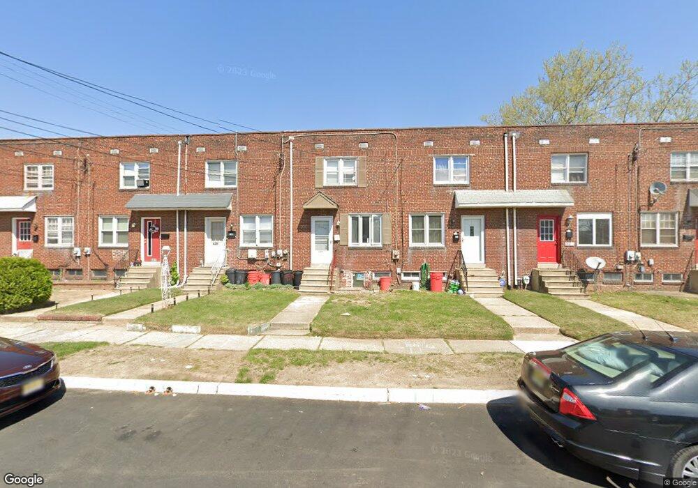
439 Thomson Ave Unit M27 Paulsboro, NJ 08066
Estimated Value: $123,969 - $166,000
--
Bed
--
Bath
896
Sq Ft
$169/Sq Ft
Est. Value
About This Home
This home is located at 439 Thomson Ave Unit M27, Paulsboro, NJ 08066 and is currently estimated at $151,323, approximately $168 per square foot. 439 Thomson Ave Unit M27 is a home located in Gloucester County with nearby schools including Billingsport Elementary School, Loudenslager Elementary School, and Paulsboro High School.
Ownership History
Date
Name
Owned For
Owner Type
Purchase Details
Closed on
Mar 13, 2020
Sold by
Ragin Melinda
Bought by
Rue Kareem
Current Estimated Value
Purchase Details
Closed on
Jul 29, 2005
Sold by
Colna Ronald R and Colna Patricia A
Bought by
Ragin Melinda
Home Financials for this Owner
Home Financials are based on the most recent Mortgage that was taken out on this home.
Original Mortgage
$51,750
Interest Rate
5.68%
Mortgage Type
Fannie Mae Freddie Mac
Create a Home Valuation Report for This Property
The Home Valuation Report is an in-depth analysis detailing your home's value as well as a comparison with similar homes in the area
Home Values in the Area
Average Home Value in this Area
Purchase History
| Date | Buyer | Sale Price | Title Company |
|---|---|---|---|
| Rue Kareem | $39,227 | None Available | |
| Ragin Melinda | $65,000 | Surety Title |
Source: Public Records
Mortgage History
| Date | Status | Borrower | Loan Amount |
|---|---|---|---|
| Previous Owner | Ragin Melinda | $51,750 |
Source: Public Records
Tax History Compared to Growth
Tax History
| Year | Tax Paid | Tax Assessment Tax Assessment Total Assessment is a certain percentage of the fair market value that is determined by local assessors to be the total taxable value of land and additions on the property. | Land | Improvement |
|---|---|---|---|---|
| 2025 | $1,742 | $39,600 | $14,900 | $24,700 |
| 2024 | $1,741 | $39,600 | $14,900 | $24,700 |
| 2023 | $1,741 | $39,600 | $14,900 | $24,700 |
| 2022 | $1,709 | $39,600 | $14,900 | $24,700 |
| 2021 | $1,676 | $39,600 | $14,900 | $24,700 |
| 2020 | $1,666 | $39,600 | $14,900 | $24,700 |
| 2019 | $1,613 | $39,600 | $14,900 | $24,700 |
| 2018 | $1,521 | $39,600 | $14,900 | $24,700 |
| 2017 | $1,515 | $39,600 | $14,900 | $24,700 |
| 2016 | $1,443 | $39,600 | $14,900 | $24,700 |
| 2015 | $1,435 | $39,600 | $14,900 | $24,700 |
| 2014 | $1,856 | $55,100 | $17,100 | $38,000 |
Source: Public Records
Map
Nearby Homes
- 219 Vanneman Blvd
- L18 20 W Broad St
- 335 W Buck St
- 344 W Washington St
- 255 Elizabeth Ave
- 269 W Broad St
- 836 E Broad St
- 227 W Buck St
- 1043 Penn Line Rd
- 1214 Walter Ave
- 1534 Pine St
- 1519 Pine St
- 330 Croce Ave
- 1224 Heddon Ave
- 122 W Washington St
- 129 W Washington St
- 140 142 W Jefferson St
- 28 W Jefferson St
- 11 W Washington St
- 21 W Adams St
- 439 Thomson Ave
- 439 1/2 Thomson Ave
- 437 Thomson Ave
- 441 Thomson Ave
- 443 Thomson Ave Unit M27
- 435 1/2 Thomson Ave
- 435 Thomson Ave
- 443 1/2 Thomson Ave
- 433 Thomson Ave
- 445 Thomson Ave
- 451 Thomson Ave
- 438 W Broad St
- 432 Thomson Ave
- 440 Thomson Ave
- 428 Thomson Ave
- 442 1/2 Thomson Ave
- 442 Thomson Ave
- 432 W Broad St
- 444 W Broad St
- 444 Thomson Ave