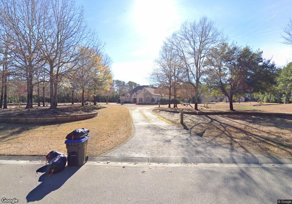
439 Whitebridge Rd Hampstead, NC 28443
Estimated Value: $1,118,000 - $2,183,191
5
Beds
7
Baths
4,636
Sq Ft
$344/Sq Ft
Est. Value
About This Home
This home is located at 439 Whitebridge Rd, Hampstead, NC 28443 and is currently estimated at $1,594,548, approximately $343 per square foot. 439 Whitebridge Rd is a home located in Pender County with nearby schools including South Topsail Elementary School, Topsail Middle School, and Topsail High School.
Ownership History
Date
Name
Owned For
Owner Type
Purchase Details
Closed on
Jul 7, 2006
Sold by
Cockrell Jonathan Lee and Cockrell Neris E
Bought by
Buffalino Chris and Buffalino Kelly
Current Estimated Value
Purchase Details
Closed on
Jun 1, 2005
Sold by
Audino Ricky Scott and Audino Teresa Winesett
Bought by
Cockrell Jonathan Lee and Cockrell Neris E
Home Financials for this Owner
Home Financials are based on the most recent Mortgage that was taken out on this home.
Original Mortgage
$160,000
Interest Rate
5.75%
Mortgage Type
Adjustable Rate Mortgage/ARM
Purchase Details
Closed on
Mar 1, 2005
Sold by
Audino Teresa Winesett and Audino Ricky Scott
Bought by
Audino Ricky Scott and Audino Teresa Winesett
Create a Home Valuation Report for This Property
The Home Valuation Report is an in-depth analysis detailing your home's value as well as a comparison with similar homes in the area
Home Values in the Area
Average Home Value in this Area
Purchase History
| Date | Buyer | Sale Price | Title Company |
|---|---|---|---|
| Buffalino Chris | $385,000 | -- | |
| Cockrell Jonathan Lee | $250,000 | -- | |
| Audino Ricky Scott | -- | -- |
Source: Public Records
Mortgage History
| Date | Status | Borrower | Loan Amount |
|---|---|---|---|
| Previous Owner | Cockrell Jonathan Lee | $160,000 |
Source: Public Records
Tax History
| Year | Tax Paid | Tax Assessment Tax Assessment Total Assessment is a certain percentage of the fair market value that is determined by local assessors to be the total taxable value of land and additions on the property. | Land | Improvement |
|---|---|---|---|---|
| 2025 | $10,356 | $1,569,007 | $268,000 | $1,301,007 |
| 2024 | $10,356 | $1,097,982 | $175,000 | $922,982 |
| 2023 | $9,251 | $1,097,982 | $175,000 | $922,982 |
| 2022 | $9,251 | $1,097,982 | $175,000 | $922,982 |
| 2021 | $9,251 | $1,097,982 | $175,000 | $922,982 |
| 2020 | $8,921 | $1,058,321 | $162,500 | $895,821 |
| 2019 | $8,921 | $1,058,321 | $162,500 | $895,821 |
| 2018 | $9,729 | $1,089,803 | $268,000 | $821,803 |
| 2017 | $9,729 | $1,089,803 | $268,000 | $821,803 |
| 2016 | $9,620 | $1,089,803 | $268,000 | $821,803 |
| 2015 | $9,584 | $1,089,803 | $268,000 | $821,803 |
| 2014 | $7,468 | $1,089,803 | $268,000 | $821,803 |
| 2013 | -- | $1,089,803 | $268,000 | $821,803 |
| 2012 | -- | $1,089,803 | $268,000 | $821,803 |
Source: Public Records
Map
Nearby Homes
- 10 Abaco Way
- 314 E Rolling Meadows Rd
- 79 Colonial Heights Dr
- 141 Dogwood Ln
- 33 Medina Ct
- 1438 Washington Acres Rd
- 350 Whitebridge Rd
- 38 Pin Oak Ct
- 718 Hughes Rd
- 37 Twisted Oak Ct
- 613 Hughes Rd
- 802 Sound View Dr
- Tract 2 Christian Chapel Rd
- 13241 US Highway 17 N
- 119 Waters Edge
- 105 Fletcher Ln
- 21801 U S 17
- 601 Wildwood Rd
- 211 Simmons Dr
- 2645 Scotts Hill Loop Rd
- 449 Whitebridge Rd
- 429 Whitebridge Rd
- 40 Otter Pond Ln
- 0 Otter Pond Ln
- 17 Otter Pond Ln
- 448 Whitebridge Rd
- 459 Whitebridge Rd
- 112 Otter Pond Ln
- 415 Whitebridge Rd
- 60 W Rolling Meadows Rd
- 58 Saddlebrook Ln
- 469 Whitebridge Rd
- 115 Saddle Brook Ln Unit Lon
- 115 Saddle Brook Ln
- 146 Abaco Way
- 194 Hampton Ct
- 117 W Abaco Way
- 134 Bluenose Ln
- 0 Saddlebrook Ln Unit 30445773
- 0 Saddlebrook Ln Unit 30445767
Your Personal Tour Guide
Ask me questions while you tour the home.