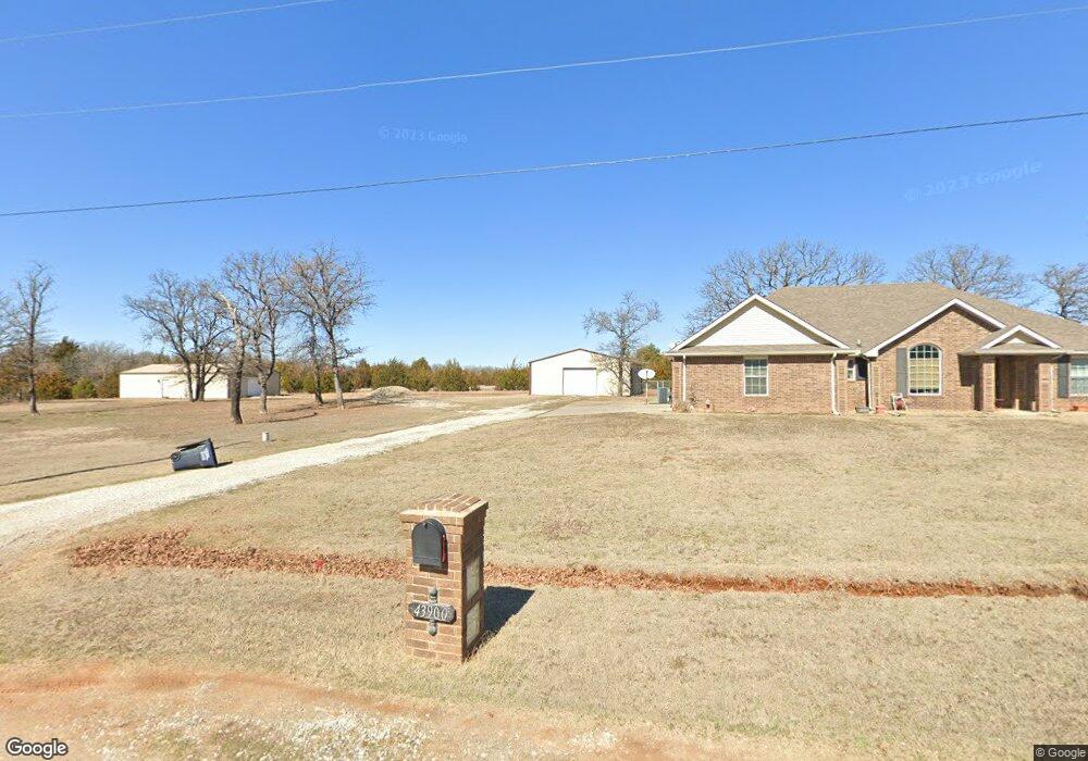
43900 Limestone Dr Shawnee, OK 74804
Estimated Value: $264,227 - $294,000
3
Beds
2
Baths
1,935
Sq Ft
$145/Sq Ft
Est. Value
About This Home
This home is located at 43900 Limestone Dr, Shawnee, OK 74804 and is currently estimated at $280,557, approximately $144 per square foot. 43900 Limestone Dr is a home.
Ownership History
Date
Name
Owned For
Owner Type
Purchase Details
Closed on
May 31, 2013
Sold by
Ferrell Steve and Ferrell Jill
Bought by
Burton Ponie Joe and Burton Frances E
Current Estimated Value
Home Financials for this Owner
Home Financials are based on the most recent Mortgage that was taken out on this home.
Original Mortgage
$155,873
Outstanding Balance
$108,539
Interest Rate
3.25%
Mortgage Type
FHA
Estimated Equity
$172,018
Create a Home Valuation Report for This Property
The Home Valuation Report is an in-depth analysis detailing your home's value as well as a comparison with similar homes in the area
Home Values in the Area
Average Home Value in this Area
Purchase History
| Date | Buyer | Sale Price | Title Company |
|---|---|---|---|
| Burton Ponie Joe | $159,000 | First American Title |
Source: Public Records
Mortgage History
| Date | Status | Borrower | Loan Amount |
|---|---|---|---|
| Open | Burton Ponie Joe | $155,873 |
Source: Public Records
Tax History Compared to Growth
Tax History
| Year | Tax Paid | Tax Assessment Tax Assessment Total Assessment is a certain percentage of the fair market value that is determined by local assessors to be the total taxable value of land and additions on the property. | Land | Improvement |
|---|---|---|---|---|
| 2025 | $1,682 | $19,501 | $960 | $18,541 |
| 2024 | $1,682 | $18,933 | $960 | $17,973 |
| 2023 | $1,704 | $18,933 | $960 | $17,973 |
| 2022 | $1,672 | $18,933 | $960 | $17,973 |
| 2021 | $1,687 | $18,933 | $960 | $17,973 |
| 2020 | $1,846 | $20,651 | $960 | $19,691 |
| 2019 | $1,889 | $20,887 | $960 | $19,927 |
| 2018 | $1,888 | $20,766 | $960 | $19,806 |
| 2017 | $1,915 | $21,216 | $960 | $20,256 |
| 2016 | $1,877 | $20,598 | $960 | $19,638 |
| 2015 | $1,607 | $19,998 | $960 | $19,038 |
| 2014 | $1,557 | $19,416 | $960 | $18,456 |
Source: Public Records
Map
Nearby Homes
- 43844 Limestone Dr
- 110 Cuyler Dr
- 127 Castle Rock Ln
- 8888 Arthur Rd
- 126 Hope Ave
- 207 Hope Ave
- 213 Hope Ave
- 219 Hope Ave
- 7777 Arthur Rd
- 103 Trimble Dr
- 138 Trimble Dr
- 5505 Capricorn
- 5707 Earl Dr
- 7110 Brangus Rd
- 43289 Garrett's Lake Rd
- 0000 Big Sky Dr
- 12906 Waterside Way
- 44233 Whitetail Rd
- 44237 Whitetail Rd
- 42829 Garrett's Lake Rd
- 43941 Limestone Dr
- 43842 Limestone Dr
- 43865 Limestone Dr
- 43950 Limestone Dr
- 6106 Brangus Rd
- 6100 Brangus Rd
- 6014 Brangus Rd
- 6200 Brangus Rd
- 6004 Brangus Rd
- 5920 Brangus Rd
- 0 Brangus Rd
- 1 Brangus Rd
- 5900 Brangus Rd
- 6220 Brangus Rd
- 5822 Brangus Rd
- 5908 Brangus Rd
- 5816 Brangus Rd
- 123 Cuyler Dr
- 5812 Brangus Rd Unit SHA
- 103 Ashley Dr