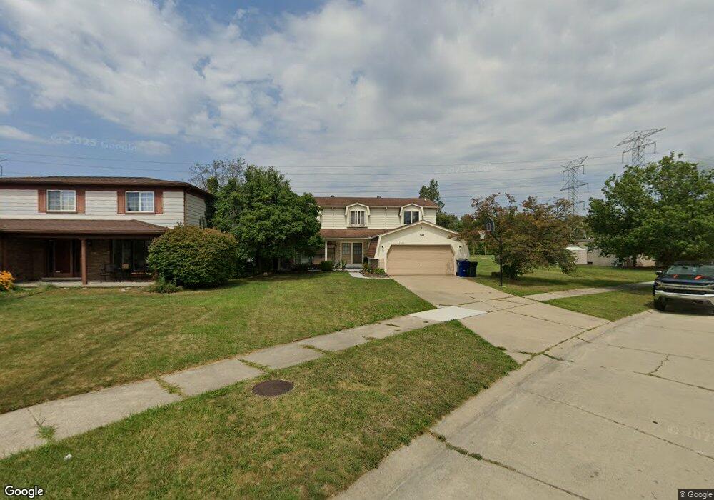
43902 Cranford Ave Unit Bldg-Unit Canton, MI 48187
Estimated Value: $389,000 - $455,413
--
Bed
3
Baths
2,242
Sq Ft
$184/Sq Ft
Est. Value
About This Home
This home is located at 43902 Cranford Ave Unit Bldg-Unit, Canton, MI 48187 and is currently estimated at $413,103, approximately $184 per square foot. 43902 Cranford Ave Unit Bldg-Unit is a home located in Wayne County with nearby schools including Canton High School, Discovery Middle School, and Salem High School.
Ownership History
Date
Name
Owned For
Owner Type
Purchase Details
Closed on
Aug 30, 2018
Sold by
Bane Thao
Bought by
Ghabbour Waale
Current Estimated Value
Home Financials for this Owner
Home Financials are based on the most recent Mortgage that was taken out on this home.
Original Mortgage
$208,250
Outstanding Balance
$181,232
Interest Rate
4.5%
Mortgage Type
New Conventional
Estimated Equity
$231,871
Purchase Details
Closed on
Jul 30, 2009
Sold by
Patel Sunil P and Patel Parul S
Bought by
Bane Thao
Purchase Details
Closed on
Sep 18, 2001
Sold by
Campbell Donald A
Bought by
Patel Parul S
Create a Home Valuation Report for This Property
The Home Valuation Report is an in-depth analysis detailing your home's value as well as a comparison with similar homes in the area
Home Values in the Area
Average Home Value in this Area
Purchase History
| Date | Buyer | Sale Price | Title Company |
|---|---|---|---|
| Ghabbour Waale | $245,000 | Leading Edge Title Agency | |
| Bane Thao | $174,500 | None Available | |
| Patel Parul S | $230,000 | -- |
Source: Public Records
Mortgage History
| Date | Status | Borrower | Loan Amount |
|---|---|---|---|
| Open | Ghabbour Waale | $208,250 |
Source: Public Records
Tax History Compared to Growth
Tax History
| Year | Tax Paid | Tax Assessment Tax Assessment Total Assessment is a certain percentage of the fair market value that is determined by local assessors to be the total taxable value of land and additions on the property. | Land | Improvement |
|---|---|---|---|---|
| 2025 | $2,622 | $199,900 | $0 | $0 |
| 2024 | $2,622 | $178,900 | $0 | $0 |
| 2023 | $2,500 | $162,300 | $0 | $0 |
| 2022 | $5,453 | $142,500 | $0 | $0 |
| 2021 | $5,291 | $140,900 | $0 | $0 |
| 2020 | $5,225 | $134,500 | $0 | $0 |
| 2019 | $5,129 | $123,520 | $0 | $0 |
| 2018 | $1,466 | $112,100 | $0 | $0 |
| 2017 | $3,697 | $110,800 | $0 | $0 |
| 2016 | $3,270 | $113,300 | $0 | $0 |
| 2015 | $8,055 | $101,580 | $0 | $0 |
| 2013 | $7,803 | $81,050 | $0 | $0 |
| 2010 | -- | $91,000 | $52,065 | $38,935 |
Source: Public Records
Map
Nearby Homes
- 437 Corinne Blvd
- 44150 Duchess Dr
- 278 Cornell St
- 1322 Saltz Ct
- 44893 Fair Oaks Dr
- 227 Edington Cir
- 603 Concord Dr Unit 67
- 288 Edington Cir Unit 61
- 5887 Northford
- 1494 Ranier Blvd
- 42771 Lilley Pointe Dr Unit 154
- 42789 Lilley Pointe Dr Unit 146
- 42697 Redfern St
- 1822 N Sheldon Rd
- 550 Concord Dr Unit 75
- 45030 Glengarry Rd
- 1625 Longfellow Dr
- 58560 Stuart Dr
- 1710 Longfellow Dr
- 42479 Redfern St
- 43902 Cranford Ave
- 43924 Palisades Dr
- 43938 Palisades Dr
- 43860 Cranford Ave
- 43950 Palisades Dr
- 43848 Cranford Ave
- 43905 Cranford Ave
- 43855 Cranford Ave
- 43836 Cranford Ave
- 44004 Palisades Dr
- 43941 Palisades Dr
- 43925 Palisades Dr
- 43913 Palisades Dr
- 43866 Palisades Dr
- 43837 Cranford Ave
- 44001 Palisades Dr
- 43824 Cranford Ave
- 44016 Palisades Dr
- 43901 Palisades Dr
- 43825 Cranford Ave