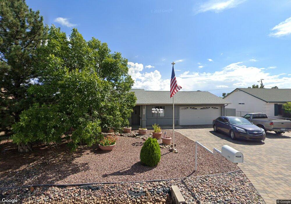
4391 N Preston Dr Unit 1 Prescott Valley, AZ 86314
Estimated Value: $356,261 - $373,000
3
Beds
2
Baths
1,228
Sq Ft
$296/Sq Ft
Est. Value
About This Home
This home is located at 4391 N Preston Dr Unit 1, Prescott Valley, AZ 86314 and is currently estimated at $364,065, approximately $296 per square foot. 4391 N Preston Dr Unit 1 is a home located in Yavapai County with nearby schools including Mountain View Elementary School, Glassford Hill Middle School, and Bradshaw Mountain High School.
Ownership History
Date
Name
Owned For
Owner Type
Purchase Details
Closed on
Jun 17, 2014
Sold by
Spandl Richard and Spandl Ruth
Bought by
Spandl Richard and Spandl Ruth
Current Estimated Value
Purchase Details
Closed on
Aug 9, 2011
Sold by
Spandl Richard A and Spandl Ruth L
Bought by
Spandl Richard A and Spandl Ruth L
Home Financials for this Owner
Home Financials are based on the most recent Mortgage that was taken out on this home.
Original Mortgage
$45,850
Interest Rate
4.53%
Mortgage Type
New Conventional
Purchase Details
Closed on
Jul 25, 2005
Sold by
Spandl Richard A and Spandl Ruth L
Bought by
Spandl Richard A and Spandl Ruth L
Purchase Details
Closed on
Aug 14, 2003
Sold by
Davis Reed A
Bought by
Spandl Richard A and Spandl Ruth L
Purchase Details
Closed on
Jan 19, 2000
Sold by
Norwest Mtg Inc
Bought by
Davis Reed A
Home Financials for this Owner
Home Financials are based on the most recent Mortgage that was taken out on this home.
Original Mortgage
$81,900
Interest Rate
8.16%
Mortgage Type
FHA
Purchase Details
Closed on
Sep 2, 1999
Sold by
Jackson Teddi and Storebo Daryl
Bought by
Norwest Mtg Inc
Purchase Details
Closed on
Jul 23, 1997
Sold by
Franklin Roy E
Bought by
Storebo Daryl R and Jackson Teddi L
Home Financials for this Owner
Home Financials are based on the most recent Mortgage that was taken out on this home.
Original Mortgage
$76,000
Interest Rate
7.58%
Purchase Details
Closed on
Mar 10, 1997
Sold by
Quinn Nicole A
Bought by
Franklin Roy E
Purchase Details
Closed on
Feb 2, 1994
Sold by
Mckown John and Mckown Shelly
Bought by
Franklin Roy E and Quinn Nicole A
Home Financials for this Owner
Home Financials are based on the most recent Mortgage that was taken out on this home.
Original Mortgage
$75,100
Interest Rate
7.38%
Mortgage Type
New Conventional
Create a Home Valuation Report for This Property
The Home Valuation Report is an in-depth analysis detailing your home's value as well as a comparison with similar homes in the area
Home Values in the Area
Average Home Value in this Area
Purchase History
| Date | Buyer | Sale Price | Title Company |
|---|---|---|---|
| Spandl Richard | -- | None Available | |
| Spandl Richard A | -- | Accommodation | |
| Spandl Richard A | -- | Pioneer Title Agency Inc | |
| Spandl Richard A | -- | None Available | |
| Spandl Richard A | $121,900 | Yavapai Title Agency | |
| Davis Reed A | $81,900 | First American Title | |
| Norwest Mtg Inc | $76,000 | Yavapai Coconino Title Agenc | |
| Storebo Daryl R | $76,000 | Capital Title Agency | |
| Franklin Roy E | -- | First American Title Ins | |
| Franklin Roy E | $75,100 | First American Title Ins |
Source: Public Records
Mortgage History
| Date | Status | Borrower | Loan Amount |
|---|---|---|---|
| Closed | Spandl Richard A | $45,850 | |
| Previous Owner | Davis Reed A | $81,900 | |
| Previous Owner | Storebo Daryl R | $76,000 | |
| Previous Owner | Franklin Roy E | $75,100 |
Source: Public Records
Tax History Compared to Growth
Tax History
| Year | Tax Paid | Tax Assessment Tax Assessment Total Assessment is a certain percentage of the fair market value that is determined by local assessors to be the total taxable value of land and additions on the property. | Land | Improvement |
|---|---|---|---|---|
| 2026 | $1,255 | $29,357 | -- | -- |
| 2024 | $1,151 | $30,305 | -- | -- |
| 2023 | $1,151 | $25,293 | $4,168 | $21,125 |
| 2022 | $1,132 | $20,493 | $2,868 | $17,625 |
| 2021 | $1,183 | $18,790 | $2,883 | $15,907 |
| 2020 | $1,137 | $0 | $0 | $0 |
| 2019 | $1,123 | $0 | $0 | $0 |
| 2018 | $1,068 | $0 | $0 | $0 |
| 2017 | $1,047 | $0 | $0 | $0 |
| 2016 | $1,011 | $0 | $0 | $0 |
| 2015 | $997 | $0 | $0 | $0 |
| 2014 | $943 | $0 | $0 | $0 |
Source: Public Records
Map
Nearby Homes
- 4395 N Katie Cir W
- 4351 N Romero Cir W Unit 5
- 4461 N Phillip Dr
- 4500 N Phillip Dr Unit 4
- 547 N Vermillion Dr
- 8591 E Tracy Dr
- 4471 N Romero Cir E Unit E
- 4420 N Katie Cir E
- 4112 N Edith Ct
- 3965 N Robert Rd
- 4441 N Tonto Way
- 7316 Spouse Dr
- 4148 N Jay Ct
- 8775 E Loos Dr
- 8515 E Leigh Dr
- 3860 E Teri (Plus Full Basement) Ct
- 4096 N Jay Ct
- 7940 E Loos Dr
- 0 E Lakeshore Dr Unit PAR1074038
- 3981 N Robert Rd
- 4391 N Preston Dr
- 4375 N Preston Dr
- 4581 N Preston Dr
- 1625 N Preston Dr
- 0 N Preston Dr
- 4401 N Preston Dr
- 4401 N Preston Dr
- 4361 N Preston Dr
- 4372 N Katie Cir W
- 4417 N Preston Dr
- 4417 N Preston Dr Unit 205
- 4417 N Preston Dr Unit 4
- 4400 N Katie Cir W
- 4400 N Katie Cir W Unit W
- 4374 N Preston Dr Unit 1
- 4374 N Preston Dr
- 4374 N Preston Dr Unit 4
- 4400 N Preston Dr
- 4356 N Katie Cir W
- 4356 N Katie Cir W Unit 5