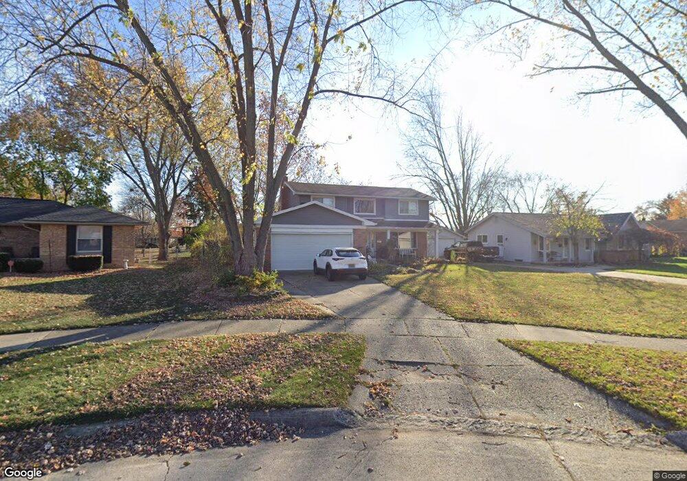
43915 S Umberland Cir Canton, MI 48187
Estimated Value: $386,381 - $442,000
--
Bed
3
Baths
1,759
Sq Ft
$234/Sq Ft
Est. Value
About This Home
This home is located at 43915 S Umberland Cir, Canton, MI 48187 and is currently estimated at $411,845, approximately $234 per square foot. 43915 S Umberland Cir is a home located in Wayne County with nearby schools including Canton High School, Discovery Middle School, and Salem High School.
Ownership History
Date
Name
Owned For
Owner Type
Purchase Details
Closed on
Jul 17, 2012
Sold by
Kline Douglas R
Bought by
Kline Anne
Current Estimated Value
Purchase Details
Closed on
Oct 30, 2006
Sold by
Whiting Robert W and Whiting Deann
Bought by
Kline Douglas R
Purchase Details
Closed on
Aug 30, 2000
Sold by
Adams Bryan M
Bought by
Whiting Deann
Purchase Details
Closed on
Jun 25, 1997
Sold by
Anders Mark L and Anders Michelle
Bought by
Adams Bryan M and Adams Raymond Renee
Create a Home Valuation Report for This Property
The Home Valuation Report is an in-depth analysis detailing your home's value as well as a comparison with similar homes in the area
Home Values in the Area
Average Home Value in this Area
Purchase History
| Date | Buyer | Sale Price | Title Company |
|---|---|---|---|
| Kline Anne | -- | None Available | |
| Kline Douglas R | $225,000 | Fidelity National Title | |
| Whiting Deann | $203,000 | -- | |
| Adams Bryan M | $166,500 | -- |
Source: Public Records
Tax History Compared to Growth
Tax History
| Year | Tax Paid | Tax Assessment Tax Assessment Total Assessment is a certain percentage of the fair market value that is determined by local assessors to be the total taxable value of land and additions on the property. | Land | Improvement |
|---|---|---|---|---|
| 2025 | $1,732 | $166,000 | $0 | $0 |
| 2024 | $1,732 | $157,800 | $0 | $0 |
| 2023 | $1,651 | $138,300 | $0 | $0 |
| 2022 | $3,733 | $128,100 | $0 | $0 |
| 2021 | $3,617 | $124,600 | $0 | $0 |
| 2020 | $3,560 | $117,800 | $0 | $0 |
| 2019 | $3,498 | $112,740 | $0 | $0 |
| 2018 | $1,403 | $102,540 | $0 | $0 |
| 2017 | $3,701 | $101,200 | $0 | $0 |
| 2016 | $3,210 | $97,800 | $0 | $0 |
| 2015 | $7,711 | $89,500 | $0 | $0 |
| 2013 | $7,470 | $79,950 | $0 | $0 |
| 2010 | -- | $78,300 | $36,627 | $41,673 |
Source: Public Records
Map
Nearby Homes
- 43875 Leeann Ln
- 6877 Pittsford St
- 43783 Leeann Ln
- 44018 Bannockburn Dr
- 835 Coldrose Way
- 43764 Hanford Rd
- 6586 Carriage Hills Dr
- 6972 Harvard Ln
- 6907 Harvard Ln
- 6986 Harvard Ln Unit 129
- 44409 Newburyport Dr Unit 133
- 43425 Warren Rd
- 43737 Westminister Way
- 43625 Westminister Way
- 6838 Bostonhill Ln
- 7060 Bunkerhill Ln
- 44585 Nantucket Dr
- 44995 Quaker Hill Dr
- 7085 London Ct
- 44609 Meadowcreek Ln Unit 24
- 43929 S Umberland Cir
- 43901 S Umberland Cir
- 44001 S Umberland Cir Unit Bldg-Unit
- 44001 S Umberland Cir
- 43900 N Umberland Cir
- 43876 Leeann Ln
- 44015 S Umberland Cir
- 43898 Leeann Ln
- 43862 Leeann Ln
- 43904 Leeann Ln
- 43914 N Umberland Cir
- 43936 S Umberland Cir
- 43923 S Umberland Cir
- 44029 S Umberland Cir
- 43918 Leeann Ln
- 44014 S Umberland Cir
- 43850 Leeann Ln
- 43932 Leeann Ln
- 44028 S Umberland Cir
- 44043 S Umberland Cir