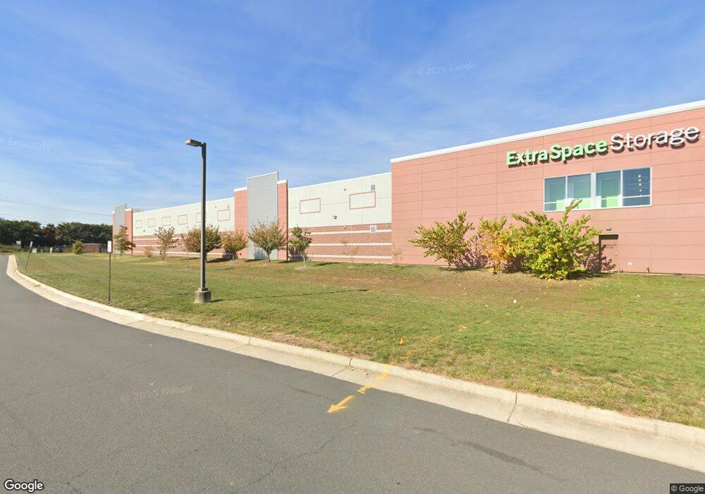
43923 Centergate Dr Ashburn, VA 20148
Moorefield Station Neighborhood
--
Bed
--
Bath
106,658
Sq Ft
6.25
Acres
About This Home
This home is located at 43923 Centergate Dr, Ashburn, VA 20148. 43923 Centergate Dr is a home located in Loudoun County with nearby schools including Moorefield Station Elementary School, Rock Ridge High School, and Stone Hill Middle School.
Ownership History
Date
Name
Owned For
Owner Type
Purchase Details
Closed on
Sep 22, 2015
Sold by
Dpi Investors Llc
Bought by
Centergate Self Storage Llc
Purchase Details
Closed on
Aug 15, 2008
Sold by
Miller and Dulles Pw Pw @
Bought by
D P I Investors Llc
Home Financials for this Owner
Home Financials are based on the most recent Mortgage that was taken out on this home.
Original Mortgage
$5,600,000
Interest Rate
6.4%
Mortgage Type
Construction
Create a Home Valuation Report for This Property
The Home Valuation Report is an in-depth analysis detailing your home's value as well as a comparison with similar homes in the area
Home Values in the Area
Average Home Value in this Area
Purchase History
| Date | Buyer | Sale Price | Title Company |
|---|---|---|---|
| Centergate Self Storage Llc | $2,600,000 | None Available | |
| D P I Investors Llc | $4,114,153 | -- |
Source: Public Records
Mortgage History
| Date | Status | Borrower | Loan Amount |
|---|---|---|---|
| Previous Owner | D P I Investors Llc | $5,600,000 |
Source: Public Records
Tax History Compared to Growth
Tax History
| Year | Tax Paid | Tax Assessment Tax Assessment Total Assessment is a certain percentage of the fair market value that is determined by local assessors to be the total taxable value of land and additions on the property. | Land | Improvement |
|---|---|---|---|---|
| 2025 | $132,825 | $13,216,420 | $2,994,800 | $10,221,620 |
| 2024 | $142,840 | $13,412,210 | $2,994,800 | $10,417,410 |
| 2023 | $115,398 | $13,188,350 | $2,994,800 | $10,193,550 |
| 2022 | $107,731 | $12,104,620 | $2,722,500 | $9,382,120 |
| 2021 | $114,557 | $11,689,500 | $2,722,500 | $8,967,000 |
| 2020 | $103,020 | $9,953,580 | $2,722,500 | $7,231,080 |
| 2019 | $95,438 | $9,132,850 | $2,722,500 | $6,410,350 |
| 2018 | $92,457 | $8,521,420 | $2,450,300 | $6,071,120 |
| 2017 | $27,566 | $9,143,280 | $2,450,300 | $6,692,980 |
| 2016 | $28,056 | $2,450,300 | $0 | $0 |
| 2015 | $27,811 | $0 | $0 | $0 |
| 2014 | $26,728 | $0 | $0 | $0 |
Source: Public Records
Map
Nearby Homes
- 43837 Kingston Station Terrace
- 43841 Centergate Dr
- 43700 Hamilton Chapel Terrace
- 43778 Tattinger Terrace
- 22405 Claude Moore Dr
- 22691 Ashley Inn Terrace
- 22381 Roanoke Rise Terrace
- 22361 Roanoke Rise Terrace
- 42597 Nubbins Terrace
- 22260 Cornerstone Crossing Terrace
- 22317 Seabring Terrace
- 43466 Grandmoore St
- 22477 Foundation Dr
- 43495 Monroe Crest Terrace
- 43452 Founder's Park Terrace
- 43303 John Michael Terrace
- 43400 Apple Orchard Square
- 22275 Sims Terrace
- 43360 Southland St
- 22088 Midmoore Dr
- 43853 Kingston Station Terrace
- 43835 Kingston Station Terrace
- 43833 Kingston Station Terrace
- 0 Concord Station Terrace Unit 22339 1007022594
- 0 Concord Station Terrace Unit 22339 LO9002436
- 43831 Kingston Station Terrace
- 43839 Kingston Station Terrace
- 43855 Kingston Station Terrace
- 43855 Kingston Station Terrace Unit 5102
- 43841 Kingston Station Terrace
- 43855 Kingston Station Terrace Unit 43855
- 43827 Kingston Station Terrace
- 43827 Kingston Station Terrace
- 43849 Kingston Station Terrace
- 43845 Kingston Station Terrace
- 43823 Kingston Station Terrace Unit 1
- 43823 Kingston Station Terrace
- 43915 Centergate Dr
- 43819 Kingston Station Terrace
- 43817 Kingston Station Terrace