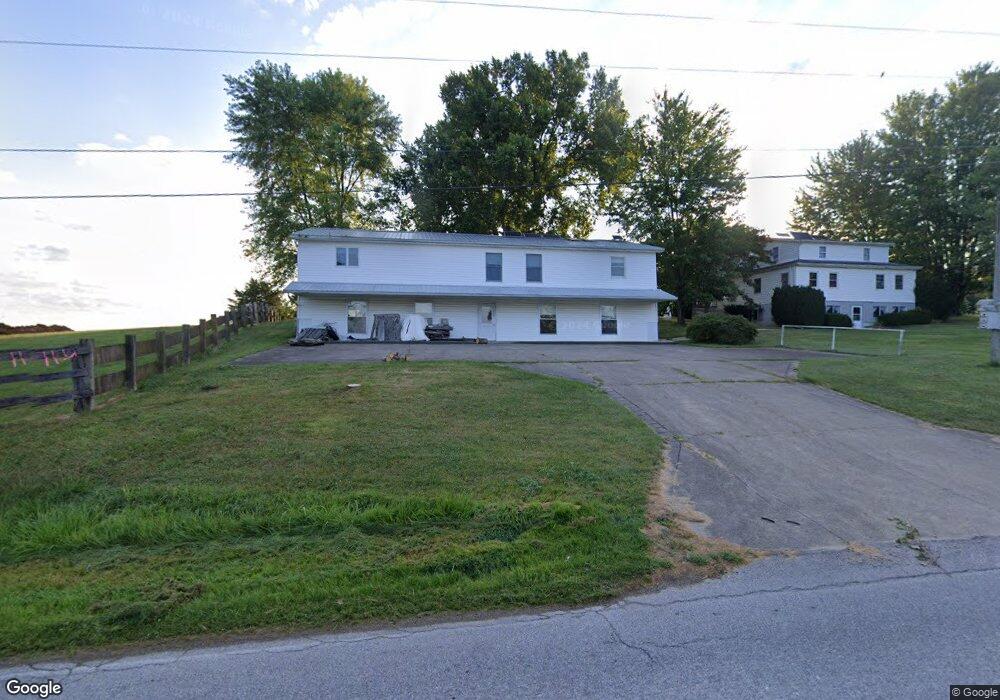
4399 Unity Rd West Union, OH 45693
Estimated Value: $286,000 - $331,000
4
Beds
2
Baths
2,328
Sq Ft
$134/Sq Ft
Est. Value
About This Home
This home is located at 4399 Unity Rd, West Union, OH 45693 and is currently estimated at $310,905, approximately $133 per square foot. 4399 Unity Rd is a home located in Adams County with nearby schools including North Adams Elementary School and North Adams High School.
Ownership History
Date
Name
Owned For
Owner Type
Purchase Details
Closed on
Nov 23, 2019
Sold by
Yoder Menno
Bought by
Yoder Jonathon
Current Estimated Value
Purchase Details
Closed on
Apr 19, 2016
Sold by
Yoder Menno
Bought by
Menno Yoder
Purchase Details
Closed on
Oct 3, 1991
Bought by
Yoder Menno
Create a Home Valuation Report for This Property
The Home Valuation Report is an in-depth analysis detailing your home's value as well as a comparison with similar homes in the area
Purchase History
| Date | Buyer | Sale Price | Title Company |
|---|---|---|---|
| Yoder Jonathon | $150,000 | None Available | |
| Menno Yoder | -- | -- | |
| Yoder Menno | $20,000 | -- |
Source: Public Records
Tax History
| Year | Tax Paid | Tax Assessment Tax Assessment Total Assessment is a certain percentage of the fair market value that is determined by local assessors to be the total taxable value of land and additions on the property. | Land | Improvement |
|---|---|---|---|---|
| 2025 | $2,922 | $73,890 | $8,120 | $65,770 |
| 2024 | $2,783 | $73,890 | $8,120 | $65,770 |
| 2023 | $2,799 | $73,890 | $8,120 | $65,770 |
| 2022 | $2,781 | $65,950 | $5,850 | $60,100 |
| 2021 | $2,831 | $65,950 | $5,850 | $60,100 |
| 2020 | $2,753 | $66,370 | $5,850 | $60,520 |
| 2019 | $2,258 | $66,370 | $5,850 | $60,520 |
| 2018 | $1,832 | $56,290 | $5,850 | $50,440 |
| 2017 | $1,780 | $56,290 | $5,850 | $50,440 |
| 2016 | $1,777 | $56,290 | $5,850 | $50,440 |
| 2015 | $1,780 | $58,000 | $5,080 | $52,920 |
| 2014 | $1,781 | $58,000 | $5,080 | $52,920 |
Source: Public Records
Map
Nearby Homes
- 4603 Wheat Ridge Rd
- 831 Tom Brown Rd
- 1148 Robinette Rd
- 210 Walt Alsgood Rd
- 543 Ginger Ln
- 542 Ginger Ln
- 0 Stern Dr Unit 1871153
- 0 Tranquility Pike
- 95 Ada Ln
- 19004 State Route 41
- 17479 Ohio 247
- 0 Paradise Valley Rd Unit 1852764
- 0 Paradise Valley Rd Unit 1873433
- 292 Larry Baynum Rd
- 1143 Dotson Rd
- 0 Ohio 247
- 435 Rollingwoods Dr
- 435 Rolling Woods Dr
- 1425 Jacksonville Rd
- 150 Roslin Dr
- 4361 Unity Rd
- 4489 Unity Rd
- 4313 Unity Rd
- 4312 Unity Rd
- 4291 Unity Rd
- 4276 Wheat Ridge Rd
- 4479 Wheat Ridge Rd
- 4271 Unity Rd
- 4222 Wheat Ridge Rd
- 4222 Wheat Ridge Rd
- 4238 Wheat Ridge Rd
- 4500 Wheat Ridge Rd
- 4185 Wheat Ridge Rd
- 4666 Wheat Ridge Rd
- 4192 Unity Rd
- 4647 Wheat Ridge Rd
- 4153 Unity Rd
- 4141 Wheat Ridge Rd
- 14 Clay Moore Rd
- 4100 Wheat Ridge Rd
Your Personal Tour Guide
Ask me questions while you tour the home.