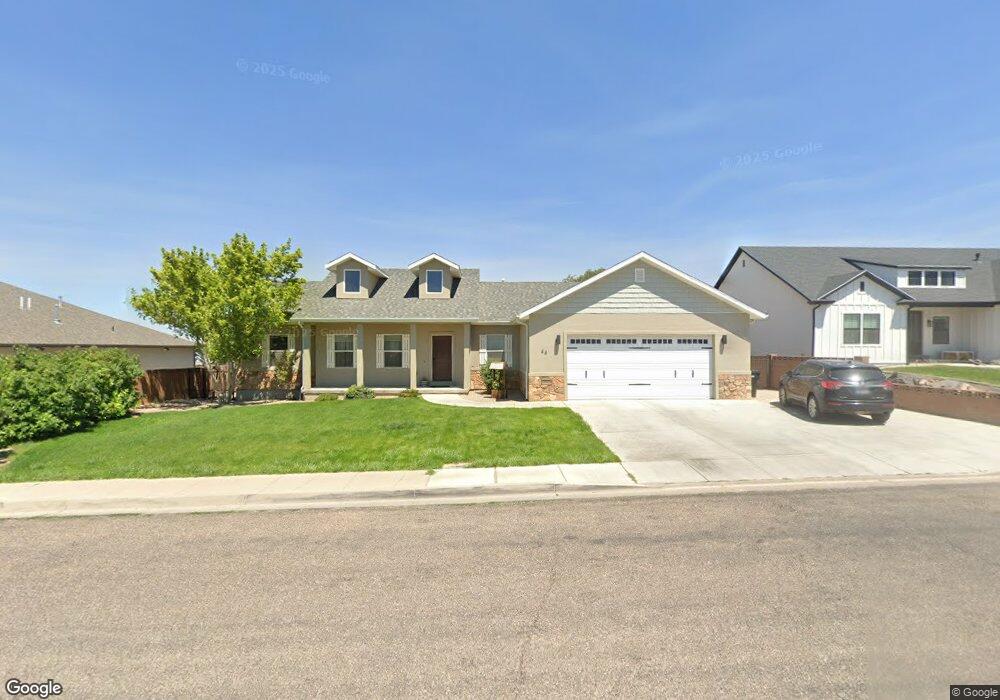
44 2775 St N Cedar City, UT 84721
Estimated Value: $589,000 - $657,957
5
Beds
--
Bath
3,955
Sq Ft
$157/Sq Ft
Est. Value
About This Home
This home is located at 44 2775 St N, Cedar City, UT 84721 and is currently estimated at $621,989, approximately $157 per square foot. 44 2775 St N is a home located in Iron County with nearby schools including Three Peaks School, Canyon View Middle School, and Canyon View High School.
Ownership History
Date
Name
Owned For
Owner Type
Purchase Details
Closed on
Apr 27, 2020
Sold by
Lustig Jane R
Bought by
Barlow Jacob
Current Estimated Value
Purchase Details
Closed on
Mar 17, 2017
Sold by
Carter Violet S
Bought by
Lustig Jane R
Purchase Details
Closed on
Jul 29, 2016
Sold by
Smith Kent N and Barday Angla
Bought by
Carter Phillip C and Carter Violet S
Home Financials for this Owner
Home Financials are based on the most recent Mortgage that was taken out on this home.
Original Mortgage
$270,700
Interest Rate
5%
Mortgage Type
Construction
Purchase Details
Closed on
Jun 13, 2011
Sold by
Smith Kent N and Smith Dorothella C
Bought by
Smith Kent N and Smith Dorothella C
Create a Home Valuation Report for This Property
The Home Valuation Report is an in-depth analysis detailing your home's value as well as a comparison with similar homes in the area
Home Values in the Area
Average Home Value in this Area
Purchase History
| Date | Buyer | Sale Price | Title Company |
|---|---|---|---|
| Barlow Jacob | -- | Southern Ut Ttl Co Of Cedar | |
| Lustig Jane R | -- | Security Escrow & Title Insu | |
| Carter Phillip C | -- | Security Escrow & Title Insu | |
| Smith Kent N | -- | -- |
Source: Public Records
Mortgage History
| Date | Status | Borrower | Loan Amount |
|---|---|---|---|
| Previous Owner | Carter Phillip C | $270,700 |
Source: Public Records
Tax History Compared to Growth
Tax History
| Year | Tax Paid | Tax Assessment Tax Assessment Total Assessment is a certain percentage of the fair market value that is determined by local assessors to be the total taxable value of land and additions on the property. | Land | Improvement |
|---|---|---|---|---|
| 2025 | $2,794 | $359,237 | $69,147 | $290,090 |
| 2023 | $2,932 | $402,920 | $60,125 | $342,795 |
| 2022 | $3,177 | $345,615 | $50,105 | $295,510 |
| 2021 | $2,577 | $280,330 | $33,405 | $246,925 |
| 2020 | $2,573 | $248,190 | $33,405 | $214,785 |
| 2019 | $2,646 | $244,110 | $33,405 | $210,705 |
| 2018 | $2,740 | $244,530 | $33,405 | $211,125 |
| 2017 | $2,487 | $218,480 | $27,800 | $190,680 |
| 2016 | $491 | $40,180 | $40,180 | $0 |
| 2015 | $511 | $39,625 | $0 | $0 |
| 2014 | $546 | $39,625 | $0 | $0 |
Source: Public Records
Map
Nearby Homes
- 92 W 2775 N
- 139 W 2825 Cir N
- 118 W 2725 N
- 124 W 2725 N
- 0 10 77 Acres Parcel: B-1548-000 Unit & Water Shares
- 111 W 2925 Cir N
- 120 W 2925 Cir N
- 0 41 47 Acres 3000 N
- 341 W Rosie Loop Unit 26W
- 341 W Rosie Loop Unit Lot 26W
- 345 W Rosie Loop Unit 25E
- 345 W Rosie Loop Unit Lot 25E
- 355 W Rosie Loop Unit 25W
- 355 W Rosie Loop Unit Lot 25W
- 344 W Rosie Loop Unit Lot 46E
- 330 W Rosie Loop Unit Lot 45E
- 336 W Rosie Loop Unit Lot 45W
- 330 W Rosie Loop Unit 45E
- 336 W Rosie Loop Unit 45W
- 344 W Rosie Loop Unit 46E
- 44 W 2775 N
- 22 W 2775 N
- 66 W 2775 N
- 1 E 2775 N
- 45 W 2775 N
- 64 W 2825 North Cir
- 91 W 2825 North Cir
- 92 2775 St N
- 27 W 2775 N
- 92 W 2775 N Unit 1
- 64 W 2825 Cir N
- 67 W 2775 N
- 23 E 2775 N
- 3 W 2775 N Unit 1
- 90 W 2825 North Cir
- 89 W 2775 N
- 115 W 2825 Cir N Unit 1
- 115 W 2825 Cir N
- 20 E 2775 N
- 90 W 2825 Cir N