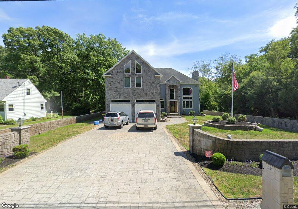
44 Briggs Rd Westport, MA 02790
North Westport NeighborhoodEstimated Value: $795,000 - $1,108,000
3
Beds
--
Bath
2,240
Sq Ft
$424/Sq Ft
Est. Value
About This Home
This home is located at 44 Briggs Rd, Westport, MA 02790 and is currently estimated at $950,446, approximately $424 per square foot. 44 Briggs Rd is a home located in Bristol County with nearby schools including Alice A. Macomber Primary School, Westport Elementary School, and Westport Middle-High School.
Ownership History
Date
Name
Owned For
Owner Type
Purchase Details
Closed on
Dec 8, 2004
Sold by
Bernardo Peter M
Bought by
Bernardo Diane R and Bernardo Peter M
Current Estimated Value
Purchase Details
Closed on
Apr 5, 2001
Sold by
Borden Thomas E and Borden Timothy E
Bought by
Bernardo Peter M
Create a Home Valuation Report for This Property
The Home Valuation Report is an in-depth analysis detailing your home's value as well as a comparison with similar homes in the area
Home Values in the Area
Average Home Value in this Area
Purchase History
| Date | Buyer | Sale Price | Title Company |
|---|---|---|---|
| Bernardo Diane R | -- | -- | |
| Bernardo Peter M | $72,000 | -- |
Source: Public Records
Mortgage History
| Date | Status | Borrower | Loan Amount |
|---|---|---|---|
| Previous Owner | Bernardo Peter M | $100,000 |
Source: Public Records
Tax History Compared to Growth
Tax History
| Year | Tax Paid | Tax Assessment Tax Assessment Total Assessment is a certain percentage of the fair market value that is determined by local assessors to be the total taxable value of land and additions on the property. | Land | Improvement |
|---|---|---|---|---|
| 2025 | $7,691 | $1,032,400 | $206,600 | $825,800 |
| 2024 | $6,040 | $781,400 | $184,800 | $596,600 |
| 2023 | $5,916 | $725,000 | $169,200 | $555,800 |
| 2022 | $5,654 | $666,700 | $169,200 | $497,500 |
| 2021 | $3,805 | $441,400 | $141,300 | $300,100 |
| 2020 | $3,679 | $436,400 | $136,300 | $300,100 |
| 2019 | $3,719 | $449,700 | $136,300 | $313,400 |
| 2018 | $3,668 | $448,900 | $141,900 | $307,000 |
| 2017 | $3,583 | $449,500 | $141,900 | $307,600 |
| 2016 | $3,312 | $418,700 | $141,900 | $276,800 |
| 2015 | $3,267 | $412,000 | $141,900 | $270,100 |
Source: Public Records
Map
Nearby Homes
- 116 Gifford Rd
- 20 Faulkner St
- 100 D Dr
- 9 Kyle Jacob Rd
- 15 S Breault St
- 0 Van Buren St
- 16 S Berryman St
- 3 Diane Way
- 9 Register Ave
- 92 Benoit St
- 771 Sanford Rd
- 565 Highland Ave
- 33 William St
- 6 Beaulieu St
- 25 Beaulieu St
- 1276 Old Fall River Rd
- 27 Dias Ave
- 47 Devol Ave
- 128 Old Bedford Rd
- 19 Charles Joseph Dr