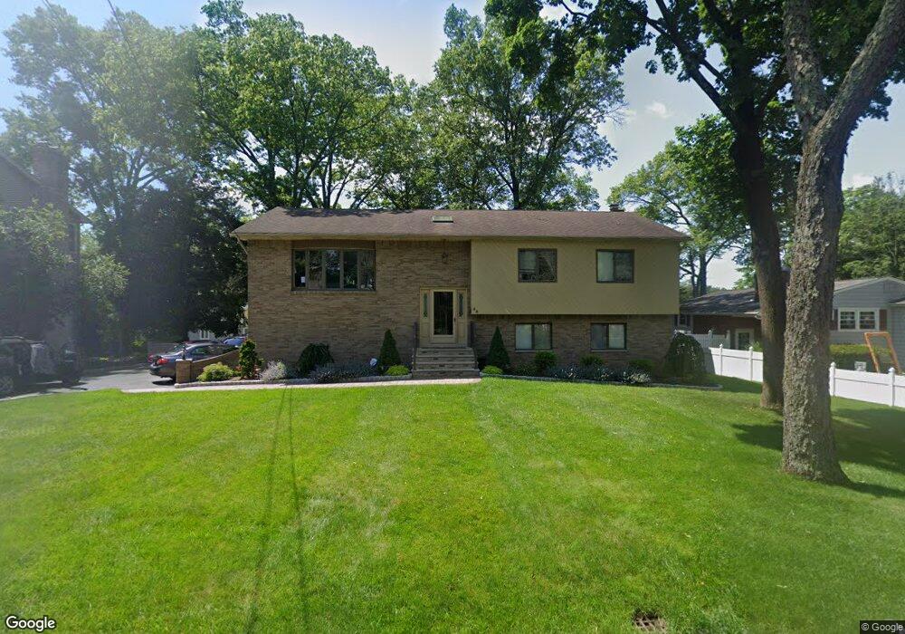
44 Cedar Rd Pompton Plains, NJ 07444
Estimated Value: $682,416 - $769,000
Studio
--
Bath
2,438
Sq Ft
$296/Sq Ft
Est. Value
About This Home
This home is located at 44 Cedar Rd, Pompton Plains, NJ 07444 and is currently estimated at $722,604, approximately $296 per square foot. 44 Cedar Rd is a home located in Morris County with nearby schools including Pequannock Twp High School, Netherlands Reformed Christian School, and St Marys School.
Ownership History
Date
Name
Owned For
Owner Type
Purchase Details
Closed on
Sep 12, 2002
Sold by
Kloss Raymond
Bought by
Smith Steven and Smith Alison
Current Estimated Value
Home Financials for this Owner
Home Financials are based on the most recent Mortgage that was taken out on this home.
Original Mortgage
$222,000
Outstanding Balance
$93,549
Interest Rate
6.36%
Estimated Equity
$629,055
Create a Home Valuation Report for This Property
The Home Valuation Report is an in-depth analysis detailing your home's value as well as a comparison with similar homes in the area
Home Values in the Area
Average Home Value in this Area
Purchase History
| Date | Buyer | Sale Price | Title Company |
|---|---|---|---|
| Smith Steven | $415,000 | -- |
Source: Public Records
Mortgage History
| Date | Status | Borrower | Loan Amount |
|---|---|---|---|
| Open | Smith Steven | $222,000 |
Source: Public Records
Tax History Compared to Growth
Tax History
| Year | Tax Paid | Tax Assessment Tax Assessment Total Assessment is a certain percentage of the fair market value that is determined by local assessors to be the total taxable value of land and additions on the property. | Land | Improvement |
|---|---|---|---|---|
| 2025 | $9,331 | $555,100 | $301,000 | $254,100 |
| 2024 | $8,907 | $511,300 | $287,500 | $223,800 |
| 2023 | $8,907 | $484,600 | $265,000 | $219,600 |
| 2022 | $9,199 | $368,400 | $191,800 | $176,600 |
| 2021 | $8,786 | $368,400 | $191,800 | $176,600 |
| 2020 | $9,081 | $368,400 | $191,800 | $176,600 |
| 2019 | $8,786 | $368,400 | $191,800 | $176,600 |
| 2018 | $8,455 | $368,400 | $191,800 | $176,600 |
| 2017 | $8,182 | $368,400 | $191,800 | $176,600 |
| 2016 | $7,924 | $368,400 | $191,800 | $176,600 |
| 2015 | $7,887 | $368,400 | $191,800 | $176,600 |
| 2014 | $7,700 | $368,400 | $191,800 | $176,600 |
Source: Public Records
Map
Nearby Homes
- 17 Garden Place
- 22 Greendale Ave
- 26 Brookside Ave
- 45 Village Rd
- 520 Turnpike C112 Unit C112
- 520 Newark Pompton Turnpike Unit C316
- 78 Maple Ln
- 7 Shore Rd
- 298 Boulevard
- 27 Colville Rd
- 337 Boulevard
- 2 Michael Ct
- 28 Kingston Rd
- 12 Kingston Rd
- 156 Ticonderoga Terrace
- 4 Jeffrey Rd
- 72 Central Ave
- 233 Walnut Ave
- 7 Welsh Ct
- 1452 Lincoln Ave