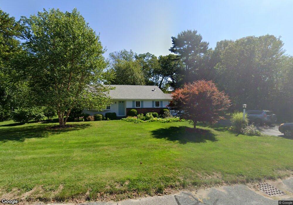
44 Daedalus Cir Scituate, MA 02066
Estimated Value: $814,999 - $928,000
3
Beds
2
Baths
1,836
Sq Ft
$479/Sq Ft
Est. Value
About This Home
This home is located at 44 Daedalus Cir, Scituate, MA 02066 and is currently estimated at $878,750, approximately $478 per square foot. 44 Daedalus Cir is a home located in Plymouth County with nearby schools including Cushing Elementary School, Lester J. Gates Middle School, and Scituate High School.
Ownership History
Date
Name
Owned For
Owner Type
Purchase Details
Closed on
Dec 15, 1995
Sold by
Vergobbe Robert M and Vergobbe Theresa M
Bought by
Najarian Gary C and Najarian Susan M
Current Estimated Value
Home Financials for this Owner
Home Financials are based on the most recent Mortgage that was taken out on this home.
Original Mortgage
$100,000
Outstanding Balance
$2,058
Interest Rate
7.43%
Mortgage Type
Purchase Money Mortgage
Estimated Equity
$876,692
Create a Home Valuation Report for This Property
The Home Valuation Report is an in-depth analysis detailing your home's value as well as a comparison with similar homes in the area
Home Values in the Area
Average Home Value in this Area
Purchase History
| Date | Buyer | Sale Price | Title Company |
|---|---|---|---|
| Najarian Gary C | $190,000 | -- |
Source: Public Records
Mortgage History
| Date | Status | Borrower | Loan Amount |
|---|---|---|---|
| Open | Najarian Gary C | $50,000 | |
| Open | Najarian Gary C | $100,000 |
Source: Public Records
Tax History
| Year | Tax Paid | Tax Assessment Tax Assessment Total Assessment is a certain percentage of the fair market value that is determined by local assessors to be the total taxable value of land and additions on the property. | Land | Improvement |
|---|---|---|---|---|
| 2025 | $6,972 | $697,900 | $378,600 | $319,300 |
| 2024 | $6,810 | $657,300 | $344,200 | $313,100 |
| 2023 | $6,735 | $608,900 | $330,300 | $278,600 |
| 2022 | $6,735 | $533,700 | $300,100 | $233,600 |
| 2021 | $6,478 | $486,000 | $285,800 | $200,200 |
| 2020 | $6,051 | $448,200 | $274,800 | $173,400 |
| 2019 | $5,951 | $433,100 | $269,400 | $163,700 |
| 2018 | $5,726 | $410,500 | $268,900 | $141,600 |
| 2017 | $5,626 | $399,300 | $257,700 | $141,600 |
| 2016 | $5,329 | $376,900 | $235,300 | $141,600 |
| 2015 | $4,791 | $365,700 | $224,100 | $141,600 |
Source: Public Records
Map
Nearby Homes
- 20 Grace Way Unit 20
- 6 Grace Way Unit 6
- 27 Grace Way
- 111 Elm St
- 115 Elm St
- 34 Cudworth Rd
- 327 Country Way
- 1 Washington Ln
- 20 Lawson Rd
- 20 Lee Ave
- 74 Branch St Unit 15
- 49 Jackson Rd
- 38 Lauren Ln
- 46 Tilden Rd
- 98 Satuit Trail
- 21 Jenkins Place
- 54 Woodland Rd
- 334 Chief Justice Cushing Hwy
- 14 Old Country Way Unit C
- 14 Old Country Way Unit B
- 38 Daedalus Cir
- 50 Daedalus Cir
- 43 Daedalus Cir
- 49 Daedalus Cir
- 47 Beach Plum Ln
- 33 Daedalus Cir
- 35 Beach Plum Ln
- 55 Beach Plum Ln
- 27 Beach Plum Ln
- 29 Hilltop Rd
- 25 Hilltop Rd
- 34 Daedalus Cir
- 32 Daedalus Cir
- 9 Daedalus Cir
- 19 Daedalus Cir
- 3 Grace Way Unit 3
- 1 Grace Way Unit 1
- 0 Branch
- 10 Emerson
- 10 Emerson (Winter Rental)
Your Personal Tour Guide
Ask me questions while you tour the home.