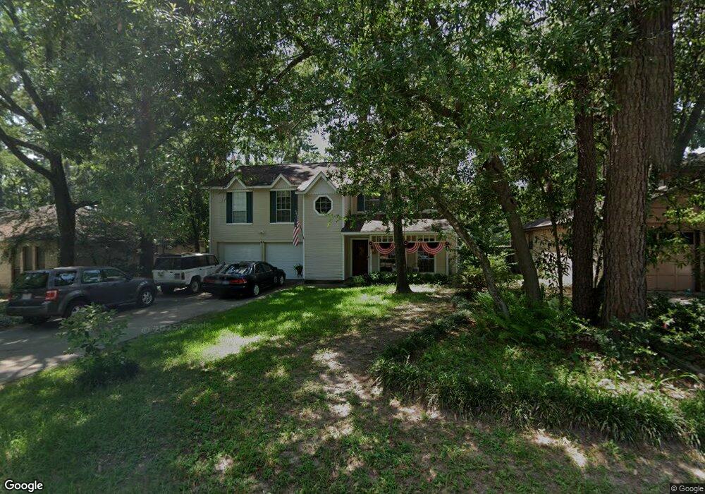
44 Dew Fall Ct Spring, TX 77380
Grogan's Mill NeighborhoodEstimated Value: $281,376 - $345,000
Studio
2
Baths
1,767
Sq Ft
$186/Sq Ft
Est. Value
About This Home
This home is located at 44 Dew Fall Ct, Spring, TX 77380 and is currently estimated at $329,094, approximately $186 per square foot. 44 Dew Fall Ct is a home located in Montgomery County with nearby schools including Hailey Elementary School, W.D Wilkerson Intermediate School, and Knox J High School.
Ownership History
Date
Name
Owned For
Owner Type
Purchase Details
Closed on
Apr 9, 1999
Sold by
Askew James P and Askew Cynthia A
Bought by
Lapaglia Bethany
Current Estimated Value
Home Financials for this Owner
Home Financials are based on the most recent Mortgage that was taken out on this home.
Original Mortgage
$84,254
Outstanding Balance
$21,370
Interest Rate
7.06%
Mortgage Type
FHA
Estimated Equity
$307,724
Purchase Details
Closed on
Sep 1, 1987
Bought by
Lapaglia Bethany
Create a Home Valuation Report for This Property
The Home Valuation Report is an in-depth analysis detailing your home's value as well as a comparison with similar homes in the area
Home Values in the Area
Average Home Value in this Area
Purchase History
| Date | Buyer | Sale Price | Title Company |
|---|---|---|---|
| Lapaglia Bethany | -- | American Title Company | |
| Lapaglia Bethany | -- | -- |
Source: Public Records
Mortgage History
| Date | Status | Borrower | Loan Amount |
|---|---|---|---|
| Open | Lapaglia Bethany | $84,254 |
Source: Public Records
Tax History
| Year | Tax Paid | Tax Assessment Tax Assessment Total Assessment is a certain percentage of the fair market value that is determined by local assessors to be the total taxable value of land and additions on the property. | Land | Improvement |
|---|---|---|---|---|
| 2025 | $2,598 | $229,186 | -- | -- |
| 2024 | $2,282 | $208,351 | -- | -- |
| 2023 | $2,282 | $189,410 | $50,000 | $176,770 |
| 2022 | $3,480 | $172,190 | $50,000 | $166,870 |
| 2021 | $3,415 | $156,540 | $13,150 | $143,390 |
| 2020 | $3,498 | $153,560 | $13,150 | $140,410 |
| 2019 | $3,726 | $158,280 | $13,150 | $145,130 |
| 2018 | $2,869 | $144,770 | $13,150 | $131,620 |
| 2017 | $3,451 | $144,770 | $13,150 | $131,620 |
| 2016 | $3,451 | $144,770 | $13,150 | $131,620 |
| 2015 | $2,973 | $144,250 | $13,150 | $138,380 |
| 2014 | $2,973 | $131,140 | $13,150 | $117,990 |
Source: Public Records
Map
Nearby Homes
- 37 Rockfern Ct
- 1251 Pruitt Rd
- 1237 Pruitt Rd
- 1231 Pruitt Rd
- 118 Angel Leaf Rd
- 9 S Brook Pebble Ct
- 30 N Drifting Leaf Ct
- 56 N Morningwood Ct
- 713 Sawdust Rd
- 134 S Tranquil Path
- 205 Grogans Point Rd
- 723 Shadowbrook Dr
- 25225 Liberty Mill Dr
- 2107 Level Oak Place
- 6 Red Deer Ln
- 98 Northgate Dr
- 90 Crystal Lake Ln
- 25607 Pecan Valley Cir
- 169 Grogans Point Rd
- 25606 Pecan Valley Cir
- 46 Dew Fall Ct
- 14 Rain Walk Ct
- 10 Rain Walk Ct
- 36 S High Oaks Cir
- 43 Dew Fall Ct
- 45 Dew Fall Ct
- 34 S High Oaks Cir
- 11 Rain Walk Ct
- 52 Dew Fall Ct
- 41 Dew Fall Ct
- 47 Dew Fall Ct
- 32 S High Oaks Cir
- 56 Dew Fall Ct
- 6 Rain Walk Ct
- 39 Dew Fall Ct
- 49 Dew Fall Ct
- 30 S High Oaks Cir
- 37 Dew Fall Ct
- 60 Dew Fall Ct
- 51 Dew Fall Ct