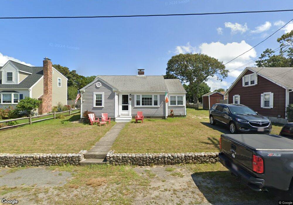
44 Ferncliff Rd Dennis Port, MA 02639
Dennis Port NeighborhoodEstimated Value: $514,000 - $646,000
2
Beds
1
Bath
840
Sq Ft
$707/Sq Ft
Est. Value
About This Home
This home is located at 44 Ferncliff Rd, Dennis Port, MA 02639 and is currently estimated at $594,010, approximately $707 per square foot. 44 Ferncliff Rd is a home located in Barnstable County with nearby schools including Dennis-Yarmouth Regional High School and St. Pius X. School.
Ownership History
Date
Name
Owned For
Owner Type
Purchase Details
Closed on
Aug 23, 2023
Sold by
Carucci Kathleen
Bought by
Moran Timothy P
Current Estimated Value
Purchase Details
Closed on
Nov 10, 2016
Sold by
Jean H Moran T H and Jean Moran
Bought by
Moran Timothy P and Carucci Kathleen
Purchase Details
Closed on
Sep 1, 2010
Sold by
Moran Robert E and Moran Jean H
Bought by
Moran Robert E and Moran Jean H
Create a Home Valuation Report for This Property
The Home Valuation Report is an in-depth analysis detailing your home's value as well as a comparison with similar homes in the area
Home Values in the Area
Average Home Value in this Area
Purchase History
| Date | Buyer | Sale Price | Title Company |
|---|---|---|---|
| Moran Timothy P | -- | None Available | |
| Moran Timothy P | -- | None Available | |
| Moran Timothy P | -- | None Available | |
| Moran Timothy P | -- | -- | |
| Moran Timothy P | -- | -- | |
| Moran Robert E | -- | -- | |
| Moran Timothy P | -- | -- | |
| Moran Robert E | -- | -- |
Source: Public Records
Tax History Compared to Growth
Tax History
| Year | Tax Paid | Tax Assessment Tax Assessment Total Assessment is a certain percentage of the fair market value that is determined by local assessors to be the total taxable value of land and additions on the property. | Land | Improvement |
|---|---|---|---|---|
| 2025 | $2,467 | $569,700 | $276,500 | $293,200 |
| 2024 | $2,303 | $524,500 | $265,900 | $258,600 |
| 2023 | $2,227 | $476,900 | $241,700 | $235,200 |
| 2022 | $2,036 | $363,600 | $190,500 | $173,100 |
| 2021 | $1,982 | $328,700 | $186,800 | $141,900 |
| 2020 | $1,926 | $315,700 | $186,800 | $128,900 |
| 2019 | $1,935 | $313,600 | $198,800 | $114,800 |
| 2018 | $1,871 | $295,100 | $189,300 | $105,800 |
| 2017 | $1,702 | $276,800 | $174,300 | $102,500 |
| 2016 | $1,646 | $252,000 | $164,400 | $87,600 |
| 2015 | $1,613 | $252,000 | $164,400 | $87,600 |
| 2014 | $1,537 | $242,000 | $154,400 | $87,600 |
Source: Public Records
Map
Nearby Homes
- 22 Ferncliff Rd
- 102 Sea St
- 37-A Beach Hills Rd
- 37 Beach Hills Rd
- 262 Old Wharf Rd Unit 67
- 262 Old Wharf Rd Unit 5
- 262 Old Wharf Rd Unit 5
- 262 Old Wharf Rd Unit 20
- 262 Old Wharf Rd Unit 87
- 402 Old Wharf Rd
- 402 Old Wharf Rd
- 405 Old Wharf Rd Unit B204
- 405 Old Wharf Rd Unit B204
- 241 Old Wharf Rd Unit 82
- 241 Old Wharf Rd Unit 127
- 241 Old Wharf Rd Unit 90
- 11 Ocean Park W
- 9 Chase Ave Unit 6
- 31 Easy St
- 217 Old Wharf Rd Unit 64
- 46 Ferncliff Rd
- 42 Ferncliff Rd
- 25 Fenway Rd
- 43 Ferncliff Rd
- 29 Fenway Rd
- 38 Ferncliff Rd
- 48 Ferncliff Rd
- 39 Ferncliff Rd
- 45 Ferncliff Rd
- 35 Ferncliff Rd
- 33 Fenway Rd
- 21 Fenway Rd
- 54 Ferncliff Rd
- 25 Arbor Way
- 23 Arbor Way
- 25 Arbor Way Unit Kare
- 25 Arbor Way Unit 25
- 23 Arbor Way Unit 29
- 23 Arbor Way Unit 25
- 29 Arbor Way