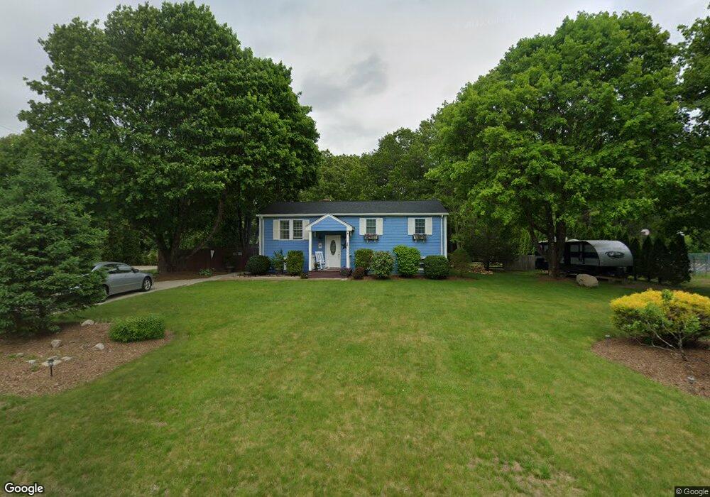
44 Francis Rd North Scituate, RI 02857
Estimated Value: $453,000 - $557,000
3
Beds
2
Baths
1,510
Sq Ft
$321/Sq Ft
Est. Value
About This Home
This home is located at 44 Francis Rd, North Scituate, RI 02857 and is currently estimated at $485,146, approximately $321 per square foot. 44 Francis Rd is a home located in Providence County with nearby schools including Fogarty Memorial School, Ponaganset Middle School, and Ponaganset High School.
Ownership History
Date
Name
Owned For
Owner Type
Purchase Details
Closed on
Jun 9, 2000
Sold by
Barros Mitchell and Barros Mary
Bought by
Deschenes Paul J and Deschenes Joyce C
Current Estimated Value
Purchase Details
Closed on
Dec 28, 1995
Sold by
Castiglioni Marie Est
Bought by
Barros Mitchell and Barros Mary
Create a Home Valuation Report for This Property
The Home Valuation Report is an in-depth analysis detailing your home's value as well as a comparison with similar homes in the area
Home Values in the Area
Average Home Value in this Area
Purchase History
| Date | Buyer | Sale Price | Title Company |
|---|---|---|---|
| Deschenes Paul J | $150,000 | -- | |
| Barros Mitchell | $104,000 | -- |
Source: Public Records
Mortgage History
| Date | Status | Borrower | Loan Amount |
|---|---|---|---|
| Open | Barros Mitchell | $314,500 | |
| Closed | Barros Mitchell | $176,250 | |
| Closed | Barros Mitchell | $35,280 | |
| Closed | Barros Mitchell | $165,000 |
Source: Public Records
Tax History Compared to Growth
Tax History
| Year | Tax Paid | Tax Assessment Tax Assessment Total Assessment is a certain percentage of the fair market value that is determined by local assessors to be the total taxable value of land and additions on the property. | Land | Improvement |
|---|---|---|---|---|
| 2025 | $5,209 | $365,300 | $134,300 | $231,000 |
| 2024 | $5,063 | $365,300 | $134,300 | $231,000 |
| 2023 | $5,206 | $365,300 | $134,300 | $231,000 |
| 2022 | $5,158 | $279,700 | $90,000 | $189,700 |
| 2021 | $5,158 | $279,700 | $90,000 | $189,700 |
| 2020 | $5,096 | $279,700 | $90,000 | $189,700 |
| 2018 | $5,108 | $255,400 | $79,300 | $176,100 |
| 2017 | $5,039 | $255,400 | $79,300 | $176,100 |
| 2016 | $4,903 | $218,400 | $67,900 | $150,500 |
| 2015 | $4,831 | $218,400 | $67,900 | $150,500 |
| 2014 | $4,755 | $218,400 | $67,900 | $150,500 |
| 2013 | $4,686 | $220,600 | $77,200 | $143,400 |
Source: Public Records
Map
Nearby Homes
- 22 Liberty Ln
- 485 Snake Hill Rd
- 56 Pine Ledge Rd
- 35 Steere Rd
- 0 Winchester Dr Unit 1386967
- 219 Peeptoad Rd
- 389 Elmdale Rd
- 125 Smith Ave Unit 1B
- 17 Country Side Ln
- 27 Sunnybrook Rd
- 4 Fair Oaks Ct N
- 219-221 Peeptoad Rd
- 15 Chiswick Rd
- 369 Hunting House Rd
- 0 Quaker Ln
- 0 Cranberry Ridge Rd
- 62 Orchard Ave
- 66 Orchard Ave
- 261 Quaker Ln
- 112 Cranberry Ridge Rd