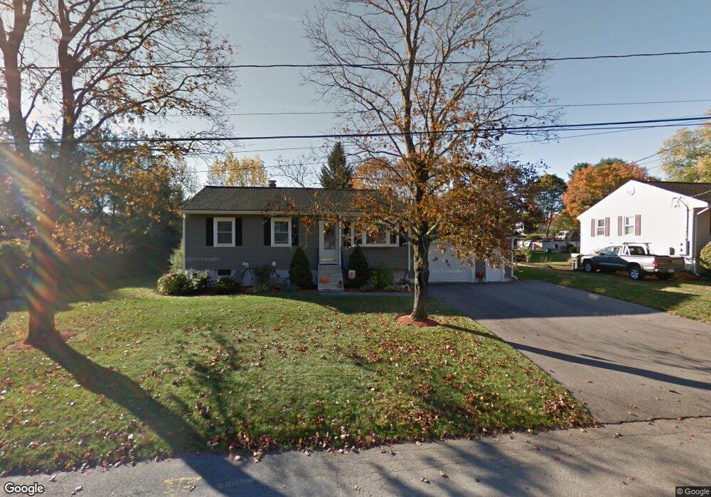
44 Gorwin Dr Medway, MA 02053
Estimated Value: $545,000 - $570,000
3
Beds
2
Baths
1,012
Sq Ft
$553/Sq Ft
Est. Value
About This Home
This home is located at 44 Gorwin Dr, Medway, MA 02053 and is currently estimated at $559,793, approximately $553 per square foot. 44 Gorwin Dr is a home located in Norfolk County with nearby schools including John D. McGovern Elementary School, Burke-Memorial Elementary, and Medway Middle School.
Ownership History
Date
Name
Owned For
Owner Type
Purchase Details
Closed on
Apr 21, 2016
Sold by
Martini Judith H and Martini John J
Bought by
Martinal Ft
Current Estimated Value
Purchase Details
Closed on
May 31, 2000
Sold by
Svilas Algimantas A
Bought by
Martini John J and Martini Judith H
Home Financials for this Owner
Home Financials are based on the most recent Mortgage that was taken out on this home.
Original Mortgage
$152,000
Interest Rate
8.14%
Mortgage Type
Purchase Money Mortgage
Create a Home Valuation Report for This Property
The Home Valuation Report is an in-depth analysis detailing your home's value as well as a comparison with similar homes in the area
Home Values in the Area
Average Home Value in this Area
Purchase History
| Date | Buyer | Sale Price | Title Company |
|---|---|---|---|
| Martinal Ft | -- | -- | |
| Martini John J | $190,000 | -- |
Source: Public Records
Mortgage History
| Date | Status | Borrower | Loan Amount |
|---|---|---|---|
| Previous Owner | Martini John J | $176,300 | |
| Previous Owner | Martini John J | $225,000 | |
| Previous Owner | Martini John J | $42,800 | |
| Previous Owner | Martini John J | $152,000 |
Source: Public Records
Tax History
| Year | Tax Paid | Tax Assessment Tax Assessment Total Assessment is a certain percentage of the fair market value that is determined by local assessors to be the total taxable value of land and additions on the property. | Land | Improvement |
|---|---|---|---|---|
| 2025 | $6,521 | $457,600 | $283,900 | $173,700 |
| 2024 | $6,589 | $457,600 | $283,900 | $173,700 |
| 2023 | $6,142 | $385,300 | $235,200 | $150,100 |
| 2022 | $6,059 | $357,900 | $208,900 | $149,000 |
| 2021 | $5,800 | $332,200 | $192,600 | $139,600 |
| 2020 | $5,565 | $318,000 | $178,400 | $139,600 |
| 2019 | $5,344 | $314,900 | $178,400 | $136,500 |
| 2018 | $5,418 | $306,800 | $170,300 | $136,500 |
| 2017 | $5,294 | $295,400 | $164,200 | $131,200 |
| 2016 | $5,207 | $287,500 | $158,200 | $129,300 |
| 2015 | $5,434 | $297,900 | $146,000 | $151,900 |
| 2014 | $5,002 | $265,500 | $129,800 | $135,700 |
Source: Public Records
Map
Nearby Homes
- 33 Gorwin Dr
- 50 Main St
- 58 Holliston St
- 20 Broad St Unit 1
- 20 Broad St Unit 6
- 20 Broad St Unit A
- 20 Broad St Unit 4
- 10 Barber St
- 79 Lovering St Unit B
- 14 Sanford St Unit 47
- 19 Evergreen St Unit A
- 5 Richardson St
- 8 Winthrop St
- 19 Sycamore Way
- 11 Fairway Ln
- 13 Teresa Dr
- 14 Teresa Dr
- 40 Timber Crest Dr
- 17 Fairway Ln
- 26 Timber Crest Dr
Your Personal Tour Guide
Ask me questions while you tour the home.