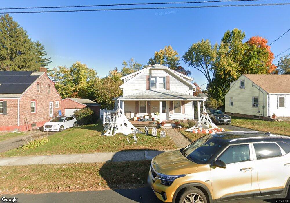
44 Jennings Rd Bristol, CT 06010
North Bristol NeighborhoodEstimated Value: $305,426 - $345,000
3
Beds
2
Baths
1,512
Sq Ft
$216/Sq Ft
Est. Value
About This Home
This home is located at 44 Jennings Rd, Bristol, CT 06010 and is currently estimated at $327,107, approximately $216 per square foot. 44 Jennings Rd is a home located in Hartford County with nearby schools including West Bristol Sch, Bristol Central High School, and St. Joseph School.
Ownership History
Date
Name
Owned For
Owner Type
Purchase Details
Closed on
Jul 1, 2008
Sold by
Toolan John F and Toolan Beverly F
Bought by
Hultman Geoffrey and Hultman Katie
Current Estimated Value
Home Financials for this Owner
Home Financials are based on the most recent Mortgage that was taken out on this home.
Original Mortgage
$203,309
Interest Rate
6.37%
Purchase Details
Closed on
Jul 18, 2005
Sold by
Martins William J and Martins Donna L
Bought by
Toolan John F and Toolan Beverly F
Purchase Details
Closed on
Sep 4, 1987
Sold by
Nelson Est Hopkins
Bought by
Martins Wm J
Home Financials for this Owner
Home Financials are based on the most recent Mortgage that was taken out on this home.
Original Mortgage
$92,100
Interest Rate
10.28%
Create a Home Valuation Report for This Property
The Home Valuation Report is an in-depth analysis detailing your home's value as well as a comparison with similar homes in the area
Home Values in the Area
Average Home Value in this Area
Purchase History
| Date | Buyer | Sale Price | Title Company |
|---|---|---|---|
| Hultman Geoffrey | $206,500 | -- | |
| Toolan John F | $214,900 | -- | |
| Martins Wm J | $118,000 | -- |
Source: Public Records
Mortgage History
| Date | Status | Borrower | Loan Amount |
|---|---|---|---|
| Open | Martins Wm J | $206,857 | |
| Closed | Martins Wm J | $203,309 | |
| Previous Owner | Martins Wm J | $30,000 | |
| Previous Owner | Martins Wm J | $92,100 |
Source: Public Records
Tax History
| Year | Tax Paid | Tax Assessment Tax Assessment Total Assessment is a certain percentage of the fair market value that is determined by local assessors to be the total taxable value of land and additions on the property. | Land | Improvement |
|---|---|---|---|---|
| 2025 | $4,588 | $135,940 | $31,780 | $104,160 |
| 2024 | $4,330 | $135,940 | $31,780 | $104,160 |
| 2023 | $4,126 | $135,940 | $31,780 | $104,160 |
| 2022 | $3,766 | $98,210 | $24,080 | $74,130 |
| 2021 | $3,766 | $98,210 | $24,080 | $74,130 |
| 2020 | $3,766 | $98,210 | $24,080 | $74,130 |
| 2019 | $3,737 | $98,210 | $24,080 | $74,130 |
| 2018 | $3,622 | $98,210 | $24,080 | $74,130 |
| 2017 | $3,783 | $105,000 | $34,370 | $70,630 |
| 2016 | $3,783 | $105,000 | $34,370 | $70,630 |
| 2015 | $3,634 | $105,000 | $34,370 | $70,630 |
| 2014 | $3,634 | $105,000 | $34,370 | $70,630 |
Source: Public Records
Map
Nearby Homes
- 380 Burlington Ave
- 95 Birge Rd
- 99 Lexington St
- 215 Burlington Ave
- 88 N Pond St
- 480 Burlington Ave
- 228 Fern Hill Rd
- 0 Fairlawn St
- 74 Nancy Rd
- 118 Berkshire Dr
- 110 Oakwood Cir
- 1 Hickory St
- 40 Matthews St Unit LOT 43
- 40 Matthews St Unit 30
- 523 West St
- 81 Hoover Ave
- 15 Lincoln Place
- 85 Wildewood Run
- 28 Merriman St
- 40 Woodland St
- 50 Jennings Rd
- 38 Jennings Rd
- 54 Jennings Rd
- 32 Jennings Rd
- 26 Jennings Rd
- 28 Jennings Rd
- 47 Birge Rd
- 70 Jennings Rd
- 23 Birge Rd
- 29 Birge Rd
- 55 Birge Rd
- 59 Birge Rd
- 31 Birge Rd
- #202 -291 Burlington Ave Unit 202
- #113 -291 Burlington Ave Unit 113
- #111 -291 Burlington Ave Unit 111
- 206 Burlington Ave Unit 206
- 207 Burlington Ave
- 206 Burlington Ave Unit 102
- #110 -291 Burlington Ave Unit 110
Your Personal Tour Guide
Ask me questions while you tour the home.