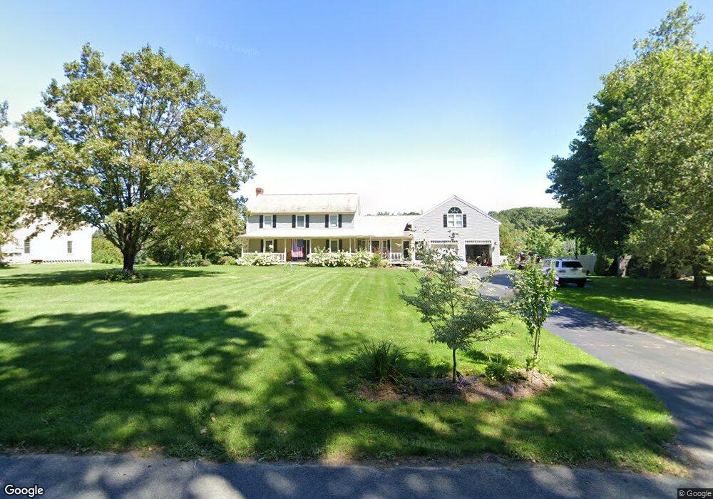
44 Jones Rd Unit + in law Charlton, MA 01507
Estimated Value: $689,000 - $874,000
4
Beds
4
Baths
2,604
Sq Ft
$298/Sq Ft
Est. Value
About This Home
This home is located at 44 Jones Rd Unit + in law, Charlton, MA 01507 and is currently estimated at $775,011, approximately $297 per square foot. 44 Jones Rd Unit + in law is a home located in Worcester County with nearby schools including Shepherd Hill Regional High School.
Ownership History
Date
Name
Owned For
Owner Type
Purchase Details
Closed on
Dec 22, 2021
Sold by
Normand Jeffrey C
Bought by
Leroux Heather R and Normand Jeffrey C
Current Estimated Value
Home Financials for this Owner
Home Financials are based on the most recent Mortgage that was taken out on this home.
Original Mortgage
$467,961
Outstanding Balance
$428,746
Interest Rate
2.98%
Mortgage Type
VA
Estimated Equity
$346,265
Purchase Details
Closed on
Jun 10, 2019
Sold by
Graff Kenneth E
Bought by
Graff Heidi N and Normand Jeffrey C
Home Financials for this Owner
Home Financials are based on the most recent Mortgage that was taken out on this home.
Original Mortgage
$405,000
Interest Rate
4.1%
Mortgage Type
VA
Purchase Details
Closed on
May 15, 1996
Sold by
Jr Edward Fcote and Cote Paula J
Bought by
Graff Kenneth E and Graff Heidi
Create a Home Valuation Report for This Property
The Home Valuation Report is an in-depth analysis detailing your home's value as well as a comparison with similar homes in the area
Home Values in the Area
Average Home Value in this Area
Purchase History
| Date | Buyer | Sale Price | Title Company |
|---|---|---|---|
| Leroux Heather R | -- | None Available | |
| Normand Jeffrey C | -- | None Available | |
| Leroux Heather R | -- | None Available | |
| Leroux Heather R | -- | None Available | |
| Normand Jeffrey C | -- | None Available | |
| Normand Jeffrey C | -- | None Available | |
| Graff Heidi N | $479,000 | -- | |
| Graff Heidi N | $479,000 | -- | |
| Graff Heidi N | $479,000 | -- | |
| Graff Kenneth E | $127,900 | -- | |
| Graff Kenneth E | $127,900 | -- |
Source: Public Records
Mortgage History
| Date | Status | Borrower | Loan Amount |
|---|---|---|---|
| Open | Normand Jeffrey C | $467,961 | |
| Closed | Normand Jeffrey C | $467,961 | |
| Previous Owner | Graff Heidi N | $405,000 | |
| Previous Owner | Graff Kenneth E | $355,500 |
Source: Public Records
Tax History Compared to Growth
Tax History
| Year | Tax Paid | Tax Assessment Tax Assessment Total Assessment is a certain percentage of the fair market value that is determined by local assessors to be the total taxable value of land and additions on the property. | Land | Improvement |
|---|---|---|---|---|
| 2025 | $7,465 | $670,700 | $105,500 | $565,200 |
| 2024 | $7,216 | $636,300 | $99,800 | $536,500 |
| 2023 | $7,078 | $581,600 | $99,800 | $481,800 |
| 2022 | $6,862 | $516,300 | $88,400 | $427,900 |
| 2021 | $6,642 | $442,500 | $79,900 | $362,600 |
| 2020 | $6,551 | $438,500 | $75,900 | $362,600 |
| 2019 | $6,477 | $438,500 | $75,900 | $362,600 |
| 2018 | $5,920 | $438,500 | $75,900 | $362,600 |
| 2017 | $5,777 | $409,700 | $75,900 | $333,800 |
| 2016 | $5,679 | $412,100 | $75,900 | $336,200 |
| 2015 | $5,530 | $412,100 | $75,900 | $336,200 |
| 2014 | $5,325 | $420,600 | $80,900 | $339,700 |
Source: Public Records
Map
Nearby Homes
- 9 Knollwood Dr
- 50 Old Spencer Rd
- 65 Old Spencer Rd
- 199 Center Depot Rd
- 7 Little Muggett Rd
- 68 Borkum Rd
- 208 Sunset Dr
- 7 Hycrest Rd
- 8 Hycrest Rd
- 38 Stevens Park Rd
- Lot 3 Smith Rd
- Lot 5 Smith Rd
- Lot 4 Smith Rd
- 40 Carroll Hill Rd
- 3 Cranberry Meadow Shore Rd
- 27 W Applewood Dr
- 39 Hycrest Rd
- 105 Carroll Hill Rd
- 86 Jolicoeur Ave
- 102 Worcester Rd