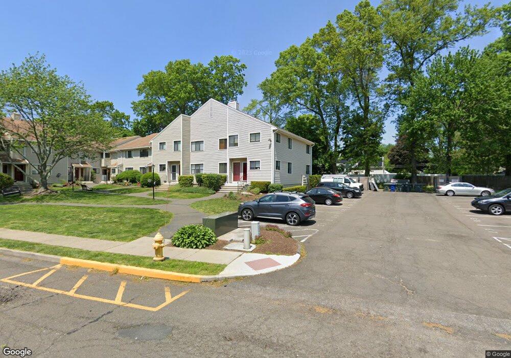
44 Lance Cir Bridgeport, CT 06606
North End NeighborhoodEstimated Value: $229,000 - $287,000
1
Bed
1
Bath
1,011
Sq Ft
$254/Sq Ft
Est. Value
About This Home
This home is located at 44 Lance Cir, Bridgeport, CT 06606 and is currently estimated at $257,053, approximately $254 per square foot. 44 Lance Cir is a home located in Fairfield County with nearby schools including John Winthrop School, Central High School, and St Andrew School.
Ownership History
Date
Name
Owned For
Owner Type
Purchase Details
Closed on
Dec 13, 2023
Sold by
Zochol Emily
Bought by
Tang Danhuan and Dai Wenjun
Current Estimated Value
Purchase Details
Closed on
Nov 18, 2013
Sold by
National Res Nominee S
Bought by
Zochol Emily
Home Financials for this Owner
Home Financials are based on the most recent Mortgage that was taken out on this home.
Original Mortgage
$113,975
Interest Rate
4.24%
Mortgage Type
New Conventional
Purchase Details
Closed on
Jul 25, 2013
Sold by
Moker Josephine and Moker Kevin
Bought by
National Res Nominee S
Purchase Details
Closed on
Jul 15, 2004
Sold by
Kowalski Isidor
Bought by
Cuozzo Josephine
Purchase Details
Closed on
Jan 5, 1994
Sold by
Reichental Abraham and Reichental Dorit
Bought by
Kowalski Isador
Create a Home Valuation Report for This Property
The Home Valuation Report is an in-depth analysis detailing your home's value as well as a comparison with similar homes in the area
Home Values in the Area
Average Home Value in this Area
Purchase History
| Date | Buyer | Sale Price | Title Company |
|---|---|---|---|
| Tang Danhuan | $215,000 | None Available | |
| Tang Danhuan | $215,000 | None Available | |
| Tang Danhuan | $215,000 | None Available | |
| Tang Danhuan | $215,000 | None Available | |
| Zochol Emily | $117,500 | -- | |
| Zochol Emily | $117,500 | -- | |
| National Res Nominee S | $119,000 | -- | |
| Moker Josephine | -- | -- | |
| Moker Josephine | -- | -- | |
| Cuozzo Josephine | $171,000 | -- | |
| Cuozzo Josephine | $171,000 | -- | |
| Kowalski Isador | $31,810 | -- | |
| Kowalski Isador | $31,810 | -- |
Source: Public Records
Mortgage History
| Date | Status | Borrower | Loan Amount |
|---|---|---|---|
| Previous Owner | Kowalski Isador | $113,975 |
Source: Public Records
Tax History
| Year | Tax Paid | Tax Assessment Tax Assessment Total Assessment is a certain percentage of the fair market value that is determined by local assessors to be the total taxable value of land and additions on the property. | Land | Improvement |
|---|---|---|---|---|
| 2025 | $4,090 | $94,140 | $0 | $94,140 |
| 2024 | $4,090 | $94,140 | $0 | $94,140 |
| 2023 | $4,090 | $94,140 | $0 | $94,140 |
| 2022 | $4,090 | $94,140 | $0 | $94,140 |
| 2021 | $4,090 | $94,140 | $0 | $94,140 |
| 2020 | $4,289 | $79,440 | $0 | $79,440 |
| 2019 | $4,289 | $79,440 | $0 | $79,440 |
| 2018 | $4,319 | $79,440 | $0 | $79,440 |
| 2017 | $4,319 | $79,440 | $0 | $79,440 |
| 2016 | $4,319 | $79,440 | $0 | $79,440 |
| 2015 | $5,236 | $124,080 | $0 | $124,080 |
| 2014 | $5,236 | $124,080 | $0 | $124,080 |
Source: Public Records
Map
Nearby Homes
- 3432 Old Town Rd
- 3460 Old Town Rd
- 69 Seaver Cir
- 170 Marilyn Dr
- 3125 Old Town Rd
- 8 Raleigh Rd
- 121 Campbell Rd
- 99 Quinsey Dr
- 18 Ridgebury Dr
- 252 Bear Paw Rd
- 3370 Madison Ave Unit 10B
- 110 Minturn Rd
- 394 Anton Dr
- 114 Minturn Place
- lot 194 Prospect Ave
- 3200 Madison Ave Unit 20
- 50 Greenhouse Rd Unit 65D
- 50 Greenhouse Rd Unit 49C
- 50 Greenhouse Rd Unit 42C
- 50 Greenhouse Rd Unit 33C
- 46 Lance Cir
- 44 Lance Cir Unit 44
- 82 Lance Cir
- 82 Lance Cir Unit 82
- 88 Lance Cir
- 78 Lance Cir
- 78 Lance Cir Unit 78
- 42 Lance Cir
- 50 Lance Cir
- 50 Lance Cir Unit Old Town Commons
- 76 Lance Cir
- 76 Lance Cir Unit 76
- 94 Lance Cir
- 94 Lance Cir
- 98 Lance Cir
- 98 Lance Cir Unit 98
- 68 Lance Cir
- 68 Lance Cir Unit 68
- 66 Lance Cir
- 38 Lance Cir
Your Personal Tour Guide
Ask me questions while you tour the home.