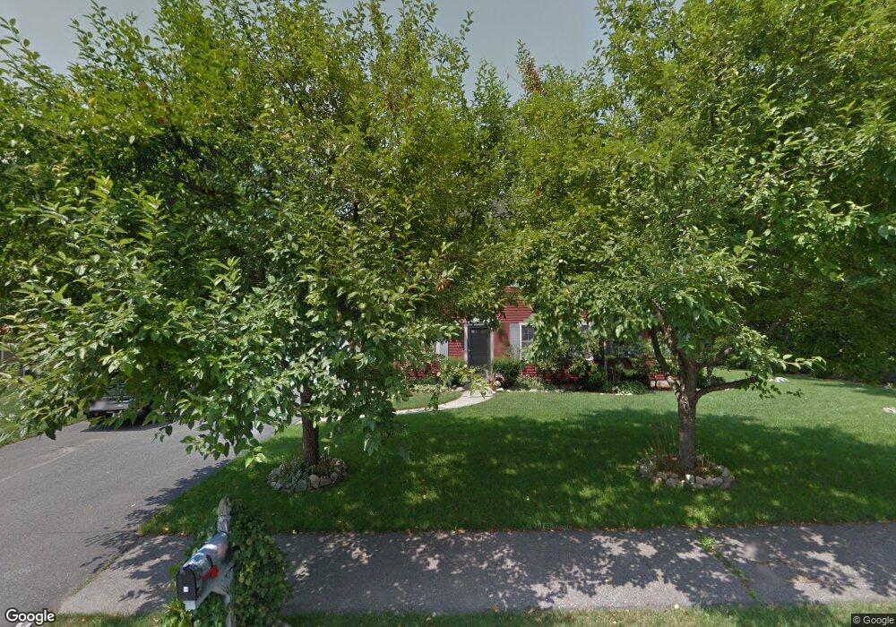
44 Longfellow Rd Shrewsbury, MA 01545
Estimated Value: $812,596 - $918,000
4
Beds
3
Baths
2,362
Sq Ft
$360/Sq Ft
Est. Value
About This Home
This home is located at 44 Longfellow Rd, Shrewsbury, MA 01545 and is currently estimated at $849,399, approximately $359 per square foot. 44 Longfellow Rd is a home located in Worcester County with nearby schools including Walter J. Paton Elementary School, Sherwood Middle School, and Oak Middle School.
Ownership History
Date
Name
Owned For
Owner Type
Purchase Details
Closed on
Jun 15, 2007
Sold by
Hadley Irene A and Hadley Mark P
Bought by
Eagle Jacqueline M and Eagle Thomas R
Current Estimated Value
Home Financials for this Owner
Home Financials are based on the most recent Mortgage that was taken out on this home.
Original Mortgage
$337,500
Interest Rate
6.19%
Mortgage Type
Purchase Money Mortgage
Purchase Details
Closed on
Jun 2, 1995
Sold by
Peppiette Roger and Peppiette Hilary
Bought by
Hadley Mark and Hadley Irene
Purchase Details
Closed on
Dec 11, 1992
Sold by
Farley Mark R and Farley Annette
Bought by
Peppiette Roger C and Peppiette Hilary
Create a Home Valuation Report for This Property
The Home Valuation Report is an in-depth analysis detailing your home's value as well as a comparison with similar homes in the area
Home Values in the Area
Average Home Value in this Area
Purchase History
| Date | Buyer | Sale Price | Title Company |
|---|---|---|---|
| Eagle Jacqueline M | $447,500 | -- | |
| Eagle Jacqueline M | $447,500 | -- | |
| Eagle Jacqueline M | $447,500 | -- | |
| Hadley Mark | $216,000 | -- | |
| Hadley Mark | $216,000 | -- | |
| Peppiette Roger C | $200,000 | -- | |
| Peppiette Roger C | $200,000 | -- |
Source: Public Records
Mortgage History
| Date | Status | Borrower | Loan Amount |
|---|---|---|---|
| Open | Peppiette Roger C | $332,398 | |
| Closed | Eagle Jacqueline M | $337,500 |
Source: Public Records
Tax History Compared to Growth
Tax History
| Year | Tax Paid | Tax Assessment Tax Assessment Total Assessment is a certain percentage of the fair market value that is determined by local assessors to be the total taxable value of land and additions on the property. | Land | Improvement |
|---|---|---|---|---|
| 2025 | $88 | $734,800 | $272,600 | $462,200 |
| 2024 | $8,760 | $707,600 | $259,600 | $448,000 |
| 2023 | $8,220 | $626,500 | $259,600 | $366,900 |
| 2022 | $7,989 | $566,200 | $259,600 | $306,600 |
| 2021 | $6,500 | $492,800 | $207,700 | $285,100 |
| 2020 | $6,145 | $492,800 | $207,700 | $285,100 |
| 2019 | $5,844 | $464,900 | $192,200 | $272,700 |
| 2018 | $5,753 | $454,400 | $184,800 | $269,600 |
| 2017 | $5,512 | $429,600 | $168,700 | $260,900 |
| 2016 | $5,403 | $415,600 | $159,500 | $256,100 |
| 2015 | $5,419 | $410,500 | $154,400 | $256,100 |
Source: Public Records
Map
Nearby Homes
- 20 Browning Rd
- 251 Boylston St Unit 253
- 2 Burkhardt Cir Unit 5
- 20 Rawson Hill Dr
- 313 Gulf St
- 345 Sewall St
- 28 Sewall St
- 22 Ridge Rd
- 2 Morgan Cir Unit 16
- 291 Sewall St Unit 291
- 289 Sewall St Unit 289
- 2 Applewood Cir
- 281 Sewall St Unit 281
- 279 Sewall St Unit 279
- 17 Wilder Rd
- 11 Adin Dr
- 3 Merriam Ave
- 11 Cranbrook Rd
- 70 Colonial Dr
- 48 Perry Rd