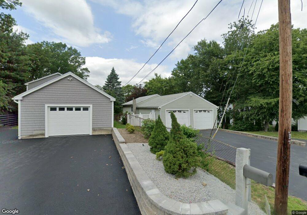
44 Macarthur Dr Millbury, MA 01527
Estimated Value: $486,000 - $651,136
2
Beds
2
Baths
1,031
Sq Ft
$547/Sq Ft
Est. Value
About This Home
This home is located at 44 Macarthur Dr, Millbury, MA 01527 and is currently estimated at $563,784, approximately $546 per square foot. 44 Macarthur Dr is a home located in Worcester County with nearby schools including Elmwood Street Elementary School, Raymond E. Shaw Elementary School, and Millbury Junior/Senior High School.
Ownership History
Date
Name
Owned For
Owner Type
Purchase Details
Closed on
Apr 17, 1998
Sold by
Notargiacomo Jennifer and Notargiacomo Michael K
Bought by
Notargiacomo Michael K
Current Estimated Value
Home Financials for this Owner
Home Financials are based on the most recent Mortgage that was taken out on this home.
Original Mortgage
$14,900
Interest Rate
7.04%
Purchase Details
Closed on
Dec 21, 1995
Sold by
Brisebois David F
Bought by
Notargiacomo Michael and Notargiacomo Jennifer
Create a Home Valuation Report for This Property
The Home Valuation Report is an in-depth analysis detailing your home's value as well as a comparison with similar homes in the area
Home Values in the Area
Average Home Value in this Area
Purchase History
| Date | Buyer | Sale Price | Title Company |
|---|---|---|---|
| Notargiacomo Michael K | $7,500 | -- | |
| Notargiacomo Michael K | $7,500 | -- | |
| Notargiacomo Michael | $115,000 | -- | |
| Notargiacomo Michael | $115,000 | -- |
Source: Public Records
Mortgage History
| Date | Status | Borrower | Loan Amount |
|---|---|---|---|
| Open | Notargiacomo Michael | $174,000 | |
| Closed | Notargiacomo Michael | $155,000 | |
| Closed | Notargiacomo Michael | $14,900 |
Source: Public Records
Tax History
| Year | Tax Paid | Tax Assessment Tax Assessment Total Assessment is a certain percentage of the fair market value that is determined by local assessors to be the total taxable value of land and additions on the property. | Land | Improvement |
|---|---|---|---|---|
| 2025 | $8,156 | $609,084 | $352,584 | $256,500 |
| 2024 | $7,454 | $563,388 | $326,688 | $236,700 |
| 2023 | $5,518 | $381,887 | $169,187 | $212,700 |
| 2022 | $5,448 | $363,187 | $169,187 | $194,000 |
| 2021 | $5,411 | $350,687 | $169,187 | $181,500 |
| 2020 | $4,873 | $317,900 | $141,000 | $176,900 |
| 2019 | $4,538 | $286,300 | $128,000 | $158,300 |
| 2018 | $4,363 | $267,000 | $128,000 | $139,000 |
| 2017 | $4,242 | $258,200 | $128,000 | $130,200 |
| 2016 | $4,026 | $244,600 | $128,000 | $116,600 |
| 2015 | $4,117 | $250,100 | $136,300 | $113,800 |
| 2014 | $3,367 | $196,900 | $98,800 | $98,100 |
Source: Public Records
Map
Nearby Homes
- 48 Macarthur Dr
- 2 Diane St
- 12 Irene Ct
- 2 Wilson Rd Unit B
- 2 Wilson Rd Unit A
- 8 Nightview Place
- 15 Jackson Ln
- 51 John Dr Unit 51
- 7 Barbara St
- 123 Riverlin St
- 11 Maplewood Rd
- 1459 Grafton Rd
- 182 Weatherstone Dr
- 20 Woodridge Rd
- 13 Braney Rd
- 156 Brigham Hill Rd
- 7 Clarissa St
- 18 Lincoln Ave
- 12 Village Green
- 17 Lincoln Ave
- 46 Macarthur Dr
- 42 Macarthur Dr
- 40 Macarthur Dr
- 38 Macarthur Dr
- 50 Macarthur Dr
- 52 Macarthur Dr
- 47 Macarthur Dr
- 43 Macarthur Dr
- 41 Macarthur Dr
- 1 Montgomery Dr
- 54 Macarthur Dr
- 49 Macarthur Dr
- 34 Macarthur Dr
- 35 Macarthur Dr
- 56A Macarthur Dr
- 56B Macarthur Dr
- 53 Macarthur Dr
- 28 Macarthur Dr
- 2 Montgomery Dr
- 31 Macarthur Dr