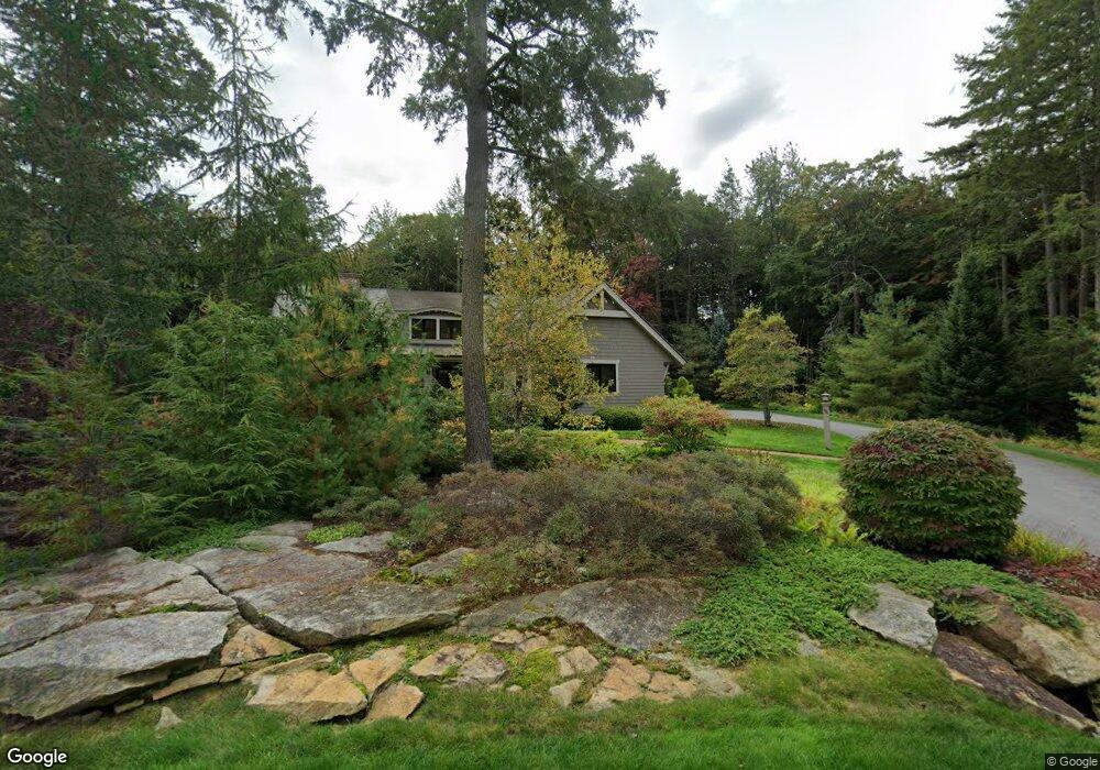
44 Maeves Way Cumberland Foreside, ME 04110
Cumberland Foreside NeighborhoodEstimated Value: $2,287,742 - $2,534,000
4
Beds
4
Baths
4,807
Sq Ft
$501/Sq Ft
Est. Value
About This Home
This home is located at 44 Maeves Way, Cumberland Foreside, ME 04110 and is currently estimated at $2,405,914, approximately $500 per square foot. 44 Maeves Way is a home located in Cumberland County with nearby schools including Mabel I. Wilson School, Greely Middle School 4-5, and Greely Middle School.
Ownership History
Date
Name
Owned For
Owner Type
Purchase Details
Closed on
Mar 25, 2015
Sold by
Porter Debra L
Bought by
Mccann Timothy P
Current Estimated Value
Create a Home Valuation Report for This Property
The Home Valuation Report is an in-depth analysis detailing your home's value as well as a comparison with similar homes in the area
Home Values in the Area
Average Home Value in this Area
Purchase History
| Date | Buyer | Sale Price | Title Company |
|---|---|---|---|
| Mccann Timothy P | -- | -- |
Source: Public Records
Tax History Compared to Growth
Tax History
| Year | Tax Paid | Tax Assessment Tax Assessment Total Assessment is a certain percentage of the fair market value that is determined by local assessors to be the total taxable value of land and additions on the property. | Land | Improvement |
|---|---|---|---|---|
| 2025 | $28,667 | $1,138,500 | $254,300 | $884,200 |
| 2024 | $26,470 | $1,138,500 | $254,300 | $884,200 |
| 2023 | $25,218 | $1,138,500 | $254,300 | $884,200 |
| 2022 | $24,136 | $1,138,500 | $254,300 | $884,200 |
| 2021 | $23,396 | $1,138,500 | $254,300 | $884,200 |
| 2020 | $23,168 | $1,138,500 | $254,300 | $884,200 |
| 2019 | $22,599 | $1,138,500 | $254,300 | $884,200 |
| 2018 | $20,248 | $1,027,800 | $254,300 | $773,500 |
| 2017 | $19,323 | $1,027,800 | $254,300 | $773,500 |
| 2016 | $19,416 | $1,063,900 | $356,000 | $707,900 |
| 2015 | $12,328 | $681,100 | $254,300 | $426,800 |
| 2014 | $11,851 | $681,100 | $254,300 | $426,800 |
| 2013 | $11,579 | $681,100 | $254,300 | $426,800 |
Source: Public Records
Map
Nearby Homes
- 15 Sea Cove Rd
- 59 Underwood Rd
- 30 Seaside Way Unit Lot 3
- 263 Foreside Rd
- 78 Applegate Ln
- 186 Foreside Rd
- 5 Harmony Way
- 54 Longwoods Rd
- 267 U S Route 1 Unit 308
- 267 U S Route 1 Unit 404
- 267 U S Route 1 Unit 306
- 267 U S Route 1 Unit 211
- 267 U S Route 1 Unit 309 & 311
- 267 U S Route 1 Unit 201
- 267 U S Route 1 Unit 305
- R03-54-4 Longwoods Rd
- 258 Foreside Rd
- 109 Foreside Rd
- Lot 3 Dunham Ln
- Lot 2 Dunham Ln
- 44 Maeve's Way
- 15 Stony Ridge Rd
- 17 Stony Ridge Rd
- 36 Maeve's Way
- 36 Maeves Way
- 1 Nicola's Way
- 52 Maeves Way
- 13 Stony Ridge Rd
- 19 Stony Ridge Rd
- 1 Nicolas Way
- 5 Nicola's Way
- 7 Nicola's Way
- 31 Maeve's Way Unit Lot 9
- 31 Maeve's Way
- 16 Stony Ridge Rd
- 30 Maeves Way
- 18 Stony Ridge Rd
- 1 Nicolas Way
- 21 Stony Ridge Rd
- 11 Stony Ridge Rd