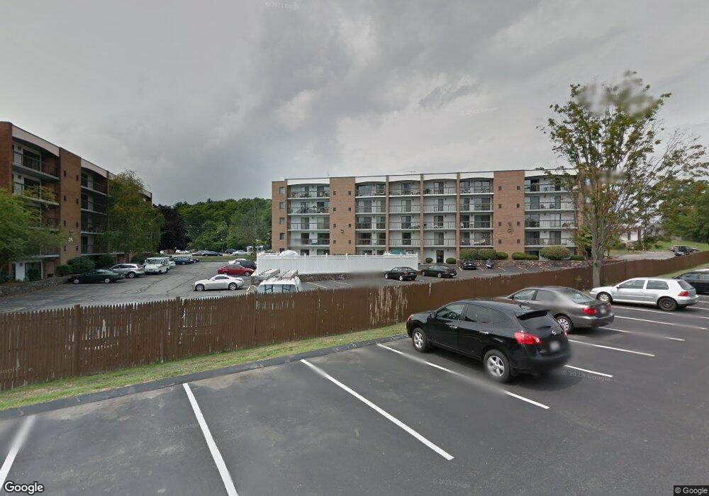
44 Main St Unit 407 Stoneham, MA 02180
Bear Hill NeighborhoodEstimated Value: $579,833 - $642,000
3
Beds
2
Baths
1,462
Sq Ft
$414/Sq Ft
Est. Value
About This Home
This home is located at 44 Main St Unit 407, Stoneham, MA 02180 and is currently estimated at $605,208, approximately $413 per square foot. 44 Main St Unit 407 is a home located in Middlesex County with nearby schools including Stoneham High School, St Joseph School, and St. Patrick Elementary School.
Ownership History
Date
Name
Owned For
Owner Type
Purchase Details
Closed on
May 17, 2011
Sold by
Ciprini Elizabeth M and Aprea Joanne
Bought by
Fu Jay J and Fu Nicole X
Current Estimated Value
Home Financials for this Owner
Home Financials are based on the most recent Mortgage that was taken out on this home.
Original Mortgage
$180,000
Outstanding Balance
$125,092
Interest Rate
4.88%
Mortgage Type
Purchase Money Mortgage
Estimated Equity
$480,116
Purchase Details
Closed on
Mar 1, 2011
Sold by
Cipriani Elizabeth M
Bought by
Aprea Joanne
Create a Home Valuation Report for This Property
The Home Valuation Report is an in-depth analysis detailing your home's value as well as a comparison with similar homes in the area
Home Values in the Area
Average Home Value in this Area
Purchase History
| Date | Buyer | Sale Price | Title Company |
|---|---|---|---|
| Fu Jay J | $240,000 | -- | |
| Aprea Joanne | -- | -- |
Source: Public Records
Mortgage History
| Date | Status | Borrower | Loan Amount |
|---|---|---|---|
| Open | Fu Jay J | $180,000 |
Source: Public Records
Tax History Compared to Growth
Tax History
| Year | Tax Paid | Tax Assessment Tax Assessment Total Assessment is a certain percentage of the fair market value that is determined by local assessors to be the total taxable value of land and additions on the property. | Land | Improvement |
|---|---|---|---|---|
| 2025 | $5,079 | $496,500 | $0 | $496,500 |
| 2024 | $5,298 | $500,300 | $0 | $500,300 |
| 2023 | $5,100 | $459,500 | $0 | $459,500 |
| 2022 | $4,524 | $434,600 | $0 | $434,600 |
| 2021 | $4,396 | $406,300 | $0 | $406,300 |
| 2020 | $4,384 | $406,300 | $0 | $406,300 |
| 2019 | $4,111 | $366,400 | $0 | $366,400 |
| 2018 | $3,985 | $340,300 | $0 | $340,300 |
| 2017 | $3,826 | $308,800 | $0 | $308,800 |
| 2016 | $3,876 | $305,200 | $0 | $305,200 |
| 2015 | $3,586 | $276,700 | $0 | $276,700 |
| 2014 | $3,575 | $265,000 | $0 | $265,000 |
Source: Public Records
Map
Nearby Homes
- 40 Main St Unit 505
- 64 Main St Unit 41B
- 68 Main St Unit 36C
- 97 Oak St
- 62 Abigail Way Unit 3004
- 62 High St Unit 4
- 62 High St Unit 3
- 62 High St Unit Lot 12
- 62 High St Unit Lot 2
- 62 High St Unit Lot 7
- 62 High St Unit Lot 9
- 8 Steele St
- 97 Macarthur Rd
- 7 Leaning Elm Dr Unit 7
- 159 Main St Unit 41C
- 313 South St
- 1 Summit Dr Unit 57
- 2 Summit Dr Unit 18
- 13 Elaine Rd
- 4 Adams St
- 44 Main St Unit 508
- 44 Main St Unit 507
- 44 Main St Unit 506
- 44 Main St Unit 505
- 44 Main St Unit 504
- 44 Main St Unit 503
- 44 Main St Unit 502
- 44 Main St Unit 501
- 44 Main St Unit 408
- 44 Main St Unit 406
- 44 Main St Unit 405
- 44 Main St Unit 404
- 44 Main St Unit 403
- 44 Main St Unit 402
- 44 Main St Unit 401
- 44 Main St Unit 308
- 44 Main St Unit 307
- 44 Main St Unit 306
- 44 Main St Unit 305
- 44 Main St Unit 304