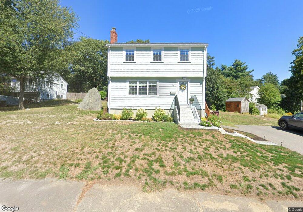
44 Marie Ave South Weymouth, MA 02190
South Weymouth NeighborhoodEstimated Value: $630,000 - $774,000
3
Beds
1
Bath
1,390
Sq Ft
$499/Sq Ft
Est. Value
About This Home
This home is located at 44 Marie Ave, South Weymouth, MA 02190 and is currently estimated at $694,241, approximately $499 per square foot. 44 Marie Ave is a home located in Norfolk County with nearby schools including Thomas W. Hamilton Primary School, Abigail Adams Middle School, and Weymouth Middle School Chapman.
Ownership History
Date
Name
Owned For
Owner Type
Purchase Details
Closed on
Jul 30, 2010
Sold by
Pearson Donald L and Farrell Elizabeth
Bought by
Nelson Cherie M
Current Estimated Value
Home Financials for this Owner
Home Financials are based on the most recent Mortgage that was taken out on this home.
Original Mortgage
$212,000
Outstanding Balance
$141,843
Interest Rate
4.78%
Mortgage Type
Purchase Money Mortgage
Estimated Equity
$552,398
Create a Home Valuation Report for This Property
The Home Valuation Report is an in-depth analysis detailing your home's value as well as a comparison with similar homes in the area
Home Values in the Area
Average Home Value in this Area
Purchase History
| Date | Buyer | Sale Price | Title Company |
|---|---|---|---|
| Nelson Cherie M | $265,000 | -- |
Source: Public Records
Mortgage History
| Date | Status | Borrower | Loan Amount |
|---|---|---|---|
| Open | Nelson Cherie M | $212,000 |
Source: Public Records
Tax History Compared to Growth
Tax History
| Year | Tax Paid | Tax Assessment Tax Assessment Total Assessment is a certain percentage of the fair market value that is determined by local assessors to be the total taxable value of land and additions on the property. | Land | Improvement |
|---|---|---|---|---|
| 2025 | $5,539 | $548,400 | $195,300 | $353,100 |
| 2024 | $5,480 | $533,600 | $186,000 | $347,600 |
| 2023 | $5,373 | $514,200 | $191,300 | $322,900 |
| 2022 | $5,476 | $477,800 | $194,900 | $282,900 |
| 2021 | $5,113 | $435,500 | $194,900 | $240,600 |
| 2020 | $4,863 | $408,000 | $194,900 | $213,100 |
| 2019 | $4,745 | $391,500 | $187,400 | $204,100 |
| 2018 | $4,528 | $362,200 | $170,400 | $191,800 |
| 2017 | $4,421 | $345,100 | $162,300 | $182,800 |
| 2016 | $4,248 | $331,900 | $156,000 | $175,900 |
| 2015 | $4,106 | $318,300 | $156,000 | $162,300 |
| 2014 | $4,209 | $316,500 | $165,900 | $150,600 |
Source: Public Records
Map
Nearby Homes
- 540 Union St
- 18 Ben Hogan Landing Unit 18
- 17 Buchanan Ln
- 299 Union St
- 79 Tilden Rd
- 82 Snowbird Ave
- 7 Blair Green
- 54 Parkview St
- 1 Sandpiper Green
- 65 Boxberry Ln
- 197 White St
- 26 Leahaven Rd
- 17 Sears Rd
- 130 Trotter Rd Unit 1309
- 110 Trotter Rd Unit 409
- 65 Webster St Unit 401
- 198 Stonehaven Dr
- 194 Stonehaven Dr
- 55 Greentree Ln Unit 27
- 775 Union St