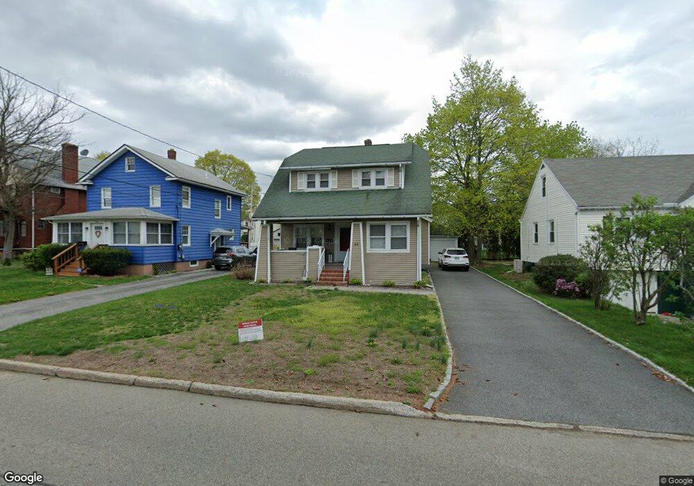
44 Narragansett Ave Ossining, NY 10562
Estimated Value: $559,000 - $616,000
3
Beds
2
Baths
1,430
Sq Ft
$416/Sq Ft
Est. Value
About This Home
This home is located at 44 Narragansett Ave, Ossining, NY 10562 and is currently estimated at $595,301, approximately $416 per square foot. 44 Narragansett Ave is a home located in Westchester County with nearby schools including Park School, Roosevelt Elementary School, and Brookside Elementary School.
Ownership History
Date
Name
Owned For
Owner Type
Purchase Details
Closed on
Feb 8, 2010
Sold by
Whitson Jeffrey R and Hunt Martina A
Bought by
Soares Miguel J and Soares Regina
Current Estimated Value
Home Financials for this Owner
Home Financials are based on the most recent Mortgage that was taken out on this home.
Original Mortgage
$298,935
Outstanding Balance
$197,746
Interest Rate
5.02%
Mortgage Type
New Conventional
Estimated Equity
$397,555
Create a Home Valuation Report for This Property
The Home Valuation Report is an in-depth analysis detailing your home's value as well as a comparison with similar homes in the area
Home Values in the Area
Average Home Value in this Area
Purchase History
| Date | Buyer | Sale Price | Title Company |
|---|---|---|---|
| Soares Miguel J | $325,000 | None Available |
Source: Public Records
Mortgage History
| Date | Status | Borrower | Loan Amount |
|---|---|---|---|
| Open | Soares Miguel J | $298,935 |
Source: Public Records
Tax History Compared to Growth
Tax History
| Year | Tax Paid | Tax Assessment Tax Assessment Total Assessment is a certain percentage of the fair market value that is determined by local assessors to be the total taxable value of land and additions on the property. | Land | Improvement |
|---|---|---|---|---|
| 2024 | $15,912 | $554,000 | $150,600 | $403,400 |
| 2023 | $15,465 | $515,900 | $150,600 | $365,300 |
| 2022 | $15,102 | $473,600 | $150,600 | $323,000 |
| 2021 | $13,009 | $422,900 | $150,600 | $272,300 |
| 2020 | $13,188 | $422,900 | $150,600 | $272,300 |
| 2019 | $13,046 | $361,100 | $150,600 | $210,500 |
| 2018 | $12,788 | $361,100 | $150,600 | $210,500 |
| 2017 | $1,882 | $354,100 | $150,600 | $203,500 |
| 2016 | $125,077 | $347,200 | $150,600 | $196,600 |
| 2015 | -- | $18,100 | $5,500 | $12,600 |
| 2014 | -- | $18,100 | $5,500 | $12,600 |
| 2013 | -- | $18,100 | $5,500 | $12,600 |
Source: Public Records
Map
Nearby Homes
- 14 Gates Ave
- 58 Narragansett Ave
- 7 Birchbrook Rd
- 24 Oakbrook Rd
- 7 Grandview Ave
- 42 Campwoods Grounds
- 53 Park Ave
- 33 Ryder Rd
- 7 Hawkes Ave
- 200 Route 9a
- 175 Croton Ave
- 78 Croton Dam Rd
- 11 Sutton Place
- 19 Donald Ln
- 15 Ferris Place
- 59 Somerstown Rd
- 113 Antler Ridge Unit 113
- 126 Whitetail Cir
- 26 Fawn Ct
- 112 Woods Brooke Cir
- 42 Narragansett Ave
- 46 Narragansett Ave
- 6 Gates Ave
- 40 Narragansett Ave
- 48 Narragansett Ave Unit 3R
- 48 Narragansett Ave
- 33 Narragansett Ave
- 38 Narragansett Ave
- 6 Robin St
- 35 Narragansett Ave
- 37 Narragansett Ave
- 39 Narragansett Ave
- 0 Gates Ave Unit H4606698
- 36 Narragansett Ave
- 3 Gates Ave
- 5 Gates Ave
- 41 Narragansett Ave
- 50 Narragansett Ave
- 9 Gates Ave
- 8 Robin St