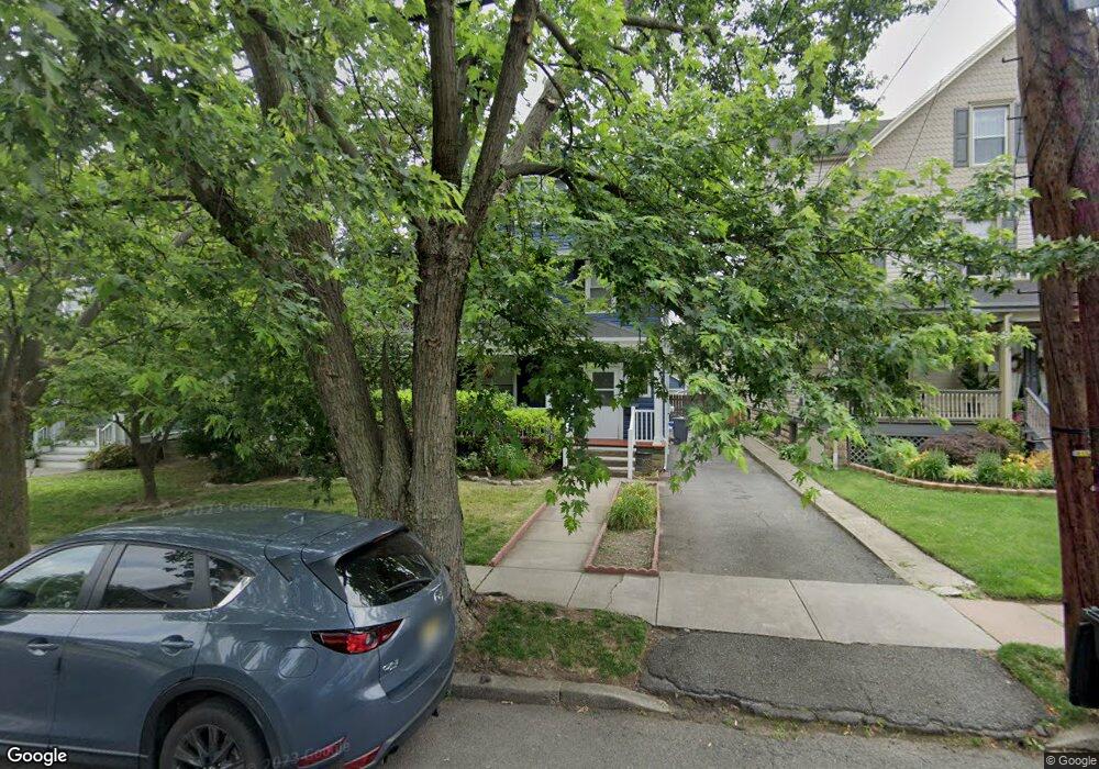
44 Osborne St Bloomfield, NJ 07003
Estimated Value: $573,000 - $721,000
--
Bed
--
Bath
1,922
Sq Ft
$347/Sq Ft
Est. Value
About This Home
This home is located at 44 Osborne St, Bloomfield, NJ 07003 and is currently estimated at $666,665, approximately $346 per square foot. 44 Osborne St is a home located in Essex County with nearby schools including Franklin School, Bloomfield Middle School, and Bloomfield High School.
Ownership History
Date
Name
Owned For
Owner Type
Purchase Details
Closed on
Mar 24, 2021
Sold by
Knott Mark and Knott Yomara
Bought by
Knott Yomara
Current Estimated Value
Home Financials for this Owner
Home Financials are based on the most recent Mortgage that was taken out on this home.
Original Mortgage
$343,500
Outstanding Balance
$308,957
Interest Rate
2.9%
Mortgage Type
New Conventional
Estimated Equity
$357,708
Purchase Details
Closed on
Dec 13, 2005
Sold by
Wiede Kristian
Bought by
Knott Mark and Baez Yomara
Home Financials for this Owner
Home Financials are based on the most recent Mortgage that was taken out on this home.
Original Mortgage
$352,000
Interest Rate
6.25%
Mortgage Type
Adjustable Rate Mortgage/ARM
Purchase Details
Closed on
May 24, 1995
Sold by
Sanford Joyce
Bought by
Wade Kristian and Mozeliak Nicole
Home Financials for this Owner
Home Financials are based on the most recent Mortgage that was taken out on this home.
Original Mortgage
$135,000
Interest Rate
8.2%
Create a Home Valuation Report for This Property
The Home Valuation Report is an in-depth analysis detailing your home's value as well as a comparison with similar homes in the area
Home Values in the Area
Average Home Value in this Area
Purchase History
| Date | Buyer | Sale Price | Title Company |
|---|---|---|---|
| Knott Yomara | -- | Solidifi Title & Closing Llc | |
| Knott Mark | $440,000 | -- | |
| Wade Kristian | $142,500 | -- |
Source: Public Records
Mortgage History
| Date | Status | Borrower | Loan Amount |
|---|---|---|---|
| Open | Knott Yomara | $343,500 | |
| Closed | Knott Mark | $352,000 | |
| Previous Owner | Wade Kristian | $135,000 |
Source: Public Records
Tax History Compared to Growth
Tax History
| Year | Tax Paid | Tax Assessment Tax Assessment Total Assessment is a certain percentage of the fair market value that is determined by local assessors to be the total taxable value of land and additions on the property. | Land | Improvement |
|---|---|---|---|---|
| 2025 | $12,778 | $391,000 | $176,100 | $214,900 |
| 2024 | $12,778 | $391,000 | $176,100 | $214,900 |
| 2022 | $12,520 | $391,000 | $176,100 | $214,900 |
| 2021 | $12,289 | $391,000 | $176,100 | $214,900 |
| 2020 | $12,101 | $391,000 | $176,100 | $214,900 |
| 2019 | $12,887 | $323,700 | $174,000 | $149,700 |
| 2018 | $12,831 | $323,700 | $174,000 | $149,700 |
| 2017 | $12,637 | $323,700 | $174,000 | $149,700 |
| 2016 | $12,356 | $323,700 | $174,000 | $149,700 |
| 2015 | $12,244 | $323,700 | $174,000 | $149,700 |
| 2014 | $12,020 | $323,700 | $174,000 | $149,700 |
Source: Public Records
Map
Nearby Homes
- 185 State St
- 218 Broad St Unit 16B
- 299 Ridgewood Ave
- 50 James St Unit 3
- 31 Spring St
- 19 High St
- 76 James St
- 29 Edgewood Rd
- 226 Baldwin St
- 366 Hoover Ave Unit 119
- 366 Hoover Ave Unit 118
- 352 Hoover Ave Unit 94
- 328 Hoover Ave
- 328-330 Hoover Ave
- 124-126 Spruce St
- 124 Spruce St Unit 126
- 971 Bloomfield Ave
- 72 Glen Ridge Ave
- 926 Bloomfield Ave Unit 4m