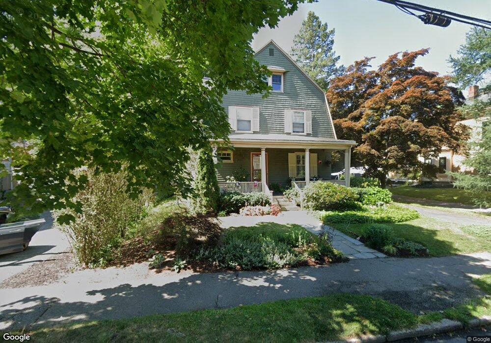
44 Page Rd Newtonville, MA 02460
Newtonville NeighborhoodEstimated Value: $1,559,000 - $1,779,959
4
Beds
3
Baths
2,826
Sq Ft
$596/Sq Ft
Est. Value
About This Home
This home is located at 44 Page Rd, Newtonville, MA 02460 and is currently estimated at $1,684,740, approximately $596 per square foot. 44 Page Rd is a home located in Middlesex County with nearby schools including Horace Mann Elementary School, F.A. Day Middle School, and Newton North High School.
Ownership History
Date
Name
Owned For
Owner Type
Purchase Details
Closed on
Apr 23, 2015
Sold by
Matlaw Jane R
Bought by
Jane R Matlaw Ret
Current Estimated Value
Purchase Details
Closed on
Jun 3, 2003
Sold by
Kaufman Michael K
Bought by
Matlaw Jane R
Home Financials for this Owner
Home Financials are based on the most recent Mortgage that was taken out on this home.
Original Mortgage
$148,000
Interest Rate
5.86%
Create a Home Valuation Report for This Property
The Home Valuation Report is an in-depth analysis detailing your home's value as well as a comparison with similar homes in the area
Home Values in the Area
Average Home Value in this Area
Purchase History
| Date | Buyer | Sale Price | Title Company |
|---|---|---|---|
| Jane R Matlaw Ret | -- | -- | |
| Matlaw Jane R | -- | -- |
Source: Public Records
Mortgage History
| Date | Status | Borrower | Loan Amount |
|---|---|---|---|
| Previous Owner | Matlaw Jane R | $148,000 |
Source: Public Records
Tax History Compared to Growth
Tax History
| Year | Tax Paid | Tax Assessment Tax Assessment Total Assessment is a certain percentage of the fair market value that is determined by local assessors to be the total taxable value of land and additions on the property. | Land | Improvement |
|---|---|---|---|---|
| 2025 | $15,013 | $1,531,900 | $831,200 | $700,700 |
| 2024 | $14,516 | $1,487,300 | $807,000 | $680,300 |
| 2023 | $13,910 | $1,366,400 | $613,100 | $753,300 |
| 2022 | $13,310 | $1,265,200 | $567,700 | $697,500 |
| 2021 | $12,843 | $1,193,600 | $535,600 | $658,000 |
| 2020 | $12,461 | $1,193,600 | $535,600 | $658,000 |
| 2019 | $12,109 | $1,158,800 | $520,000 | $638,800 |
| 2018 | $11,587 | $1,070,900 | $470,400 | $600,500 |
| 2017 | $11,235 | $1,010,300 | $443,800 | $566,500 |
| 2016 | $10,590 | $930,600 | $414,800 | $515,800 |
| 2015 | $10,097 | $869,700 | $387,700 | $482,000 |
Source: Public Records
Map
Nearby Homes
- 32-34 Rossmere St
- 168 Walnut St
- 611 Watertown St Unit 14
- 43 Walker St
- 911 Washington St
- 935 Washington St Unit 8
- 354 Linwood Ave Unit 1
- 957 Washington St Unit 1
- 57 Walnut St
- 321 Albemarle Rd
- 77 Court St Unit 205
- 42-44 Judkins St
- 11 Randlett Park
- 22 Walnut Place Unit 1
- 123-125 Mount Vernon St
- 123 Mount Vernon St Unit 2
- 4 Wiswall St
- 286 Nevada St Unit 286
- 282 Nevada St Unit 282
- 12 Wiswall St
- 52 Page Rd
- 107 Lowell Ave
- 115 Lowell Ave
- 109 Lowell Ave
- 58 Page Rd
- 47 Page Rd Unit 2
- 47 Page Rd
- 119 Lowell Ave
- 119 Lowell Ave Unit 119
- 121 Lowell Ave Unit 121
- 20 Brooks Ave
- 97 Lowell Ave
- 51 Page Rd
- 14 Edinboro Place
- 62 Page Rd
- 0 Edinboro Unit 71960078
- 125 Lowell Ave
- 89 Lowell Ave Unit B
- 89 Lowell Ave Unit A
- 26 Page Rd