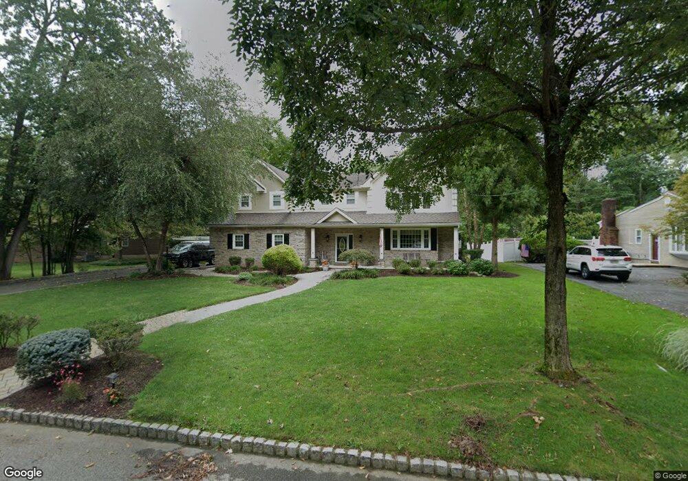
44 Pitcairn Dr Roseland, NJ 07068
Estimated Value: $980,000 - $1,097,000
--
Bed
--
Bath
3,114
Sq Ft
$335/Sq Ft
Est. Value
About This Home
This home is located at 44 Pitcairn Dr, Roseland, NJ 07068 and is currently estimated at $1,042,047, approximately $334 per square foot. 44 Pitcairn Dr is a home located in Essex County with nearby schools including West Essex Middle School, West Essex High School, and Trinity Academy.
Ownership History
Date
Name
Owned For
Owner Type
Purchase Details
Closed on
Sep 15, 1992
Sold by
Loew Renee
Bought by
Loew Steven
Current Estimated Value
Purchase Details
Closed on
Jun 24, 1991
Sold by
Detroia Mark and Detroia Colleen
Bought by
Loew Steven and Loew Renee
Purchase Details
Closed on
Jan 12, 1990
Sold by
Carroll Charles V and Carroll Caroline C
Bought by
Detroia Mark and Detroia Colleen
Create a Home Valuation Report for This Property
The Home Valuation Report is an in-depth analysis detailing your home's value as well as a comparison with similar homes in the area
Home Values in the Area
Average Home Value in this Area
Purchase History
| Date | Buyer | Sale Price | Title Company |
|---|---|---|---|
| Loew Steven | $52,000 | -- | |
| Loew Steven | $258,000 | -- | |
| Detroia Mark | $255,000 | -- |
Source: Public Records
Tax History Compared to Growth
Tax History
| Year | Tax Paid | Tax Assessment Tax Assessment Total Assessment is a certain percentage of the fair market value that is determined by local assessors to be the total taxable value of land and additions on the property. | Land | Improvement |
|---|---|---|---|---|
| 2025 | $16,152 | $822,400 | $355,300 | $467,100 |
| 2024 | $16,152 | $822,400 | $355,300 | $467,100 |
| 2022 | $16,291 | $697,700 | $343,000 | $354,700 |
| 2021 | $16,068 | $697,700 | $343,000 | $354,700 |
| 2020 | $16,012 | $697,700 | $343,000 | $354,700 |
| 2019 | $15,866 | $697,700 | $343,000 | $354,700 |
| 2018 | $15,726 | $697,700 | $343,000 | $354,700 |
| 2017 | $15,719 | $697,700 | $343,000 | $354,700 |
| 2016 | $15,475 | $697,700 | $343,000 | $354,700 |
| 2015 | $15,510 | $697,700 | $343,000 | $354,700 |
| 2014 | $15,077 | $697,700 | $343,000 | $354,700 |
Source: Public Records
Map
Nearby Homes
- 187 Passaic Ave
- 144 Passaic Ave
- 26 Bovensiepen Ct
- 26 Bovensiepen Ct Unit 3526
- 38 Passaic Ave
- 76 Glen Ave
- 34 Brian Rd
- 88 Kent Dr Unit C0176
- 6 Mulford Ct Unit Address 6
- 6 Mulford Ct Unit C0013
- 2 Cobb Terrace
- 518 Eagle Rock Ave
- 192 Eagle Rock Ave
- 4 Williamsburg Dr
- 3 Hasemann Ct
- 34 Lincoln St
- 15 Orton Rd
- 211 Eagle Rock Ave
- 58 Leonard Terrace
- 194 Eagle Rock Ave